Scenic Fall Drives of New England, USA- Part 1
Fall in New England was and is probably one of the biggest inspirations for my Nature and travel Photography. .Having had the opportunity to live in that beautiful region with its 4 full seasons and witnessed the progress of fall colours on the trees in my twenties, I have been drawn back to this wonderful gem of nature to explore and photograph as my photographic ability and my equipment has gotten better over the years. I feel there is always something more I could do to capture the magnificent fall colours.
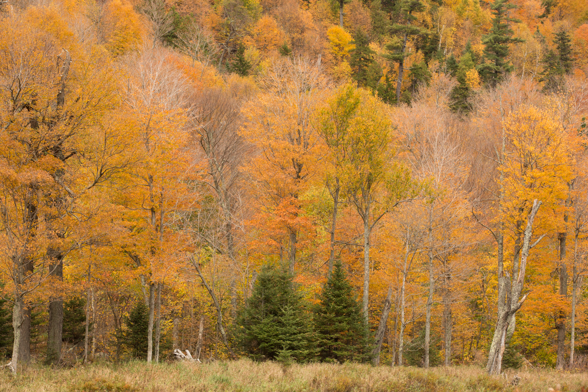
Typical Mid Fall Scene, new England
Fall in New England was and is probably one of the biggest inspirations for my Nature and travel Photography. .Having had the opportunity to live in that beautiful region with its 4 full seasons and witnessed the progress of fall colours on the trees in my twenties, I have been drawn back to this wonderful gem of nature to explore and photograph as my photographic ability and my equipment has gotten better over the years. I feel there is always something more I could do to capture the magnificent fall colours in even more vivid detail..
Multiple Exposure image of Pumpkins Ready for Harvesting during Halloween Season
For those who are not familiar, New England is a region composed of six states in the northeastern United States: Maine, Vermont, New Hampshire, Massachusetts, Rhode Island, and Connecticut.
Fall colour reflections and Goose at Boston Commons
The physical geography of New England is diverse for such a small area. Southeastern New England is covered by a narrow coastal plain, while the western and northern regions are dominated by the rolling hills and worn-down peaks of the northern end of the Appalachian Mountains. The Atlantic fall line lies close to the coast, which enabled numerous cities to take advantage of water power along the many rivers, such as the Connecticut River, which bisects the region from north to south.
The entire region and even the surrounding regions in the USA and Canada have opportunities for “Leaf Peeping” as fall colour viewing is popularly called by New Englanders.
But it is widely accepted that the most popular scenic drives are the following
The Mohawk Trail, Massachusetts
The Kancamagus Highway, New Hampshire
Smuggler’s Notch, Vermont
The Acadia Loop Road
And some other alternative drives are Route 58 from Lake Willoughby to Hazen’s Notch, Evans Notch (Route 113), The Camden Hills Loop, Jacob’s Ladder Scenic Byway (Route 20) Loops.
In this part 1 of the series of posts I will focus on The Mohawk Trail.
How to Get There
Boston, Massachusetts is the largest and most well connected city in the New England Region. Boston Logan Airport is well connected by Major International Airlines.
Alternately you could fly to New York or New Jersey and take the AMTRAK into.Boston South Station.
Getting Around
The best way to travel around in New England to view and photograph the fall colours is to drive.
Where to Stay
The Kancamagus Highway and the Mohawk Trail can be driven as day trips from Boston but for a truly immersive and thorough experience I suggest staying in one of the several bed and breakfast options along the highway and trail. I will include some links to stay in the region below.
New England Time
The Mohawk Trail
Directions From Boston:
Western route to the middle of The Mohawk Trail
From Boston via Springfield, Massachusetts I-90 (Massachusetts Turnpike) to I-91 North, I-91 North to Exit 26 in Greenfield, Massachusetts and Route 2 (The Mohawk Trail) East or West.
Western route to the western section of The Mohawk Trail
I-90 (Massachusetts Turnpike) to Exit 2, North on US 20/7 to Route 2, The Mohawk Trail
Northern route to the eastern section of The Mohawk Trail
From Boston. I-90 (Massachusetts Turnpike) to Exit 11A I-495 North, I-495 North to Exit 40, Route 2 (The Mohawk Trail) West.
Standout Places along the Mohawk Trail
Shelburne Falls - Glacial Potholes and The Bridge of Flowers
Shelburne Falls, Bridge of Flowers
Once a prime Salmon fishing spot for native Americans, the village gradually emerged more than a century ago as a manufacturing community. The village experienced a resurgence during the 80s and 90s, and unlike many similar communities, evolved and continues to be a vital downtown with a growing reputation as an arts community.
The village resisted the "urban renewal" trend of the 1950s and 1960s, which has left our generation with an historic, turn-of-the-century setting for a unique mix of locally owned businesses.
It's a village where you can buy either a head of iceberg lettuce or a hand-blown glass vase!
Shelburne Falls is home to the famous Bridge of Flowers, which attracts more than thirty five thousand visitors a year, as well as the Glacial Potholes, a curiously beautiful rock formation. The Shelburne Falls Trolley Museum celebrates the village's transportation heritage.
Most everything in the village is within walking distance, so if you're planning to spend some time in the village,and we hope you do, we encourage you to park in one of the free public parking lots off Bridge Street.
Along the Mohawk Trail
Williamstown and Williams College
Williams College, Williamstown
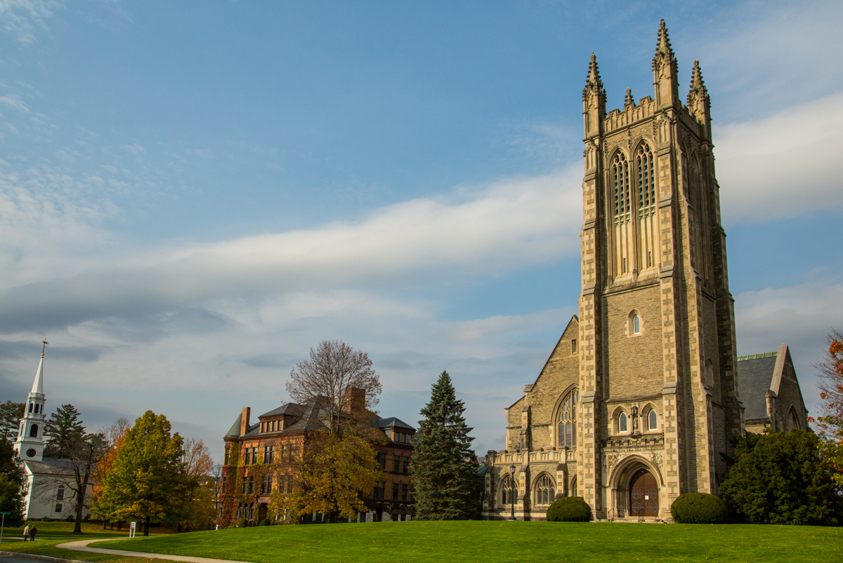
Williamstown is a lovely historic town that's well worth a visit. There are quite a few tasteful 18th, 19th and early 20th century buildings, on and off campus.The best way to explore Williamstown is on foot. It is a true college town, having hosted Williams College since 1793.
Fallen Maple Leaves
Established in 1793 with funds bequeathed by Colonel Ephraim Williams, the college is private, residential, and liberal arts, with graduate programs in the history of art and in development economics. The undergraduate enrolment is approximately 2,000 students.
Thompson Memorial Chapel at Williams College
The Berkshires
The Berkshires
A popular vacation destination, it's known for outdoor activities, fall foliage–viewing, a farm-to-table food scene and thriving arts institutions. Renowned annual festivals include the Boston Symphony Orchestra’s residency at Lenox’s Tanglewood Music Center.
Check out the link below for suggested Berkshires Driving Tours
Stream Along the Mohawk Trail
Pelham and Amherst
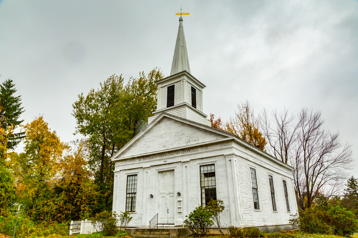
Pelham is a town in Hampshire County, Massachusetts, United States. The population was 1,321 at the 2010 census. Its ZIP Code is shared with Amherst.
Although not actually on the Mohawk Trail this is a worthwhile deviation as the road to Pelham and Amherst are also brimming with fall photo ops.
Near Pelham, Along the Mohawk Trail
The Town of Amherst, located in the lovely Pioneer Valley of Western Massachusetts, is a diverse, inclusive community offering numerous educational and cultural opportunities. Host to Amherst College, Hampshire College, and the University of Massachusetts at Amherst is a quaint college town.
Old Barn along the Mohawk Trails
Maple leaves an tree
Farm along the Mohawk Trail
Maple Leaf and Mushrooms
Along the Mohawk Trail
Fall Colours at Picnic Area
Fall colours Peaking
More Photography Destination Ideas..
Sunrise at Boston Harbour with a Leica X
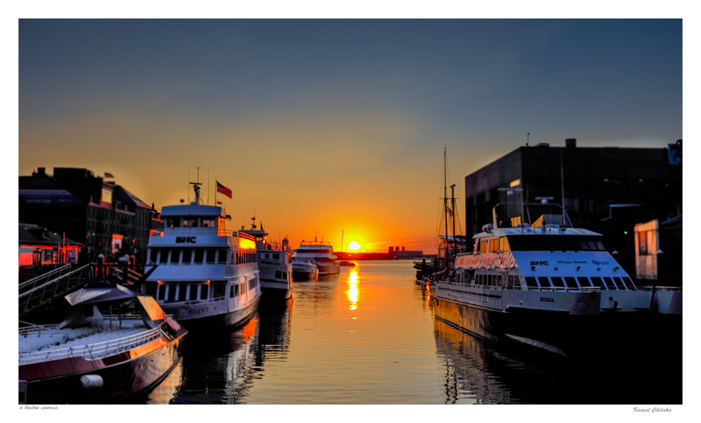
The Sun was just beginning to rise as I reached the harbour. It was a clear morning and the sun had an intense orange glow while it hung at the horizon. I shot both in colour first to capture the intense colours.
Old Customs Building and US Flag
It was late summer in 2016 when I found myself traveling to New England for my brothers wedding. It was a beautiful seaside wedding in the quant harbour town of Newport Rhode Island. But we had a few days to spend in Boston prior to the wedding .
While the family was still asleep I snuck out with my camera gear for a dawn shoot along the Boston waterfront. I was carrying just my newly acquired Leica X with its fixed 35mm equivalent f1.7 lens. It didn’t take me long to go through and understand the cameras settings. With ISO, shutter speed dials on the top plate and with aperture control on the lens it is extremely institutive to control the Exposure triangle.
The optional various flex EVF is also pretty good and make shooting in bright conditions easier. Also the live view through the EVF gives a fairly accurate rendition of the how the scene will appear in the image. All this means I was free to focus on things like composition and perspective rather than on exposure.Read more about this camera in my gear reviews.
Sunrise at Boston Harbour
The Sun was just beginning to rise as I reached the harbour. It was a clear morning and the sun had an intense orange glow while it hung at the horizon. I shot in colour first to capture the intense colours.
As the sun rose higher creating more contrast between the highlights reflecting of the water and the shadows created by the boats in the harbour I shifted to shooting in Monochrome to capture the drama created by the light.
A pier at Boston Harbour
Boston Harbour Info
Since its discovery to Europeans by John Smith in 1614, Boston Harbor has been an important port in American history. It was the site of the Boston Tea Party as well as almost continuous backfilling of the harbor until the 19th century. By 1660 almost all imports came to the greater Boston area and the New England coast through the waters of Boston Harbor. A rapid influx of people transformed Boston into a booming city.
Boston Waterfront Scene
Boston Harbor is a large harbor which constitutes the western extremity of Massachusetts Bay. The harbor is sheltered from Massachusetts Bay and the open Atlantic Ocean by a combination of the Winthrop Peninsula and Deer Island to the north, the hooked Nantasket Peninsula and Point Allerton to the south, and the harbor islands in the middle. The harbor is often described as being split into an inner harbor and an outer harbor. The harbor itself comprises fifty square miles with 180 miles (290 km) of shoreline and 34 harbor islands.
Reflections and Speedboat
The inner harbor was historically the main port of Boston and is still the site of most of its port facilities as well as the Boston waterfront, which has been redeveloped for residential and recreational uses. The inner harbor extends from the mouths of the Charles River and the Mystic River, both of which empty into the harbor, to Logan International Airport and Castle Island, where the inner harbor meets the outer harbor.
Boston , Old Customs House and Customs House Tower in background
The Custom House in Boston, Massachusetts, was established in the 17th century and stood near the waterfront in several successive locations through the years. In 1849 the U.S. federal government constructed a neoclassical building on State Street; it remains the "Custom House" known to Bostonians today. A tower was added in 1915; the building joined the National Register of Historic Places in 1973 and was designated a Boston Landmark by the Boston Landmarks Commission in 1986.
Marriot Boston Long Wharf to the near right and Customs house Tower in the background.
The Cristopher Columbus Waterfront park is one of my favourite places in Boston. It sits right between Long Wharf and Commercial Wharf. I had the opportunity to work at an office at Commercial wharf a long way back at the start of my career. I have fond memories of sitting at the park bench and enjoying a bagged lunch from Faneuil Hall. I try to visit the place whenever i visit Boston. If you haven’t been there make sure to go next time you are at Boston.
The Christopher Columbus Waterfront Park between Long Wharf and Commercial Wharf, Boston .
My favourite things to see and do near the Boston Waterfront
Christopher Colombus Park
New England Aquarium
Boston Children’s Museum
Faneuil Hall
Harbour and Whale Watching Cruises
The Institute of Contemporary Art
Boston tea Party Ships and Museum
Dining at the selection of restaurants near the waterfront ranging from High End Tasting Menus to food courts at Faneuil Hall and Food Trucks
Where to Stay to make the most of the Boston Waterfront
Luxury
Oakwood at One India Street, Boston
Intercontinental Boston
Hilton Boston Downtown Faneuil Hall
Budget
YOTEL BOSTON
PIER BOULEVARD APARTMENTS
BOSTON YACHT HAVEN


