
Chasing Light in Montreal: A Photographer's Tale (With a Side of Poutine)
You know how sometimes the best adventures start right after another one ends? Well, that's exactly what happened when I wrapped up my Quebec City shoot and thought, "Hey, Montreal's just two hours away - let's keep this photography party going!"
The Gear I Used For This Trip
Let me tell you about my trusty companions for this trip (and why my chiropractor is now sending me holiday cards):
The beast itself: Fujifilm GFX 100 II
FUJINON GF 45-100mm f/4 R LM OIS WR
DJI Pocket 3 (Because sometimes you need a break from carrying the medium format monster)
Gitzo Series 3 Carbon Fiber Tripod
Arca Swiss C1 Cube Head (The precision tool that costs more than my first car)
Home Base
Crashed at the Holiday Inn Downtown Montreal - pretty fancy, but hey, they didn't judge me for coming back covered in dew at 5 AM after sunrise shoots. Plus, the location was perfect for my "I forgot something in my room again" moments.
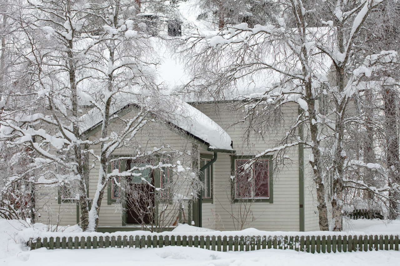
Day 1: Canal Chronicles & Old Montreal Meanders
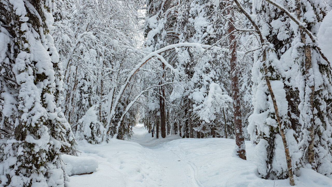
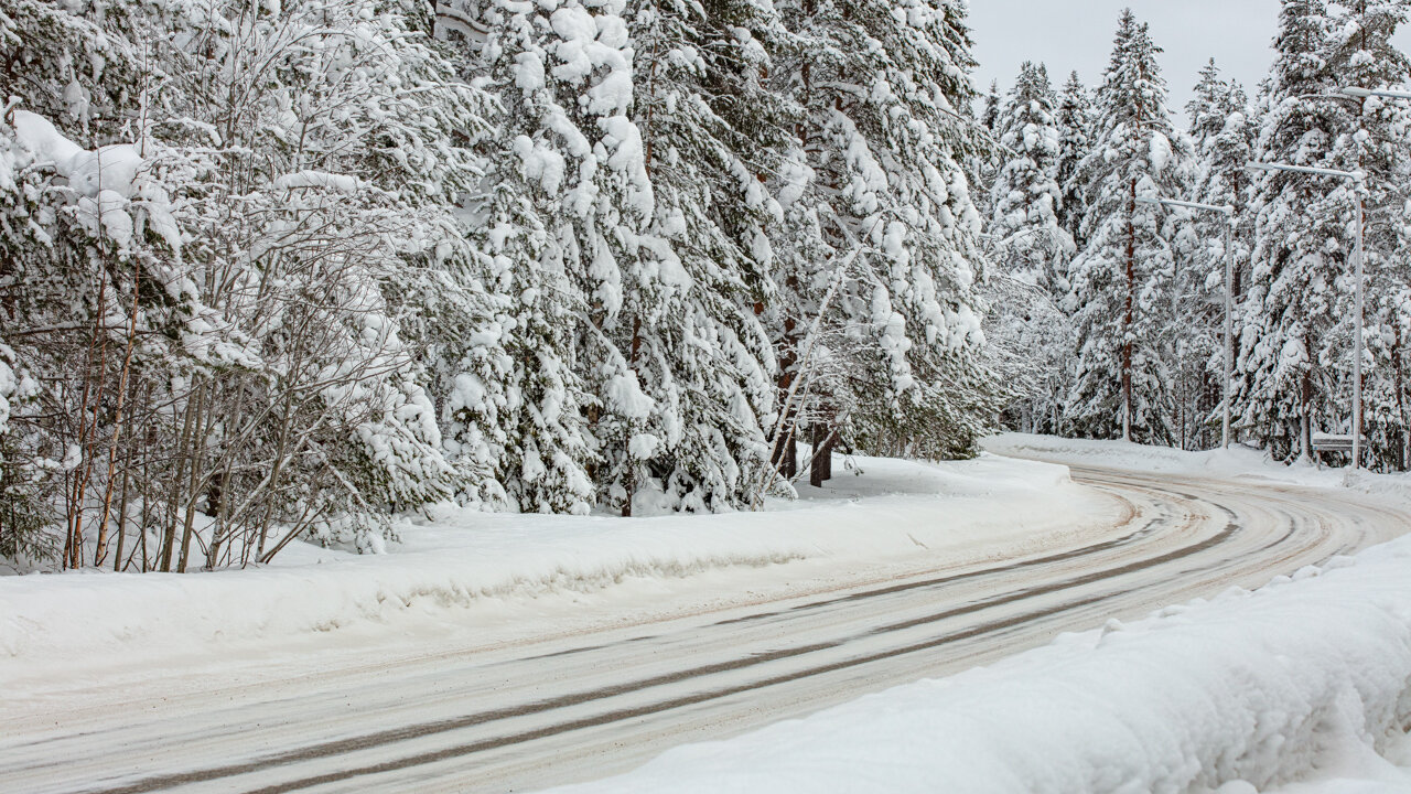
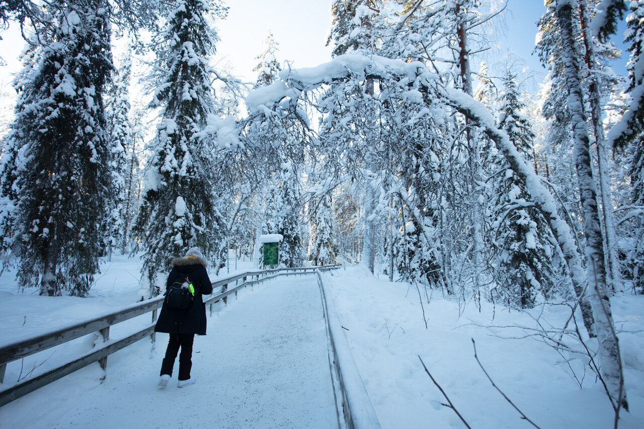
Started bright and early at the Lachine Canal, where I met a bird-watching enthusiast who probably wondered why I was lugging around a camera that could double as a workout weight. Found this gorgeous S-curve in the path - spent way too much time there, but when you're carrying a GFX 100 II, you feel obligated to make every shot count (or at least that's what I tell myself to justify the purchase).


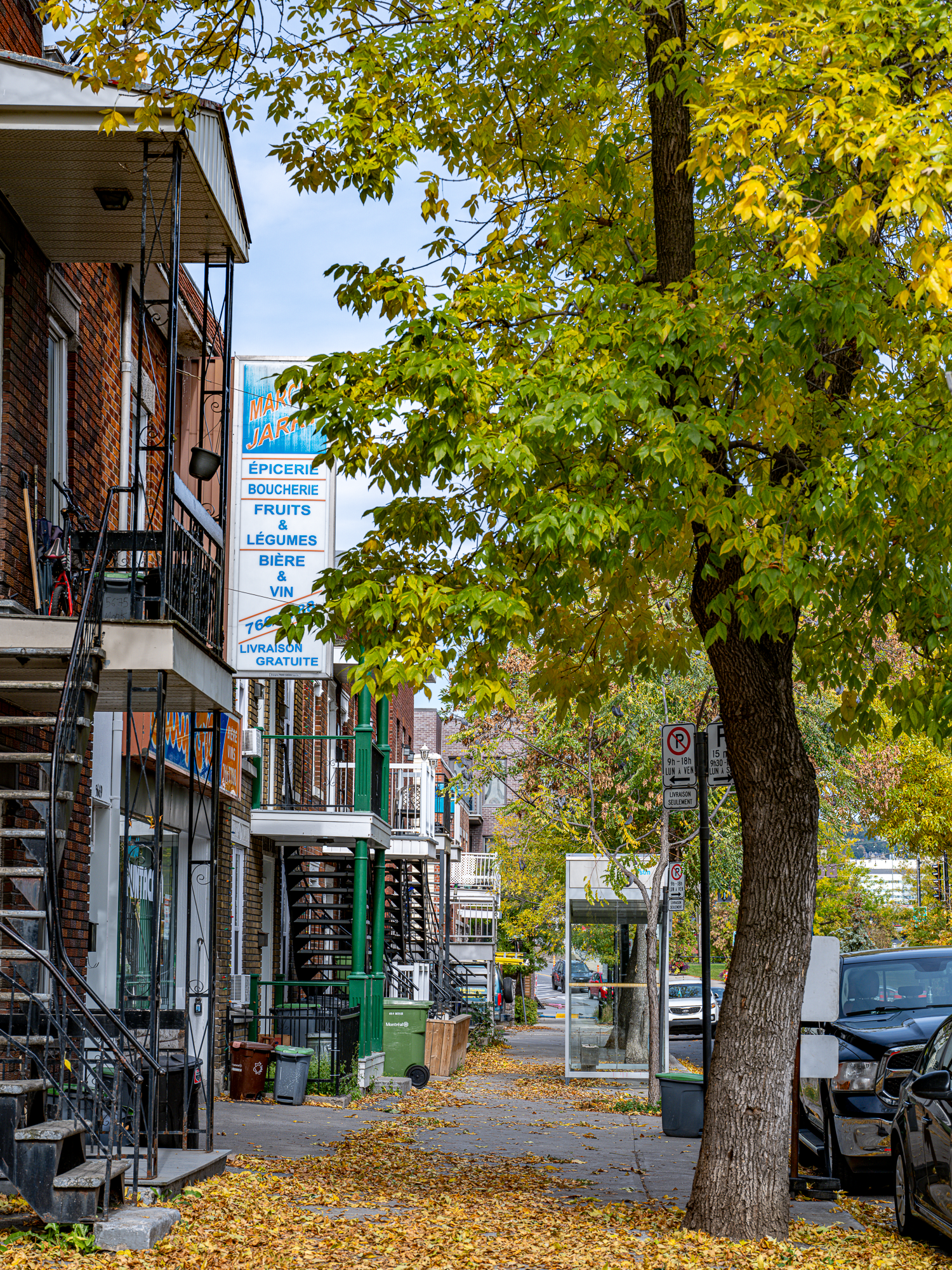

Afternoon hit Old Montreal like a tourist with a selfie stick, except I had about 10k worth of gear hanging off my shoulder. Between dodging horse carriages and trying not to trip on cobblestones (those things are not medium format camera friendly), I managed to capture some pretty sweet shots of:
Streets that look like they're straight out of Europe (but with better poutine)
The Notre-Dame Basilica (which my 20-35mm barely fit in frame)
Cafes where I pretended to know French
Ended the day at a jazz restaurant where my camera gear took up an entire chair. Pretty sure the waiter thought I was on a date with my tripod.


Day 2: The Mont Royal Workout
Ever tried carrying medium format gear up Mont Royal? No? Well, let me tell you - it's nature's way of saying "maybe you should've bought a mirrorless." But boy, were those panoramas worth it! Set up my Gitzo (which people kept mistaking for a telescope) and the Arca Swiss Cube Head (which sounds like a robot from a sci-fi movie).
Made it to Beaver Lake just in time for what I thought would be a peaceful shoot, until Mother Nature decided to play "dodge the hailstone" with my weather-sealed gear. Never seen a photographer pack up so fast - though I did manage to get some shots of very confused looking gulls first.


Day 3: Downtown Shenanigans
Spent my last day downtown, switching between the GFX and Pocket 3 like a photographer with commitment issues. The Museum of Fine Arts was a nice break - though I kept catching myself pixel-peeping actual paintings (photographer problems).
Wrapped up the day at India Rosa, where I finally gave my camera bag a rest and focused on some serious curry business. Nothing beats ending a photo trip with a food coma!
Pro Tips
1. Maximizing That Medium Format Look
- Take full advantage of the GFX sensor's beautiful falloff characteristics and depth of field
- Use wider apertures (f/2.8-4) with middle distances (10-20 feet) to subjects to maximize the '3D pop' effect
- Position subjects with depth behind them - medium format shines when there are layers in your image
- Look for scenes with lots of detail and texture - the GFX resolves incredible micro-contrast
- Consider shooting slightly wider than you would with full-frame since the depth of field characteristics will naturally separate your subject
2. Technical Excellence & Sharpness
- Always aim for base ISO (100) when possible - the GFX delivers incredible dynamic range here
- Double your usual shutter speed rule - if you'd shoot 1/100 on full frame, go 1/200 on GFX
- For critical focus:
- Use a tripod whenever possible
- Enable focus peaking
- Zoom in to 100% in live view for precise manual focusing
- Consider focus bracketing for landscapes or architectural shots
- Use the pixel shift feature for ultimate detail in static scenes
3. Workflow & Memory Management
- Shoot compressed raw to manage file sizes (files are still massive but manageable)
- Consider using the sub-memory card slot for JPEGs as backups
- Get familiar with the custom function buttons - quick access to features saves time
- Use exposure preview in EVF to nail exposure
- Keep spare batteries - the high-res sensor and processing demands more power
The Real Talk
Look, Montreal is a photographer's playground - whether you're rocking a medium format beast like I was or just your phone camera. The city's got more character than a Christopher Walken monologue, and every corner's got a new story to tell.
Just remember to look up from your viewfinder occasionally - Montreal's the kind of city you need to experience with all your senses (especially taste - did I mention the poutine?).
Wrapped up the trip with a flight back to Vancouver, my memory cards full, my back sore, but my creative soul happy. And yes, I did buy my gear its own seat on the plane. (Okay, not really, but I thought about it.)
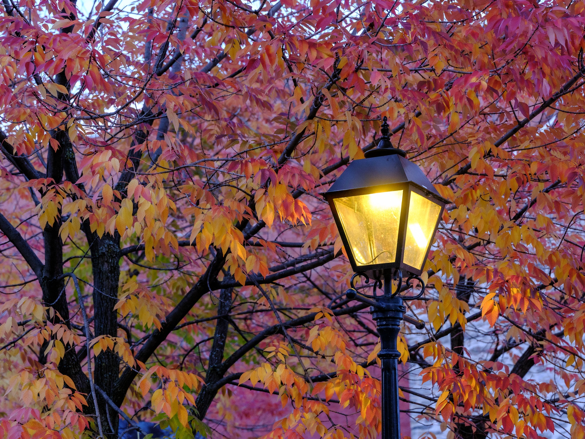
Shot in fall 2024, when the leaves were showing off and my gear's weather sealing got a proper workout. Thanks for coming to my TED Talk about carrying too much camera gear around Montreal.


A Long Weekend Getaway on Vancouver Island Part 1
This Victoria Day long weekend, my family and I set out to explore the picturesque beauty of Vancouver Island. For me, it was not just a relaxing holiday but an opportunity to indulge in my passion for landscape photography. With stunning views, historic sites, and vibrant gardens on our itinerary, I was eager to capture the island’s essence through my lens. Here’s a detailed recount of our memorable trip from the perspective of a landscape photographer.

This Victoria Day long weekend, my family and I set out to explore the picturesque beauty of Vancouver Island. For me, it was not just a relaxing holiday but an opportunity to indulge in my passion for landscape photography. With stunning views, historic sites, and vibrant gardens on our itinerary, I was eager to capture the island’s essence through my lens. Here’s a detailed recount of our memorable trip from the perspective of a landscape photographer.
Day 1: Journey to Victoria
From Vancouver to Tsawwassen Ferry Terminal
Our adventure began in the early evening with a scenic drive from Vancouver to the Tsawwassen Ferry Terminal. The soft, golden light of the setting sun bathed the landscape in a warm glow, providing beautiful lighting conditions for photography. The route, flanked by lush greenery and glimpses of the ocean, offered several captivating scenes. I couldn't resist stopping a few times to capture the beauty of the landscape illuminated by the evening light.
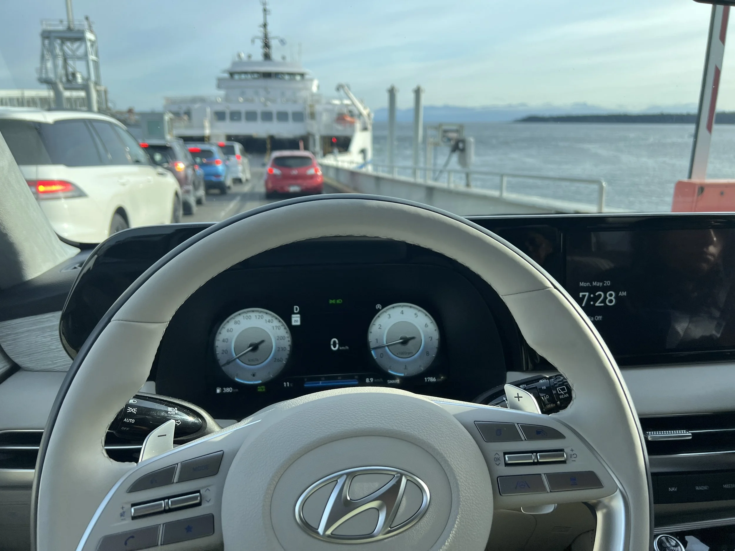
Sunset Ferry Ride to Swartz Bay

We boarded the 7 pm ferry to Swartz Bay on Vancouver Island. The ferry ride was an excellent opportunity to capture the transitioning light of the sunset over the water. The sky transformed into a vibrant palette of oranges, pinks, and purples, reflecting off the calm ocean surface. I spent most of the crossing on the deck, capturing the serene waters, the dynamic sky, and the occasional silhouette of a distant island. The children enjoyed watching the seagulls and the occasional dolphin, adding to the magical atmosphere of the journey.
Arrival and Stay in Victoria
We arrived at Swartz Bay around 8:30 pm and drove to Victoria, where we checked in at the Grand Pacific Hotel near Victoria Harbour. The drive was peaceful, with minimal traffic and the gentle glow of city lights guiding us. The hotel's prime location near the harbour was perfect for some night photography. The calm waters of the harbour, reflecting the lights of the Parliament Building and nearby boats, created a stunning scene. After capturing a few night shots, we settled in for a good night's rest.
Day 2: Exploring Victoria and Butchart Gardens
Morning Stroll Around Victoria Harbour

After a restful night and a hearty breakfast, we set out to explore Victoria Harbour. The morning light was ideal for photography, casting soft shadows and highlighting the historic architecture of the Parliament Building. The harbour was bustling with activity, from boats setting out on early morning excursions to floatplanes taking off and landing. With my GFX 100 II and GF 45-100 mm lens, I captured the vibrant harbour scenes, focusing on the interplay of light, water, and historic buildings.

Visit to Butchart Gardens
Next, we drove to Butchart Gardens, a paradise for any landscape photographer. The drive itself was picturesque, with coastal views and lush forests lining the route. As we arrived, a light rain began to fall, adding a fresh, dewy look to the gardens. After a quick lunch at the garden's cafe, the skies cleared, revealing the gardens in their full springtime splendor.
Photography in the Gardens

The Butchart Gardens were a visual feast. The highlights were the vibrant spring blossoms, particularly the tulips in full bloom. Their bright colors created stunning focal points in my compositions. The Sunken Garden, with its rich tapestry of flowers and intricate landscaping, was particularly captivating. I spent considerable time capturing wide-angle shots to encompass the grandeur of the landscape, as well as close-ups to highlight the intricate details of individual flowers.

The waterfalls within the gardens added a dynamic element to my photography. The sound of the cascading water and the play of light on the moving water made for some compelling shots. The Japanese Garden provided a tranquil escape with its serene water features, meticulously maintained plants, and traditional structures. The delicate balance of elements in this garden made it one of my favorite spots for capturing peaceful, reflective scenes.

Drive to Nanaimo
As the day came to a close, we left Butchart Gardens and set off for Nanaimo. The drive to Nanaimo was a peaceful end to a day filled with beauty and inspiration. The scenic route took us through charming small towns and along coastal roads with stunning views of the ocean. We made a few stops along the way to stretch our legs and take in the sights, including a picturesque beach where the kids played in the sand and collected shells.
Arriving in Nanaimo, we enjoyed a hearty dinner at a local Indian restaurant before heading to our Hotel and checking in. Nanaimo is known for its friendly atmosphere and delicious food, and we were not disappointed.
This Victoria Day weekend was a perfect blend of family time and landscape photography. The scenic ferry ride, the historic charm of Victoria, and the breathtaking beauty of Butchart Gardens provided endless opportunities for capturing stunning images. Vancouver Island is a paradise for landscape photographers, offering a diverse array of scenes, from bustling harbours and historic buildings to serene gardens and coastal vistas.
For anyone with a passion for photography, I highly recommend taking the time to explore both the well-known attractions and the hidden gems of Vancouver Island. Each moment on this trip was a reminder of the island's unique charm and natural beauty

A Spring Symphony in Vancouver: Capturing the Blossom Glory

Springtime in Vancouver, BC is a magical season, where nature puts on a spectacular show of vibrant colors and delicate fragrances. As a travel and fine art photographer, I find myself irresistibly drawn to the ethereal beauty that blossoms bring to urban landscapes. This year, my lens focused on the cherry blossoms that adorn Vancouver's streets, transforming them into a surreal wonderland.
The Splendor of Cherry Blossoms
The cherry blossoms in Vancouver are not just flowers; they are a celebration of life and renewal. Each spring, the city is graced with a cascade of pink and white blooms, creating a canopy that stretches over streets, parks, and gardens. These blossoms are a testament to the fleeting beauty of nature, a reminder to cherish each moment.

In the first image, I captured a street lined with pink cherry blossoms. The arching branches form a tunnel of flowers, inviting passersby to immerse themselves in the beauty. The delicate petals flutter in the breeze, creating a soft, pink snow that gently blankets the ground. This scene, with its vibrant hues and tranquil atmosphere, is a perfect representation of spring in Vancouver.
The Art of Composition
Photography is not just about capturing a scene; it's about conveying a story, an emotion. In the second image, I zoomed in to highlight the intricate details of the cherry blossoms. The clusters of flowers, with their layers of petals, create a sense of depth and texture. The pink blossoms against the clear blue sky offer a striking contrast, enhancing the visual appeal of the photograph.

This close-up shot emphasizes the delicate beauty of each blossom. The soft focus on the background ensures that the flowers take center stage, drawing the viewer's attention to their intricate structure and vibrant color. It's a celebration of nature's artistry, a moment frozen in time.
The White Blossom Avenue
The third image showcases a different side of Vancouver's springtime charm. Here, the street is adorned with white cherry blossoms, creating a serene and ethereal ambiance. The white blooms have a purity and simplicity that is both calming and captivating. They transform the urban environment into a tranquil haven, offering a brief escape from the hustle and bustle of city life.

The composition of this photograph captures the expanse of the blossom canopy. The branches reach out, almost touching, creating a continuous archway of white flowers. The parked cars and houses fade into the background, allowing the natural beauty to take precedence. This image is a testament to the transformative power of nature, even in the heart of a bustling city.
Capturing the Essence of Spring
As a fine art photographer, my goal is to evoke emotions and tell a story through my images. Spring in Vancouver is a season of renewal and transformation, where the world comes alive with color and fragrance. The cherry blossoms are a symbol of this change, a reminder that beauty can be found in the most unexpected places.

In these photographs, I aimed to capture not just the visual beauty of the blossoms, but also the emotions they evoke. The sense of wonder, tranquility, and joy that comes with witnessing such a breathtaking display of nature. Each image is a piece of the larger narrative of spring, a chapter in the story of Vancouver's seasonal transformation.
The Technical Aspects
From a technical standpoint, photographing cherry blossoms presents its own set of challenges and rewards. The soft, pastel colors can be tricky to capture accurately, requiring careful attention to exposure and white balance. I often use a wide aperture to create a shallow depth of field, allowing the blossoms to stand out against a blurred background. This technique not only highlights the subject but also adds a dreamy quality to the image.
Lighting is another critical factor. Early morning or late afternoon light, known as the golden hour, provides the best conditions for capturing the delicate hues of the blossoms. The soft, diffused light enhances the colors and reduces harsh shadows, creating a more balanced and pleasing composition.

Conclusion
Spring in Vancouver is a visual symphony, a celebration of nature's beauty that captivates the senses and inspires the soul. Through my lens, I aim to share this beauty with the world, to capture the fleeting moments of magic that define this season. The cherry blossoms, with their delicate petals and vibrant colors, are a perfect embodiment of spring's essence.
These images are more than just photographs; they are a testament to the beauty and resilience of nature. They remind us to pause, to appreciate the world around us, and to find joy in the simple, fleeting moments of life. As a travel and fine art photographer, I am grateful for the opportunity to witness and capture these moments, to share the beauty of spring in Vancouver with you.

Postcards from Vermont: A Photography Journey through Vermont and New Hampshire
For most Landscape and Travel photographers, the allure of fall colours is irresistible. During the Autumn of 2022, I embarked on a picturesque adventure through Vermont and New Hampshire, capturing the vibrant hues of autumn. My journey began in Boston, where I flew in from Baltimore, ready for a week of stunning landscapes and endless photo opportunities.
Day 1: Arrival in Boston and Drive to St. Johnsbury
Landing in Boston, I swiftly picked up my rental car at Logan Airport and hit the road towards St. Johnsbury, Vermont. The anticipation of the fall foliage was palpable as I drove through the scenic routes, each mile bringing me closer to my destination. Arriving at the Fairbanks Inn, my home from October 3rd to 6th, I felt a sense of excitement for the days ahead.
Days 2-4: Exploring St. Johnsbury and Surroundings

The Peacham Congregational Church is said to be one of the most photographed buildings in all of New England.
Peacham, a picturesque hill town in northeastern Vermont, has a population of 732 people that swells to over 1,000 in the summer months. The village center with its cluster of early to mid-19th century Federal and Greek Revival homes has been designated a National Historic District. Several large working farms are located a short distance from the village. The rolling fields, together with secluded ponds, brooks, and dense woodlands, give the town its distinctive rural character.
During my stay in St. Johnsbury, I immersed myself in the quaint charm of the area. One of my first stops was the town of Peacham, renowned for its quintessential New England beauty. The drive via Macks Mountain Road was a photographer's dream, with several spots offering breathtaking views. Peacham did not disappoint; its serene landscapes and rustic charm provided countless photo opportunities.

Macks Mountain Road is a shortcut from Walden to Peacham
Joe's Pond was another gem, with its tranquil waters reflecting the fiery autumn leaves. I spent hours here, capturing the interplay of light and colour. The highlight, however, was the AM Foster-Covered Bridge. This iconic structure, set against a backdrop of rolling hills and vibrant foliage, was a scene straight out of a postcard.

AM FOSTER COVERED BRIDGE, VT
Fueling my adventures was Amato's, conveniently located near the Fairbanks Inn. Their hearty meals energized me for the long days of exploration and photography.
Day 5: Journey to Franconia Notch State Park
On the morning of October 6th, I checked out of the Fairbanks Inn and headed to New Hampshire, aiming for the Flume Gorge in Franconia Notch State Park. The Gorge, with its towering granite walls and cascading waterfalls, was a mesmerizing subject for my lens. The scenic trek leading past flowing water and a waterfall was invigorating and I didn’t notice that I was reasonably tired after the drive and the hike with my camera gear till I got out of the Gorge.

Flume Gorge Trail at Franconia Notch State Park, New Hampshire, USA
Pushing myself, I embarked on another trek to Artist's Bluff. This short but steep hike was a test of my endurance. The narrow path, crowded with fellow photographers and Instagram influencers, was a testament to the bluff's popularity. As the sun began to set, I decided to make my way down before darkness fell. The descent was challenging, with overgrown roots and a rough path, but the effort was well worth the panoramic views I had captured.
Days 6-7: Discovering Woodstock and Surroundings

A scenic Farm near Woodstock, VT
After a tiring day, I checked into the Holiday Inn Express at White River Junction. This location served as my base for exploring Woodstock and its renowned fall colour attractions. Over the next two days, I visited Sleepy Hollow Farm and Sugarbush Farm, each offering a unique perspective on the autumn landscape. The vibrant colours and idyllic settings made for some of my favourite images of the trip.

Final Day: Return to Boston
As my trip drew to a close, I reluctantly packed up and headed back to Boston. The colours were still peaking, and it was clear that the best was yet to come. But that's the challenge with nature and travel photography—you can never time it perfectly. I spent my last night at the luxurious Colonnade Hotel, indulging in some well-deserved room service and reflecting on the incredible week I had experienced.

Reflection
My journey through Vermont and New Hampshire was a whirlwind of beauty, challenge, and fulfillment. The early mornings and long days were exhausting, but each moment spent behind the camera made it all worthwhile. As I flew back to Baltimore, my heart was sated with the memories of the stunning landscapes and vibrant colours that I had the privilege to capture. The top images from this trip will find their way to my collection called Postcards from Vermont which I had the privilege to exhibit at the Inaugural Edition of Madras Art Weekend. You can find some of these images in the Print Store.
Equipment Used on this trip
Leica SL2 , Lumix S5, Lumix S 24-104 f4, Osmo Pocket -1 , Gitzo Tripod and Arca Swiss C1 Cube Head, Mindshift Backlight 26 L Bag

My Exploratory trip to Finnish Lapland- Winter Wonderland !
February 2018 brought with it some unexpected travel plans. I think this was the quickest trip by far from Thought to Planning and actually heading there that I have experienced in a very long time. I have been wanting to do some true white winter photography for a while now and being situated in India and Singapore you can see how that can be a challenge.

February 2018 brought with it some unexpected travel plans. I think this was the quickest trip by far from thought to planning and actually heading there that I have experienced in a very long time. I have been wanting to do some true white winter photography for a while now and being situated in India and Singapore you can see how that can be a challenge.
But this year all that changed as a chain of events resulted in my ending up in Finnish Lapland near the Arctic Circle. So what follows is a Photo Essay/Travel Tip/Photography Learnings from that trip.
Why Lapland?
Having shot primarily during spring and fall for the past several years I was nagged by a desire capture photographs of a proper white winter.
I had been putting off winter photography for all the usual reasons. Having lived most of my life in the hot tropical conditions of South India and also having experienced the biting cold winters of North Eastern US for a few years I have generally been comfortable planning my Landscape and Travel shoots during the shoulder seasons of Spring and Fall.
And I have hundreds of images from those shoots. But what was starkly missing from my portfolio was winter photos.
Getting There
From Singapore
Finnair has direct connections from Singapore to Helsinki. From Helsinki fly to Rovaniemi which is the main gateway to Finnish Lapland.
From India
Finnair flies from Mumbai and New Delhi to Helsinki from where you can connect to Rovaniemi.
Other Notable Airports in Lapland are Ivalo and Kittila but I strongly suggest heading to Ravaniemi first getting your winter bearings there in the comfort of a relatively larger town with load of facilities and Tour Operators before heading in to the more remote areas.
Watch this Video for more Information on how I planned for my trip.
When to Go to Experience Winter in Lapland

December to March is winter period at Lapland.
Typical Temperatures in winter
December: -20 to -10 degrees Celsius
January: -30 to -15 degrees Celsius
February: -20 to -15 degrees Celsius
March: -15 to -5 degrees Celsius
Clothing
At these low temperatures its very important to stay warm . Wear Layers and Choose good quality lightweight synthetic fibres or wool. Stay away from cotton while choosing clothing for this trip.
During my trip the coldest temperature was -29C and on average it was in the -15C range. I wore 3 layers regularly starting with thermals and then insulated pants and woollen sweaters or fleece and the final layer being a heavy insulated jacket and snow pants.

For footwear I wore sock liners and thick wooden socks and my mid height hiking boots which did a decent job of keeping me warm. And to protect my head and face I had a balaclava over which a I wore thick woolen Beanie and UV goggles to protect my face.
I used photography gloves with openable tips for index finger and thumbs on both hands to keep me warm but also make it easier to operate the camera controls.
My Favourite Outdoor Wear Brands
For Clothing : White Sierra, Patagonia, Arcteryx, Marmot, Mammut
Winter Gear
2. Snow Pants
3. Base Layers
What was in my camera Bags?
As photographers we are ofter conflicted with what to take and what to leave behind just in case and this time was no different. I think I carried a little more than I should have but here is the list of equipment I carried for the trip. I took with me the Canon 5D IV and Canon 5DS-R Camera bodies. These are now available at a discount now and are still very good options. But technology has marched on and there are several great high resolution cameras with better dynamic range available now.
Suggested Cameras Updated for 2021
From Canon
Canon EOS R6 Full-Frame Mirrorless Camera with 4K Video
Canon RF 70-200mm f/2.8L is USM Lens
Canon RF 24-105 mm F/4 l is USM Lens
From L Mount Alliance
Panasonic Lumix S DC-S1M, Full Frame Camera with 24-105 Lens kit
Leica SL2 47MP Mirrorless Full-Frame Camera (Body Only)
Leica Vario-Elmarit-SL 24-90mm f/2.8-4 ASPH. Lens
From Fujifilm Medium Format
Fujifilm GFX 100S Body - Black
Fujinon GF32-64mmF4 R LM WR Lens
From Sony
Sony - FE 16-35mm F2.8 GM Wide-Angle Zoom Lens
Sigma 592965 28-70mm F2.8 DG DN for E mount
In hindsight I think the 55mm Otus and the 100mm Macro were overkill and weren't used all that much. The Lens that I enjoyed shooting the most with were the Sigma 20mm f1.4 and the Canon 70-200 f2.8 followed by the Canon wide angle zoom.
Accessories
Mindshift Gear- Backlight 26L Backpack , Think Tank Airport Stroller Bag
Gitzo Mountainer Tripod and Arca Swiss Z1 ball head
Rugged Torchlight
San Disk Extreme and Lexar CF Cards and SD cards
Lacie Rugged External Hard Drive and San Disk SSD Drives for backing up images
Macbook Pro and iPad Pro which were a bit redundant next trip I wil carry just one of these.
(I Lost my B1 Ball head while using the ski lift to to the top of kaunispa and now need to replace that. Hazards of travel photography !)
My Itinerary

My Journey started in Singapore from where I flew on British Airways to Helsinki Via Heathrow . From Helsinki I took a connecting flight to Rovaniemi the gateway town to Finnish Lapland . Rovaniemi has two unique qualities. 1 the Arctic Circle actually runs through it. 2 It is home to Santa’s Village and Santa’s post office.
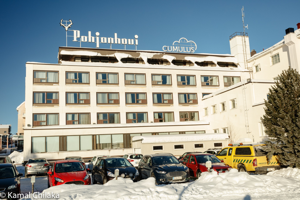
After landing at Rovaniemi Airport and collecting my baggage I quickly donned enough protective clothing to withstand the short walk from the terminal door to the free bus into the city. I was dropped off at the entrance to my hotel the Cumulus Hotel Pohjanhovi which I had booked through Booking.com and was soon checked in and up in my room with was spacious and warm.
Rovaniemi the gateway to Lapland
Rovaniemi is a nice town for starting your journey into Lapland. If you have never experienced a Nordic winter before its good to get acclimatised here and get your winter bearings. Rovaniemi has a number of good tour and safari operators who can help you with a number of Lapland activities such as trips to Reindeer Sleigh rides and farm visits, husky tours, snowmobiling, snowshoeing and even night safaris to watch the northern lights.
If you are traveling with family and young children a trip to the Santa Claus Village and and Santas post office would be a good place to start.
I was looking forward to spend time photographing the nature winter walks in and around the city.
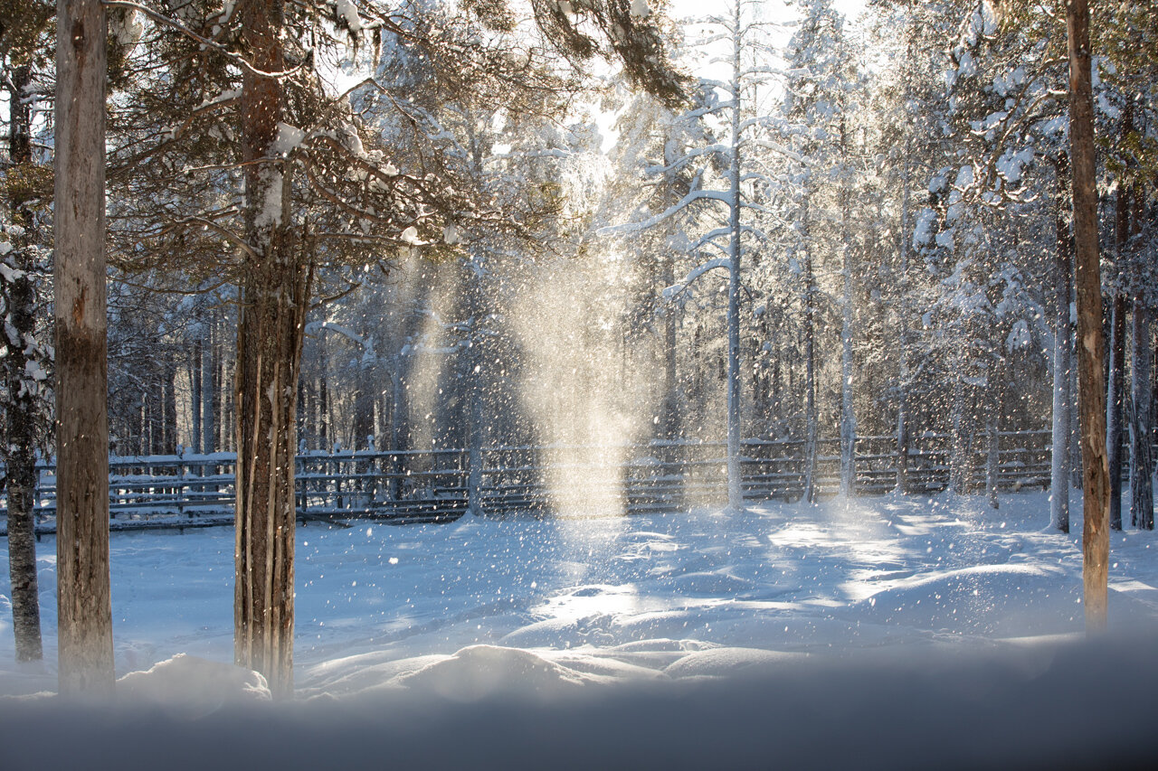
Having slept well during my long haul flight after a brief rest at the hotel I was into my winter clothing and out with my camera doing a recon of the area around the hotel which was located on the banks of the Kemijoki River. The River was mostly frozen over and a blanket of snow had covered the frozen river. I could spot people river fishing through holes in the ice and I also watched a group of snow mobiles returning from a safari which was quite fascinating to watch as they drove across the frozen river led by an expert .
It was golden hour as I was exploring the river bank and was able to capture a couple of nice images.
I started to feel cold as the sun dipped below the horizon and decided to head back to the hotel and get myself a warm drink and some dinner before retiring for the night. I ensure I had all my batteries charges and memory cards loaded and gear ready for my first full day of shooting at the Arctic Circle.
Day 1-Day 4 Rovaniemi
Where to Stay at Rovaniemi
Rovaniemi Offers a number of hotels and Apartments to stay at but winter is a very busy time specially during Christmas and accommodations can get fully booked a month or more in advance so book early.
I stayed at the Cumulus Hotel Pohjanhovi due to its location close to the river and also the rating and reviews from users. it turned out to be a good choice. The rooms were of a reasonable size and nice and warm which was a welcome relief after walking around in the cold for 5-6 hours a day.
But there area number of cottages and bed and breakfasts also available but can have little or no services and located remotely which will then require your to rent a car.
I managed without renting a car the entire trip as I was hesitant to drive in the icy winter conditions there. But I must mention the roads were all well maintained and clear and traffic was moving along well on the highways.
A few hotels which I found interesting during my search
Hotels at Rovaniemi with good reviews
Mid Range
Luxury
Video about my experiences exploring the Banks for the River Kemijoki
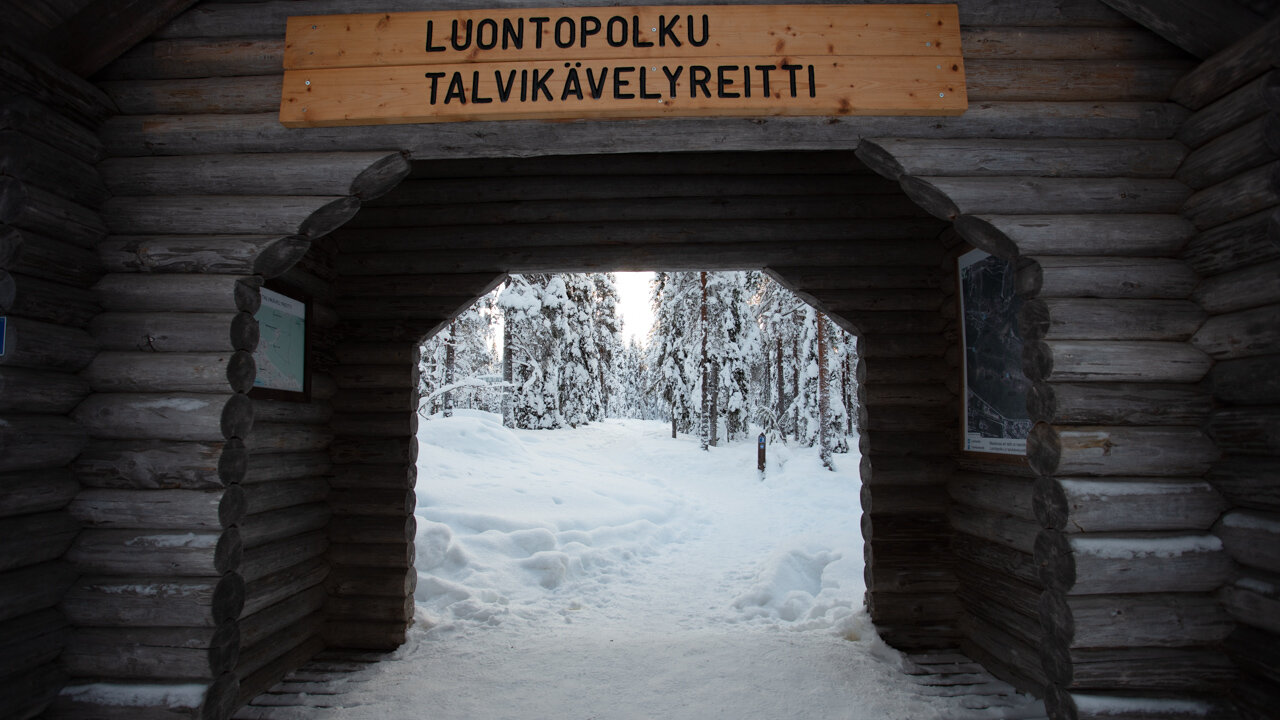
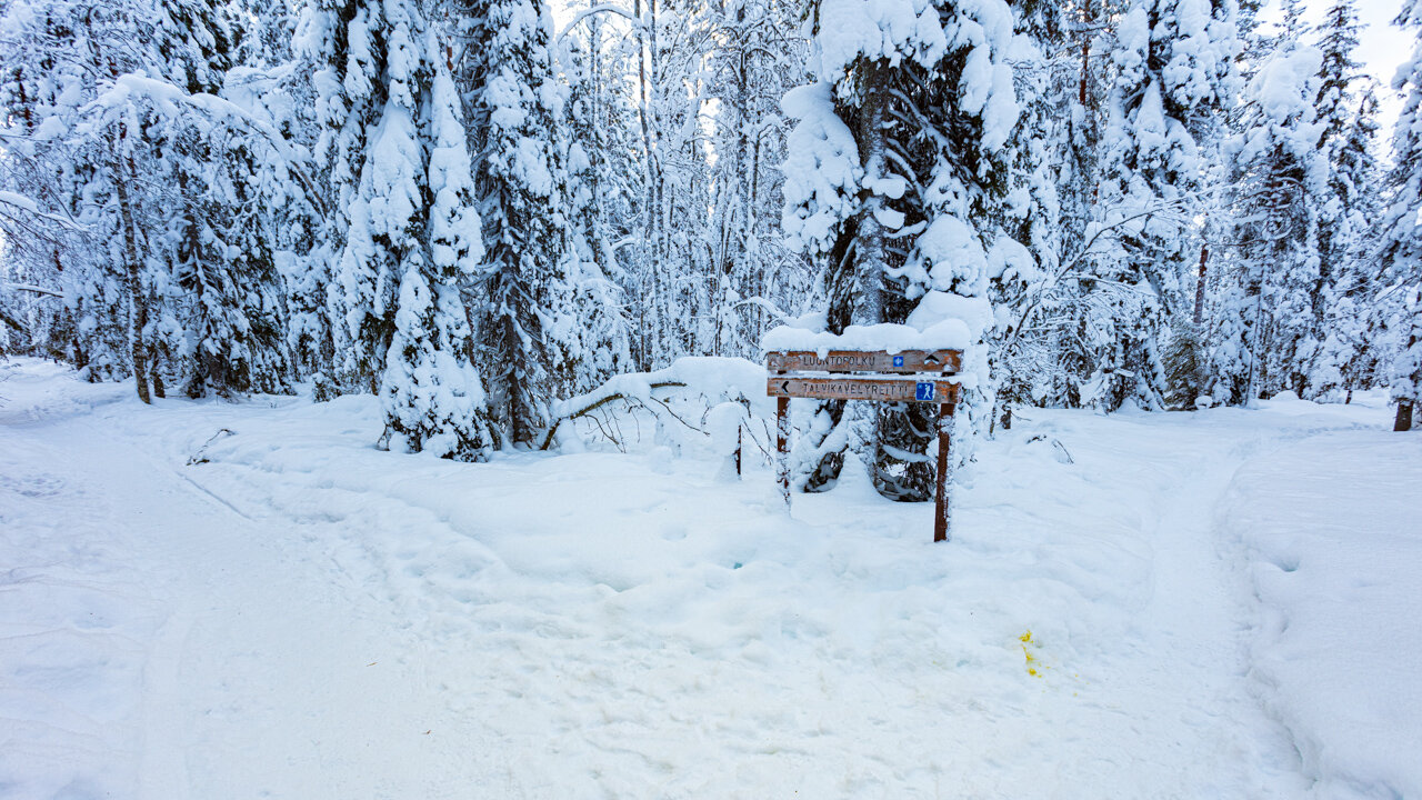
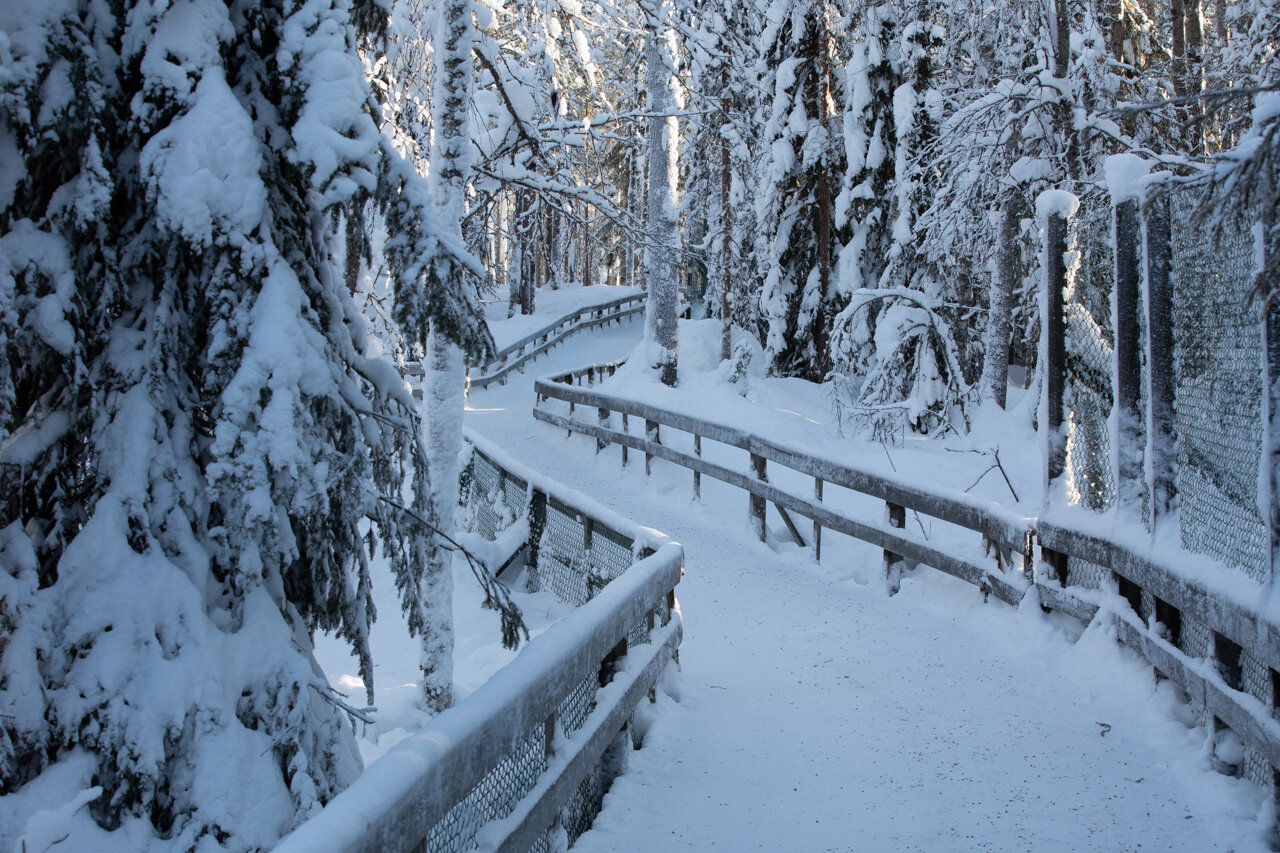
Exploring the Bridges Walk
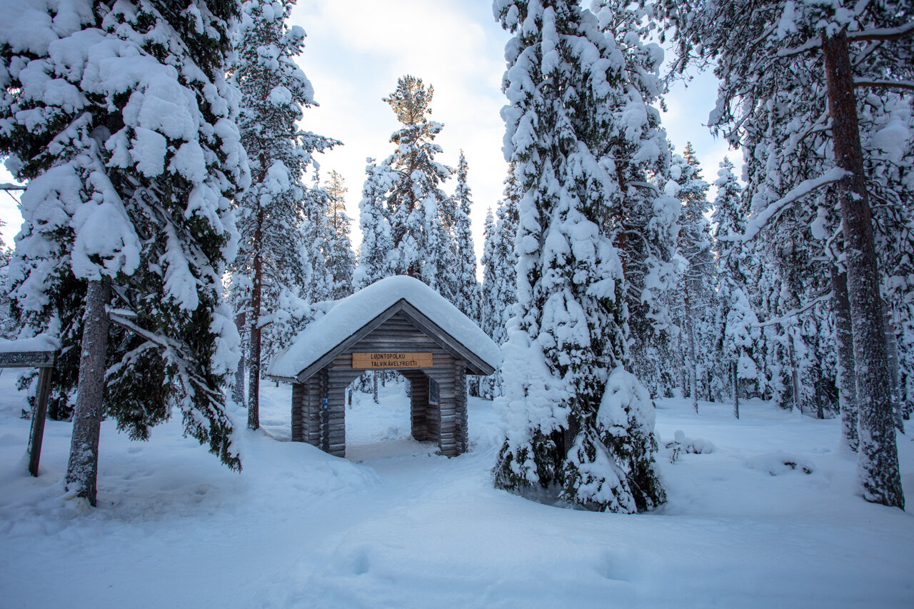
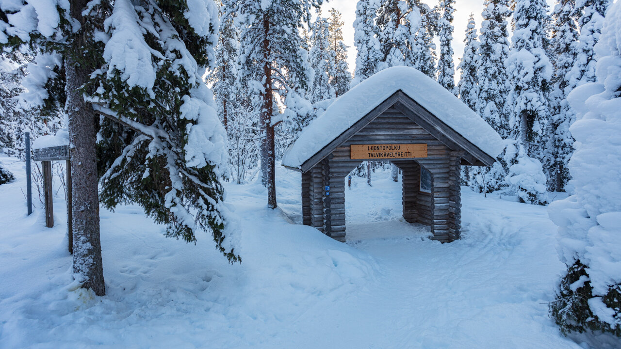
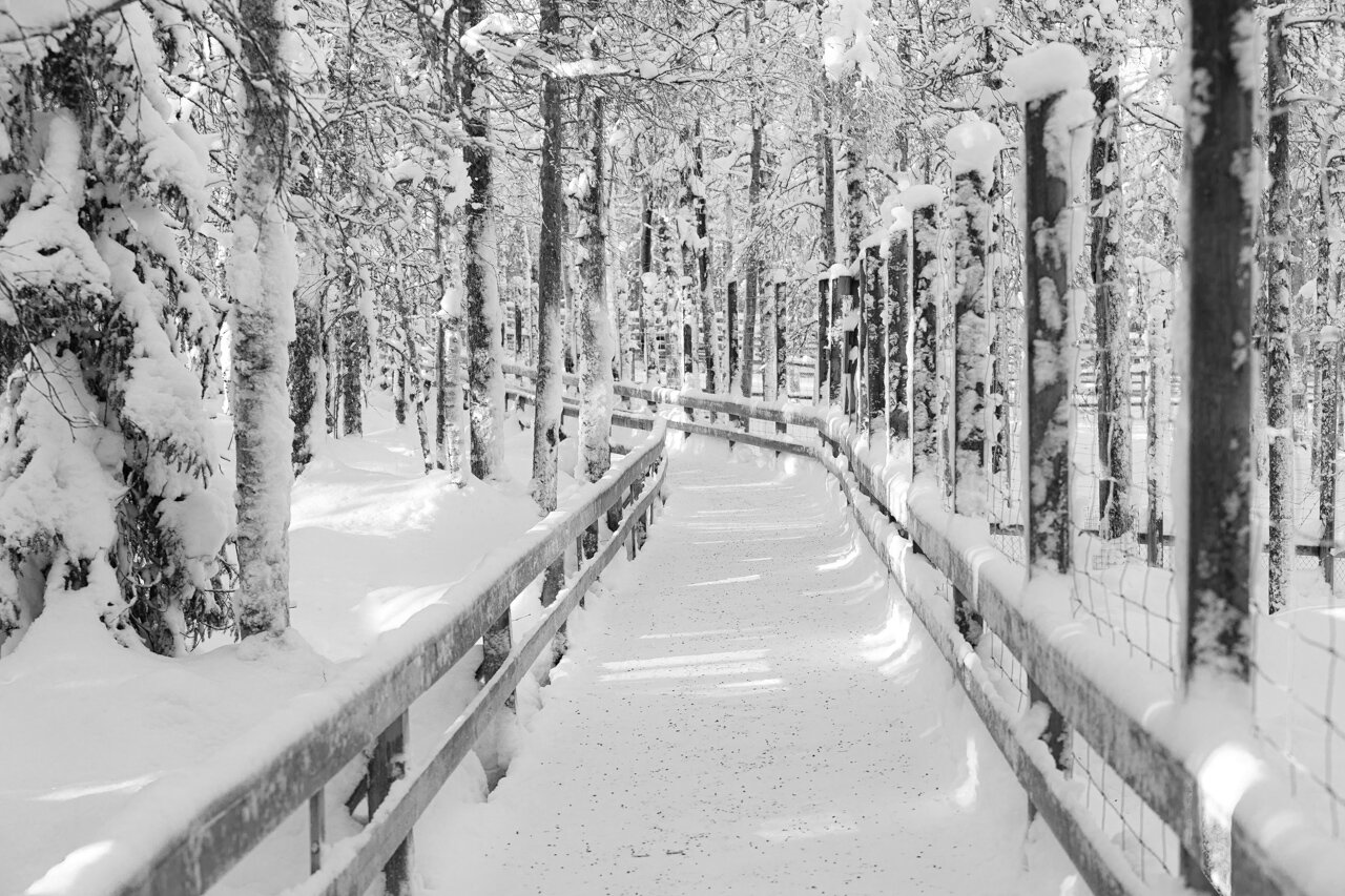
The 2 Bridges Walk is a picturesque walk along the banks of the Kemijoki River with crossings over the two bridges namely the Jätkänkynttilä, or Lumberjack Candle Bridge and the Old Railway Bridge.
You can also do the 4 Bridges walk is a longer loop covering all 4 bridges which totally about 8 km long. But I decided to just stick to the shorter walk as it was just oo cold to stay out for so long.
The walk offers great views of the Lumberjack candle bridge and frozen kemijoki and ounasjoki rivers.
You can spot people walking across the frozen river and also there area few outdoor saunas along the banks where you can take a dip in the icy waters and then get into a hot water tub.
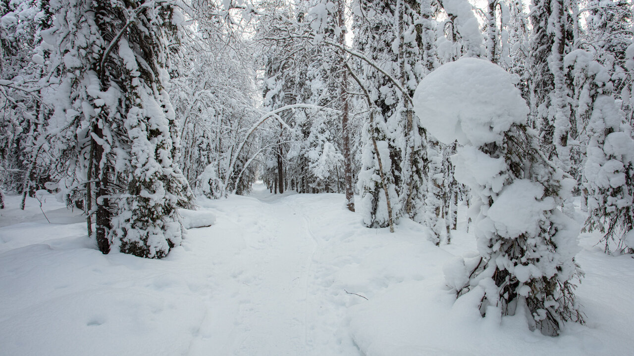
The light keeps changing continually from sunrise to sunset and you are presented with so many different options of photos.
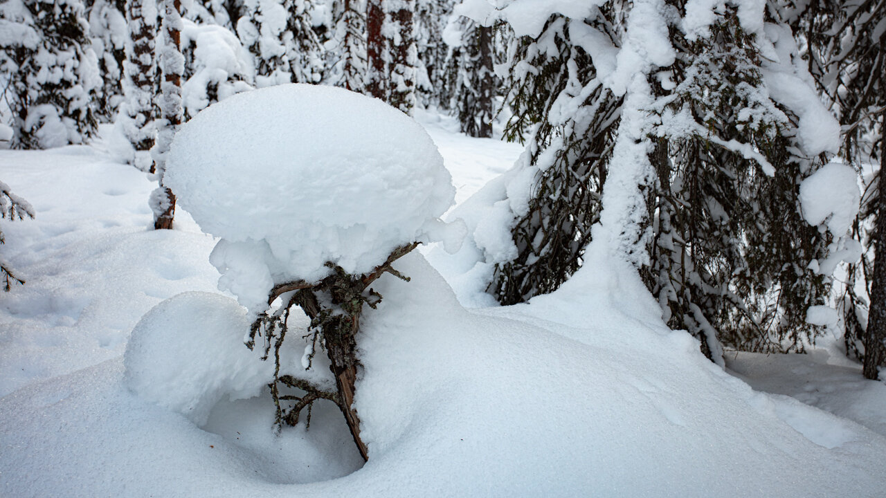
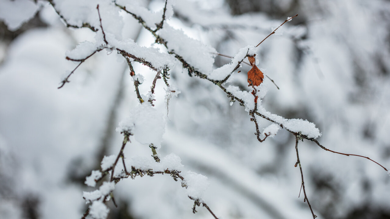
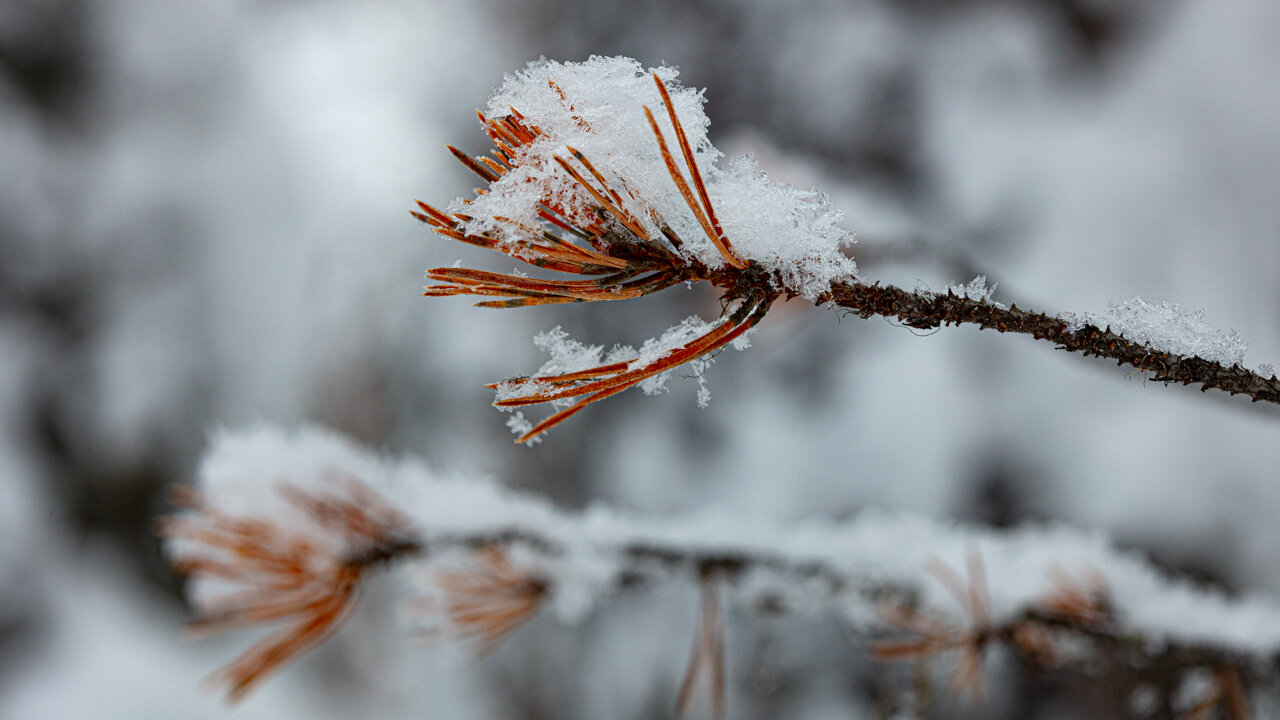
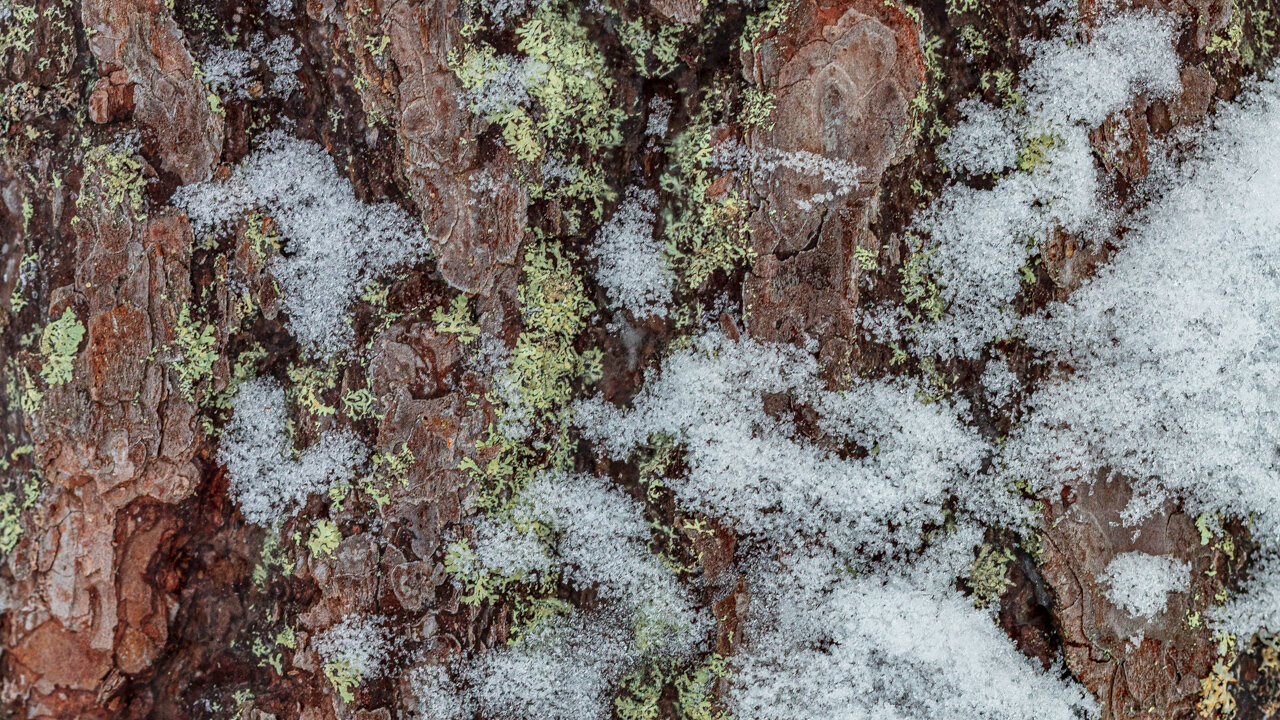
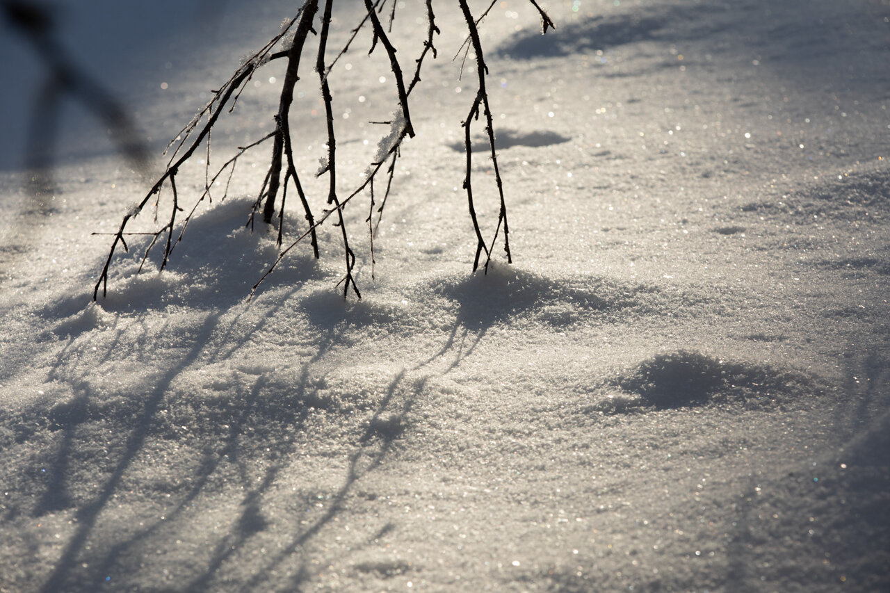
I specially liked exploring various compositions of the line of frost covered trees along the banks. I also enjoyed capturing small details and contrasts of plants and objects sticking out from the otherwise pure white snow.
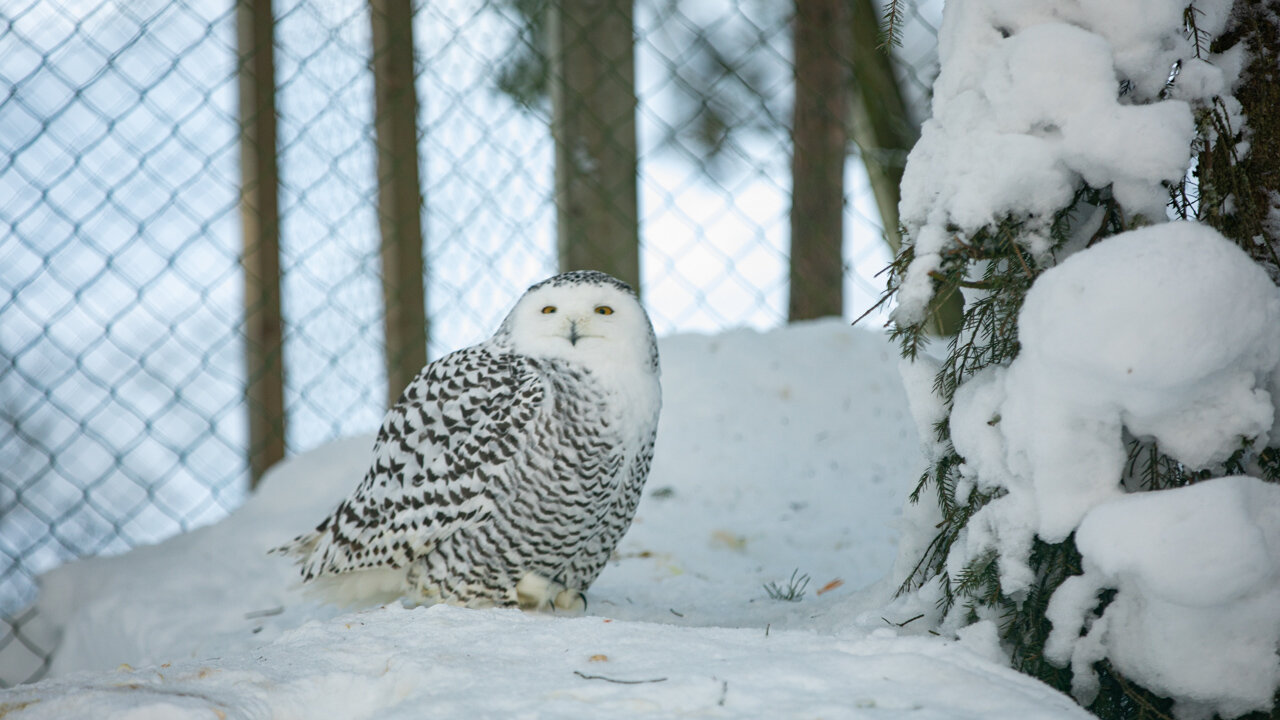
Video of my experiences Photographing at Ounasvaara Winter Trail and Ranua Wildlife Park
Image Gallery from Ounasvaara Winter Trail and Ranua Wildlife Park, Lapland, Finland.
Day 5 - Day 9 Saariselka
Where to Stay at Saariselka
I stayed at the Lapland Hotels Reikonlinna in Saariselka Village. Centrally located short walk to ski slopes and winter walking trails and has a bus stop just in front of the property.
Other hotels in Saariselka that looked interesting are
Holiday Club Saariselka
Aparthotel Kuukkeli Aurora
Kakslauttenen Igloo Village deserves special mention.its a popular and expensive resort but is unique.


Day 3 - Ranua Wildlife Park
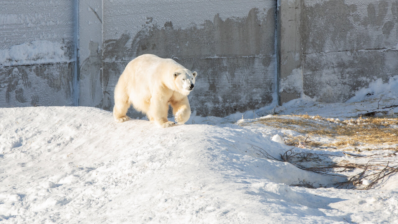
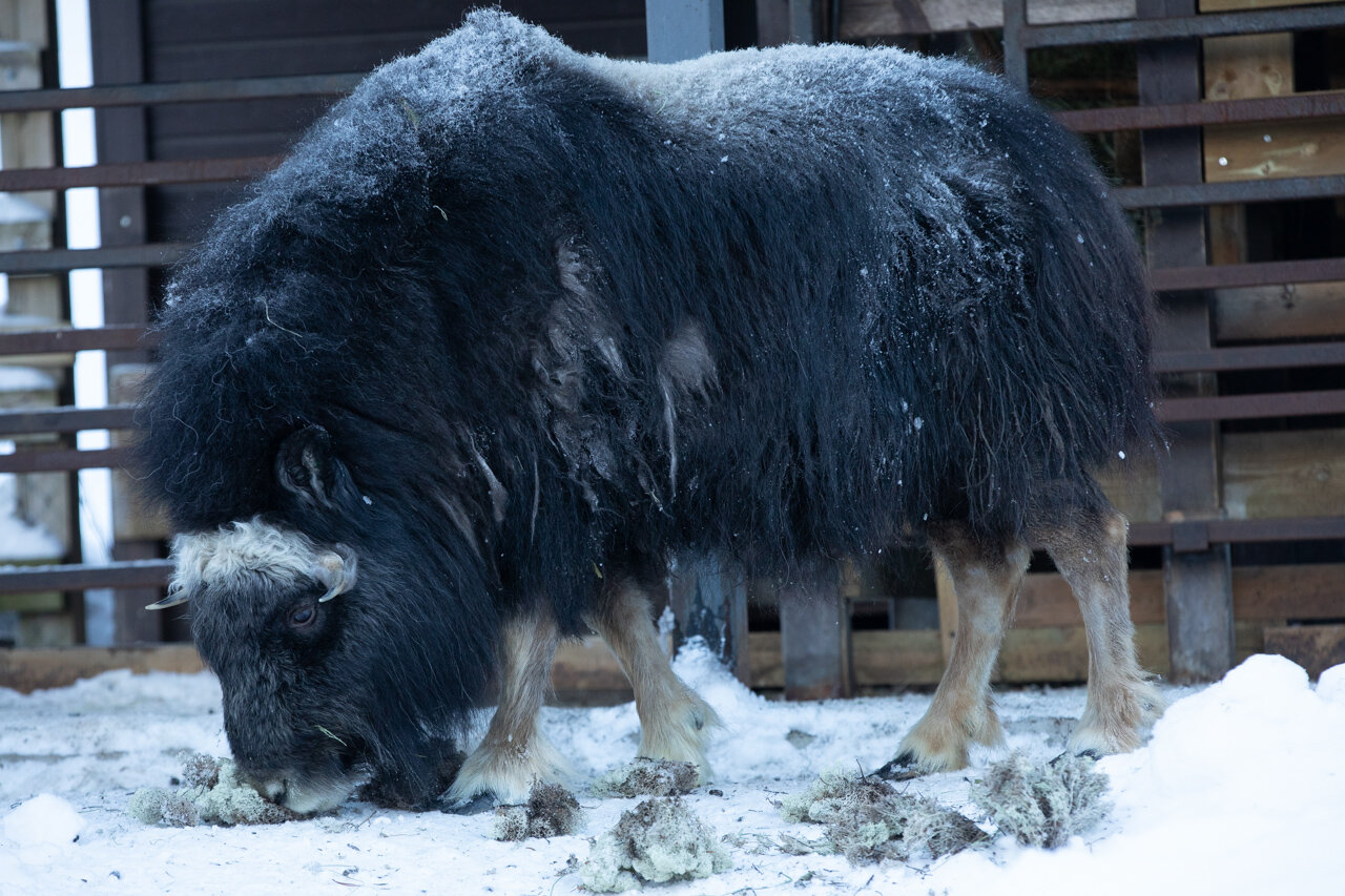
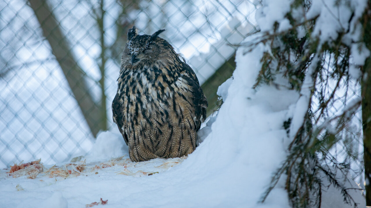
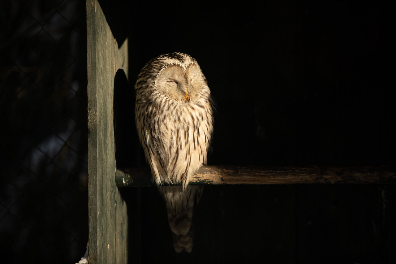
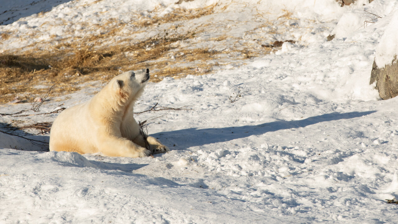
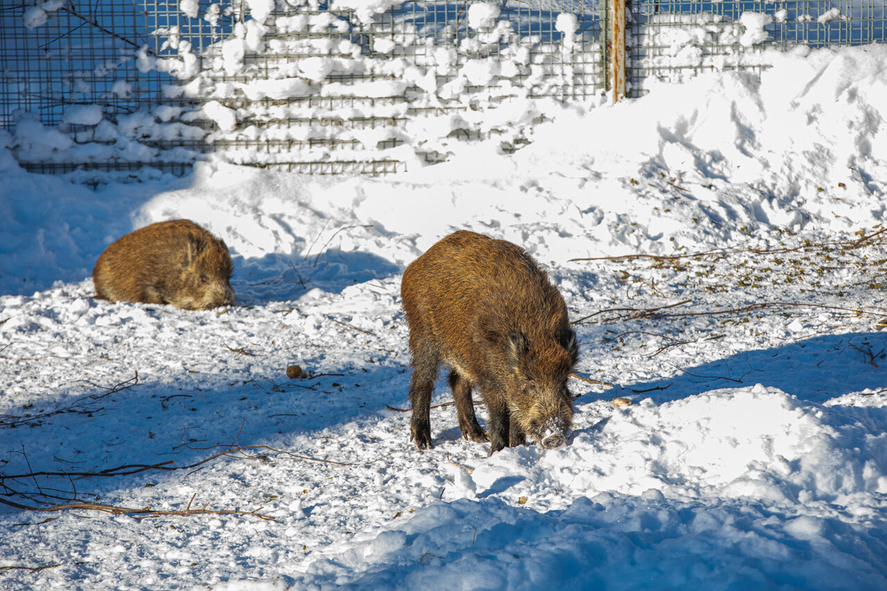
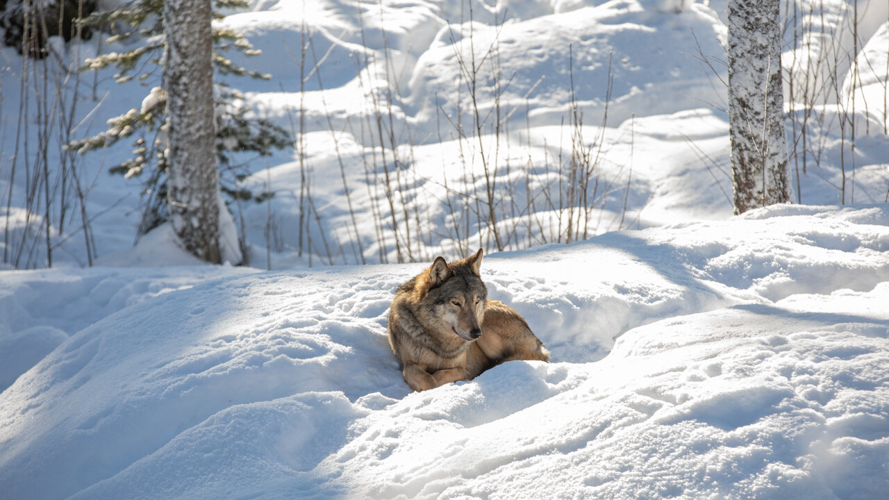
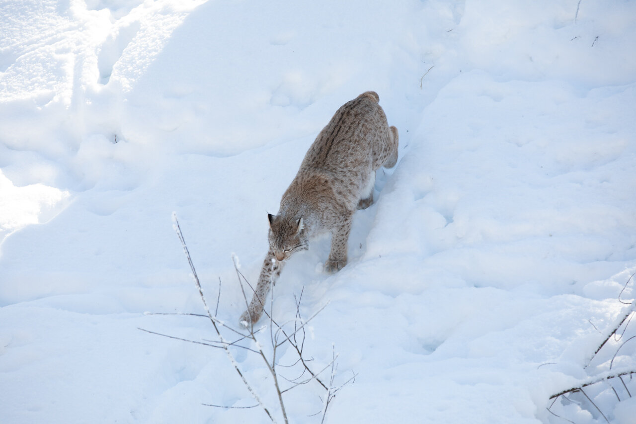
This is a great way to view Arctic Animals up close.Its a nice day trip from Rovaniemei and sure to be a hit with the kids while you practice your long lens shooting technique here. Birds of Prey, Polar Bears, Wolves, Wolverines, Red Fox, Reindeer and Musk Ox can all be seen here.
Day 4(Travel Day) Ravaniemi to Saariselka by Bus

Day 5 Exploring Saariselka Village and Kaunispaa

One can easily spend a day walking around Saariselka Village enjoying the crisp winter air and stop for a quick lunch and to warm up at the Cafe at the Supermarket. I recommend the PizzaS there. Visit Kaunispaa in the afternoon via the ski lift and take in the play of colours during golden hour all the way up to blue hour. The Ski lift only takes you up so you will have to find your own way down and back to the village either via the ski bus or call for a taxi from the cafe.

Day 6 Kiilopaa Fell Winter Walking Trail
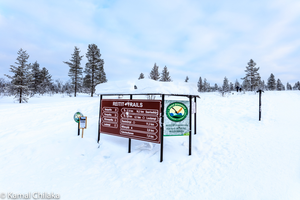
This is a lovely winter activity destination which also offer some rustic accommodations for trekkers.This is also one of the starting points for the larger Urho Kekkonen Nature Park which offers multi day hikes.
The extensive wilderness areas of Urho Kekkonen National Park can be explored on skis in winter and on foot in other times. Hiking outside marked trails requires wilderness and orienteering skills, and in winter the thick snow adds an additional layer of difficulty. A map and compass are necessary, since GPS devices are not always reliable in the remote wilderness. Nights can be spent at any of the many wilderness and reservation huts in the park, which are stocked with firewood. The huts are located about a day's journey apart from each other.


Day 7 Aurorapolku Winter Walking Trail
The Aurorapolku trail is a short 2.1 km trail ideal that ls also the one of the starting points for the Urho Kekkonen Nature park mentioned above.
This takes us you to the Aurora Viewing Platform and Day Hut with a nice warm fire and restroom facilities.

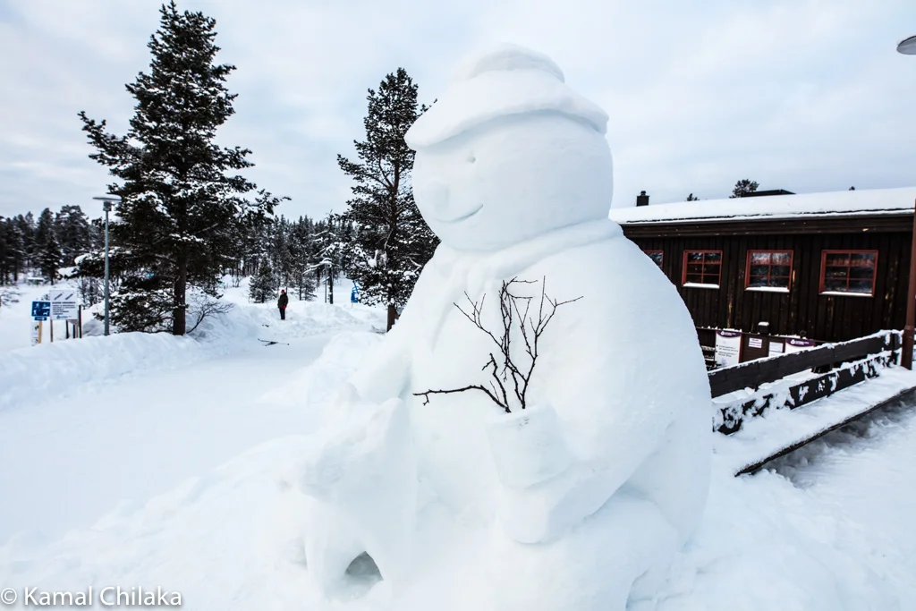
Day 8 Exploring Saariselka
On the last full day at Saariselka I decided to just enjoy walking around the village again with camera in hand. Walked a different route into snow covered cabins and houses but kept to the main road so as not to trespass on the locals residences.

Day 9 Travel Day
Having had my fill of sub zero temperatures and with memory cards full of images it was time to head back to warmer climates.
My journey from -15C to +30 C started with a bus ride from Saariselka to Ivalo airport.
After a short flight to Helsinki I boarded my Finnair flight from Helsinki to New Delhi where the temperature was a moderate 18C.
Next I boarded a flight on good old Air India to Chennai which gave me a warm welcome at 30C.
Home Sweet Home?
And here I am writing this blog as I edit my images from my trip to winter wonderland.
working on my exhibit images now. Please sign up for my newsletter or watch my Facebook page to keep updated about the dates for the Exhibit . If you like this travel adventure please do share it with your friends.Hope it was useful and helps you plan your next winter adventure. Cheers!
Here area few useful links for planning your trip to Lapland
http://www.nationalparks.fi/en/urhokekkonennp/activities
Here are quick links to Amazon.in for gear that I either used for this trip or are on my own Wishlist based on my experience in the cold. Use this to browse and pick gear for your trip.

Autumn Photography in London and the Cotswolds
I have always liked to travel during the “off peak” seasons such as Spring and Autumn. I specially like Autumn for the pallets of colours on display against a usually grey sky with a nice nip in the air. Perfect weather for long walks and photography and the drink at the end of the day (or during) tastes that much better. And for a trip to London and the Cotswolds it makes all the more sense. One can avoid the crowds and long queues at venues. Flights and Room rates tend to be cheaper than during the summer. So there’s a lot going for travel in Autumn and here’s some information on traveling to London and the Cotswolds during Autumn.

I have always liked to travel during the “off peak” seasons such as Spring and Autumn. I specially like Autumn for the pallets of colours on display against a usually grey sky with a nice nip in the air. Perfect weather for long walks and photography and the drink at the end of the day (or during) tastes that much better. And for a trip to London and the Cotswolds it makes all the more sense. One can avoid the crowds and long queues at venues. Flights and Room rates tend to be cheaper than during the summer. So there’s a lot going for travel in Autumn and here’s some information on traveling to London and the Cotswolds during Autumn.

London Taxi
London
Getting There
London has 3 International Airports namely Heathrow , Gatwick and London City Airport. Heathrow is the biggest Airport and the busiest and with the most international Connections. Gatwick is now becoming a good choice due to congestion at Heathrow. London City Airport has connections from EU. So if you are traveling from Asian cities chances are you will be flying into Heathrow or Gatwick.
London Time Zone
London is on GMT so ie IST - 4 hours and 30 mins and Singapore time - 7 hours

UK Currency
The currency of the UK is the Pound Sterling. As of this writing the exchange rates are as below
1 Pound = 1.236 USD = 88.61 INR = 1.70 SGD

Where to Stay in London
London is as an expensive city. Hotel Rooms are no exception. But one is spoilt for choice and it seems there is almost no limits as to how much one can spend for a nights accommodation here.
Ultra Luxury Option
Taj 51 Buckingham Gate Suites and Residences
In the heart of Westminster, close to Buckingham Palace, these 5 AA Red Star luxurious suites are served by 3 acclaimed restaurants and the award-winning Spa at 51.
51 Buckingham Gate, Taj Suites and Residences combine privacy with 5-star luxury. Many overlook the courtyard gardens. Guests can also benefit from concierge services.
The Michelin starred Quilon Restaurant serves South-West coastal Indian cuisine, while Bistro 51 serves a range of international dishes prepared with fresh seasonal ingredients. The Library serves an organic breakfast daily.
Kona offers an innovative interpretation of the colours, flavours and vibrancy of Southern European cuisine. The freshest and finest ingredients and predominantly sustainable organic produce is served in an elegant environment.
Victoria station is a 10-minute walk away and Buckingham Palace is just a 5-minute walk from the hotel. Westminster Borough is a great choice for travellers interested in shopping, parks and city walks.
Luxury Options
In the heart of London, Hilton London Tower Bridge has a striking modernexterior and is located just a 5-minute walk from Tower Bridge and opposite The Shard. There is free WiFi in public areas of the building, as well as the Executive Lounge. There are 2 public car parks within a 4-minute stroll from the property.
London Marriott Hotel Canary Wharf
In the vibrant Canary Wharf area, this 5-star landmark hotel has luxury rooms and a state-of-the-art fitness suite. There is easy access to LondonCity Airport and the O2 Arena.
Many of the rooms also look out over Canary Wharf and the skyline of London’s business district.
Mid Range Options
Hilton London Kensington Hotel
Park Plaza London, Park Royal
Budget Options
TCLA - Clapham / Battersea
ibis London Shepherds Bush - Hammersmith
Photo Ops in London

Royalty Driving through Hyde Park, London
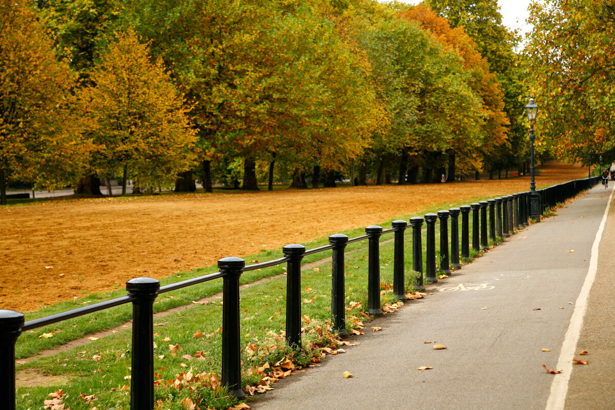
Autumns Scene at Hyde Park, London
The Cotswolds
For those of you who are not familiar, the Cotswolds is a quintessentially English Region spread out over eight hundred square miles and over five counties. The counties being Gloucestershire, Oxfordshire, Warwickshire, Wiltshire and Worcestershire. This region has the quaintest villages lined with cottages of honey coloured stone. The region is home to some of the best palaces, castles and country homes. The scenery is inspiring and well preserved through an assortment of nature reserves and Arboretas.
Cirencester, Tewkesbury, Stroud, Cheltenham, and Witney are some of the more vibrant towns.
Getting There
Cotswolds Villages

North Cotswolds
Whilst the rightly famous and popular towns of the north Cotswolds such as Cheltenham, Broadway, Bourton on the Water or Burford feature in every guidebook, head off the beaten track and you can unearth hidden gems such as Bourton on the Hill or Naunton. Each of the better known market towns such as Chipping Campden, Moreton in Marsh and Stow on the Wold has a cluster of villages around it and these are decidedly Cotswold in character and well worth investigating.
Winchcombe is an unspoilt market town set on the Cotswold edge. It’s known as being a centre for walkers and is a great place to base yourself if you want to enjoy the rural Cotswolds. A stay in the north Cotswolds brings Stratford upon Avon and Oxford into perfect range for day visits.
South Cotswolds
The south Cotswolds refers to the area around Cirencester and the Stroud Valleys – continuing down to north Wiltshire and towns such as Tetbury and Malmesbury. Bristol and Bath (famous for its Roman baths and also Home of William Shakespeare) are short drive from here.
The Cotswold Water Park dominates the south of the Cotswolds and is an incredible place for leisure offering sports, walks and a beach based around 150 lakes in 40 square miles. Despite its size, it is a well-kept secret just a few miles from Cirencester.
There are ‘Five Valleys’ here which meet at the town of Stroud; linked by the lofty heights of Rodborough, Minchinhampton and Selsley Commons. Many artists and craftspeople live in these peaceful, hidden valleys. The surrounding pretty towns of Nailsworth, Painswick, Fairford and Tetbury are all lovely Cotswold market towns.
I have been to the Cotswolds numerous times for varying lengths of times but have always come back wanting more.
Where to Stay in the Cotswolds
There are a number of villages and types of accommodation to choose from ranging from luxury manors converted into hotels to modest holiday homes, bed and breakfasts and run of the mill hotels.
The Best Accommodations in the Cotswolds tend to get booked early so do make your bookings as early as you can. I suggest bookings be done at least a couple of months ahead of your travel dates. These are some good options to consider.

Luxury
The Slaughters Manor House , Lower Slaughter
Situated in the pretty Cotswolds village of Lower Slaughter, this 17th-century manor house offers free internet and free parking on site. It retains original period features and has a sophisticated, award-winning restaurant.
The beautifully furnished and individually designed rooms at The Slaughters Manor House have a flat-screen TV and a DVD player. Some rooms have a four-poster bed or a luxurious freestanding bath.
Sixteen58 restaurant has elegant modern décor and serves creative dishes made from high-quality local produce. Breakfast is provided each morning, and special dietary requirements can be catered for.
You can relax in the chic surroundings of the Manor, with its fine antique decorations and roaring fires. Local leisure pursuits include golf and horse riding, and the centre of Cheltenham can be reached in 30 minutes’ drive.


Mid Range Inn
The Keepers Arms is located in the village of Quenington, 15 minutes’ drive from Cirencester. This charming, family-run inn features an award-winning pub and modern rooms.
The pub serves real ales and home-cooked, traditional cuisine. You can enjoy a drink out on the terrace.
The inn offers easy access to the pretty Cotswolds countryside, which is ideal for hiking, cycling, fishing and horse riding.
Cheltenham, Oxford and Swindon are within an hour’s drive of the inn.

Aparthotel
Situated in Stroud in the Gloucestershire region, Five Valleys Aparthotel features accommodation with free WiFi and free private parking.
Bath is 48 km from the apartment, while Cheltenham is 24 km from the property. The nearest airport is Gloucestershire Airport, 30 km from Five Valleys Aparthotel.


Photo Ops in the Cotswolds
Batsford Arboretum & Garden Centre

Batsford, Moreton In Marsh, Gloucestershire
The Cotswold Falconry Centre

Displaying the art of falconry

The Cotswolds Falconry Center provides opportunities to get up close to falcons and other predatory birds such as the American Bald Eagle and the Grey Eagle
Towers and Manors

Broadway Tower, Worcestershire
Cotswolds Villages


What was in my Camera Bag
Camera Bodies : Canon 5D Mark iii, , Canon 5DS -R
Lenses : Canon 70-200 f 2.8 L IS, Canon 17-40mm L, Canon 24mm TSE , Canon 2x Converter
Accessories : Gitzo Carbon Fiber Tripod, Arca Swiss B1 Ballhead, Remote release, MacBook Pro 13 in, Lacie Rugged Hard Drive, San Disk and Lexar CF and SD cards.
Summary
I have been to the Cotswolds numerous times for varying lengths of times but have always come back wanting more. It is one of the most photogenic locations in the UK and possibly the world. There are plenty of activities for the entire family as well. If you do visit the Cotswolds let me know how your trip went in the comments section below.
Some More Images from the Cotswolds.


More Photography Destinations for you..

Scenic Fall Drives of New England, USA- Part 1
Fall in New England was and is probably one of the biggest inspirations for my Nature and travel Photography. .Having had the opportunity to live in that beautiful region with its 4 full seasons and witnessed the progress of fall colours on the trees in my twenties, I have been drawn back to this wonderful gem of nature to explore and photograph as my photographic ability and my equipment has gotten better over the years. I feel there is always something more I could do to capture the magnificent fall colours.
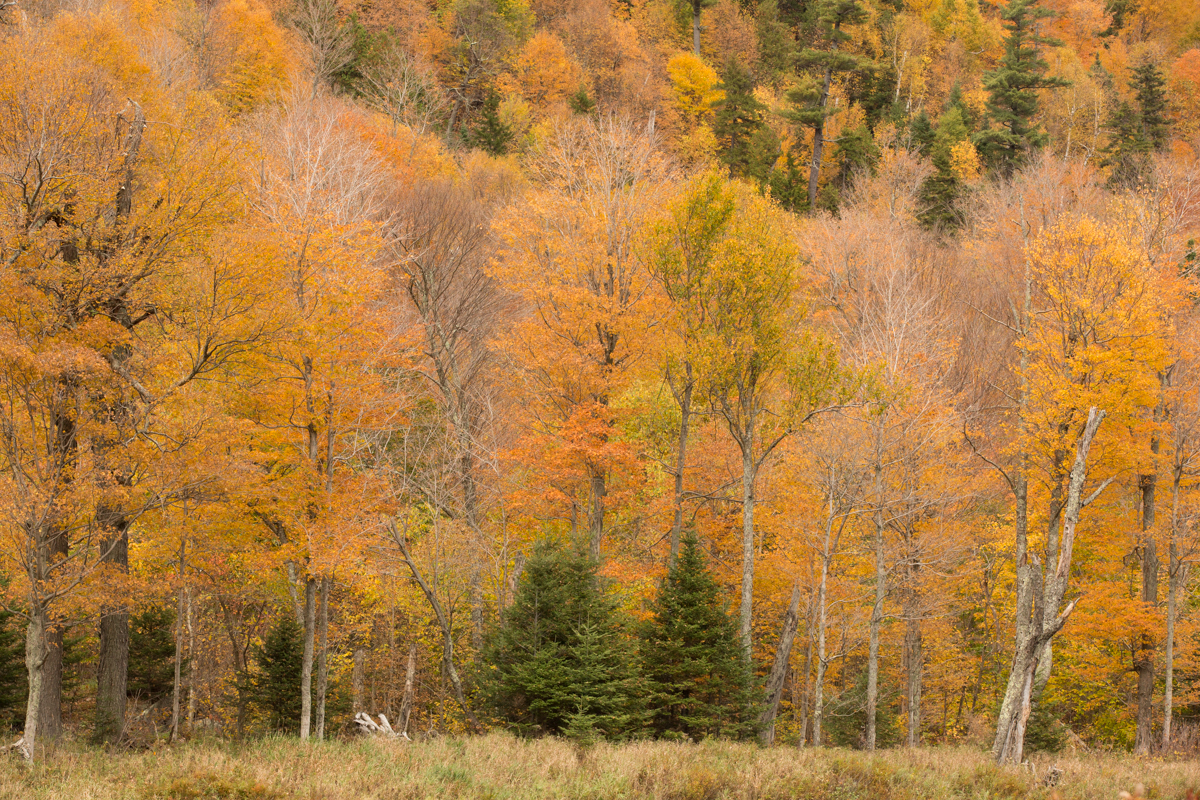
Typical Mid Fall Scene, new England
Fall in New England was and is probably one of the biggest inspirations for my Nature and travel Photography. .Having had the opportunity to live in that beautiful region with its 4 full seasons and witnessed the progress of fall colours on the trees in my twenties, I have been drawn back to this wonderful gem of nature to explore and photograph as my photographic ability and my equipment has gotten better over the years. I feel there is always something more I could do to capture the magnificent fall colours in even more vivid detail..

Multiple Exposure image of Pumpkins Ready for Harvesting during Halloween Season
For those who are not familiar, New England is a region composed of six states in the northeastern United States: Maine, Vermont, New Hampshire, Massachusetts, Rhode Island, and Connecticut.

Fall colour reflections and Goose at Boston Commons
The physical geography of New England is diverse for such a small area. Southeastern New England is covered by a narrow coastal plain, while the western and northern regions are dominated by the rolling hills and worn-down peaks of the northern end of the Appalachian Mountains. The Atlantic fall line lies close to the coast, which enabled numerous cities to take advantage of water power along the many rivers, such as the Connecticut River, which bisects the region from north to south.

The entire region and even the surrounding regions in the USA and Canada have opportunities for “Leaf Peeping” as fall colour viewing is popularly called by New Englanders.

But it is widely accepted that the most popular scenic drives are the following
The Mohawk Trail, Massachusetts
The Kancamagus Highway, New Hampshire
Smuggler’s Notch, Vermont
The Acadia Loop Road
And some other alternative drives are Route 58 from Lake Willoughby to Hazen’s Notch, Evans Notch (Route 113), The Camden Hills Loop, Jacob’s Ladder Scenic Byway (Route 20) Loops.
In this part 1 of the series of posts I will focus on The Mohawk Trail.

How to Get There
Boston, Massachusetts is the largest and most well connected city in the New England Region. Boston Logan Airport is well connected by Major International Airlines.
Alternately you could fly to New York or New Jersey and take the AMTRAK into.Boston South Station.

Getting Around
The best way to travel around in New England to view and photograph the fall colours is to drive.
Where to Stay
The Kancamagus Highway and the Mohawk Trail can be driven as day trips from Boston but for a truly immersive and thorough experience I suggest staying in one of the several bed and breakfast options along the highway and trail. I will include some links to stay in the region below.
New England Time

The Mohawk Trail

Directions From Boston:
Western route to the middle of The Mohawk Trail
From Boston via Springfield, Massachusetts I-90 (Massachusetts Turnpike) to I-91 North, I-91 North to Exit 26 in Greenfield, Massachusetts and Route 2 (The Mohawk Trail) East or West.
Western route to the western section of The Mohawk Trail
I-90 (Massachusetts Turnpike) to Exit 2, North on US 20/7 to Route 2, The Mohawk Trail
Northern route to the eastern section of The Mohawk Trail
From Boston. I-90 (Massachusetts Turnpike) to Exit 11A I-495 North, I-495 North to Exit 40, Route 2 (The Mohawk Trail) West.
Standout Places along the Mohawk Trail
Shelburne Falls - Glacial Potholes and The Bridge of Flowers

Shelburne Falls, Bridge of Flowers
Once a prime Salmon fishing spot for native Americans, the village gradually emerged more than a century ago as a manufacturing community. The village experienced a resurgence during the 80s and 90s, and unlike many similar communities, evolved and continues to be a vital downtown with a growing reputation as an arts community.
The village resisted the "urban renewal" trend of the 1950s and 1960s, which has left our generation with an historic, turn-of-the-century setting for a unique mix of locally owned businesses.
It's a village where you can buy either a head of iceberg lettuce or a hand-blown glass vase!
Shelburne Falls is home to the famous Bridge of Flowers, which attracts more than thirty five thousand visitors a year, as well as the Glacial Potholes, a curiously beautiful rock formation. The Shelburne Falls Trolley Museum celebrates the village's transportation heritage.
Most everything in the village is within walking distance, so if you're planning to spend some time in the village,and we hope you do, we encourage you to park in one of the free public parking lots off Bridge Street.

Along the Mohawk Trail
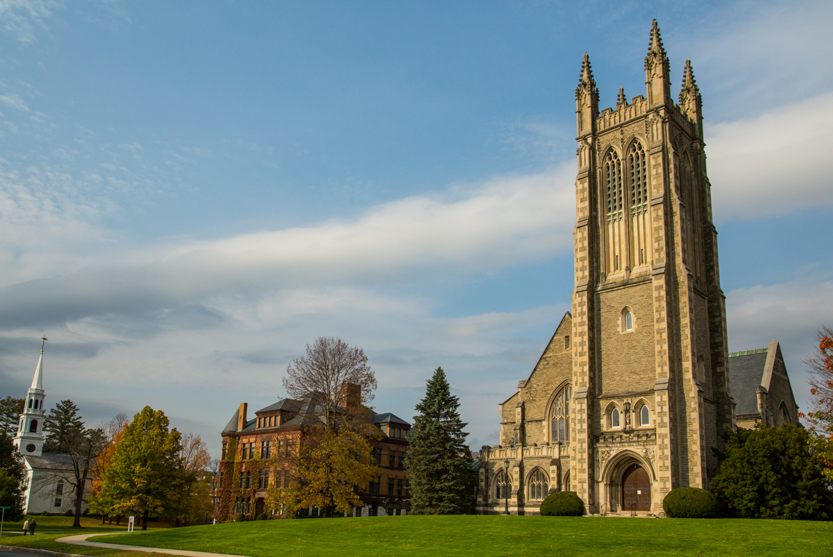
Williamstown and Williams College

Williams College, Williamstown
Williamstown is a lovely historic town that's well worth a visit. There are quite a few tasteful 18th, 19th and early 20th century buildings, on and off campus.The best way to explore Williamstown is on foot. It is a true college town, having hosted Williams College since 1793.

Fallen Maple Leaves
Established in 1793 with funds bequeathed by Colonel Ephraim Williams, the college is private, residential, and liberal arts, with graduate programs in the history of art and in development economics. The undergraduate enrolment is approximately 2,000 students.
Thompson Memorial Chapel at Williams College
The Berkshires

The Berkshires
A popular vacation destination, it's known for outdoor activities, fall foliage–viewing, a farm-to-table food scene and thriving arts institutions. Renowned annual festivals include the Boston Symphony Orchestra’s residency at Lenox’s Tanglewood Music Center.
Check out the link below for suggested Berkshires Driving Tours

Stream Along the Mohawk Trail
Pelham and Amherst
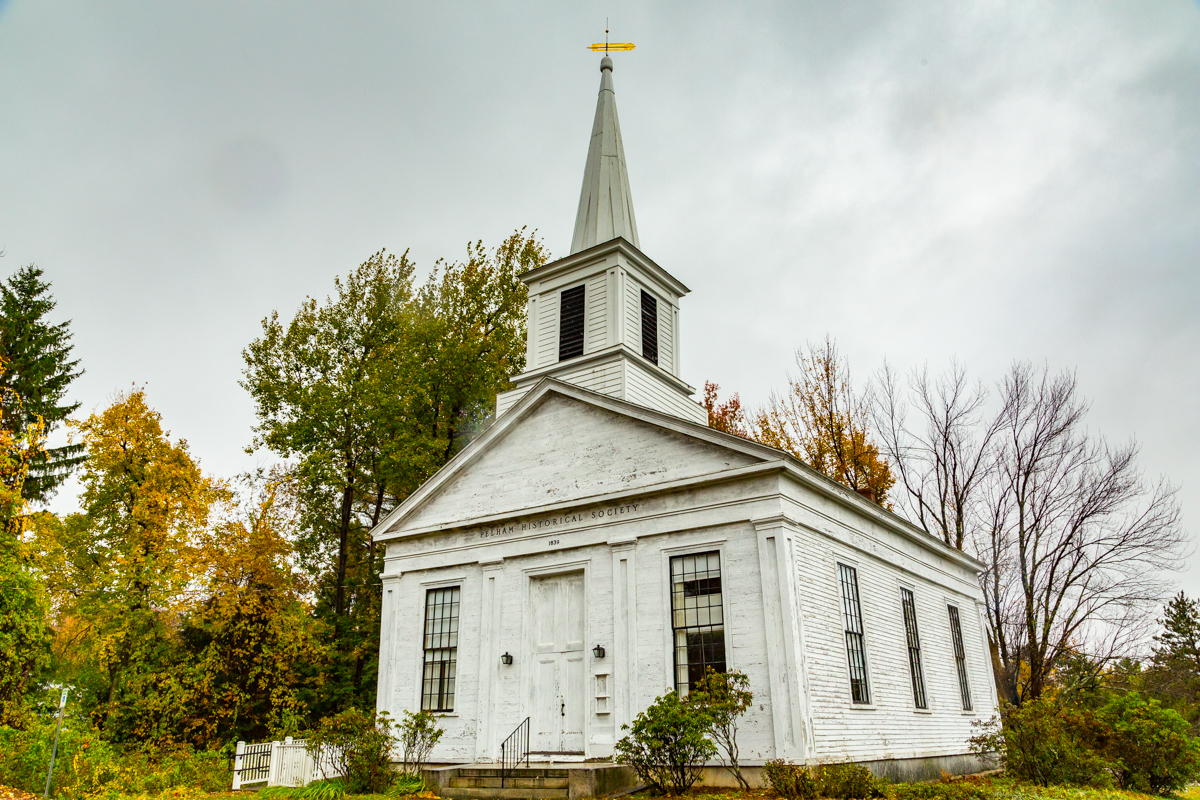
Pelham is a town in Hampshire County, Massachusetts, United States. The population was 1,321 at the 2010 census. Its ZIP Code is shared with Amherst.
Although not actually on the Mohawk Trail this is a worthwhile deviation as the road to Pelham and Amherst are also brimming with fall photo ops.

Near Pelham, Along the Mohawk Trail
The Town of Amherst, located in the lovely Pioneer Valley of Western Massachusetts, is a diverse, inclusive community offering numerous educational and cultural opportunities. Host to Amherst College, Hampshire College, and the University of Massachusetts at Amherst is a quaint college town.

Old Barn along the Mohawk Trails

Maple leaves an tree

Farm along the Mohawk Trail

Maple Leaf and Mushrooms

Along the Mohawk Trail

Fall Colours at Picnic Area

Fall colours Peaking
More Photography Destination Ideas..

One week in Switzerland, Exploring Jungfrau Valley and Zurich
20 years of travel and photography in Europe but somehow I had never made it to Switzerland for a proper holiday or photography trip.Somehow visiting Switzerland for a holiday felt like a cliche from all those Bollywood movies I watched while growing up. Finally during this spring of 2019 we decided to visit Switzerland for a family vacation enroute to the US.

Picture perfect view from Grimmelwald
20 years of travel and photography in Europe but somehow I had never made it to Switzerland for a proper holiday or photography trip.Somehow visiting Switzerland for a holiday felt like a cliche from all those Bollywood movies I watched while growing up. Finally during this spring of 2019 we decided to visit Switzerland for a family vacation enroute to the US.

Tulips and Other spring flowers decorate the streets of Interlaken
We decided to restrict ourselves to the Jungfrau Region of Switzerland as my research said it was one of the most photogenic areas and also great for a family holiday. We also decided to spend 2 days in Zurich to explore the city and take a break before continuing our Journey to the USA.
Getting there
Zurich Airport is the main International gateway into Switzerland . Zurich is served by a host of Airlines. You can check out the list of airlines flying to Zurich here.
The best options from India are Swissair, British Airways, Lufthansa, Emirates, and Qatar Airlines.
From Singapore , Swissair and Singapore offer direct flights to Zurich.
From Zurich to Interlaken if you are traveling light you can take the train from Zurich airport to Interlaken.
Here I must mention that getting a Swiss Travel Pass for your holiday in Switzerland is a great option which allows you to travel by Train, Bus and Boat on Swiss public transportation.
if you have a lot of luggage like we did the best option would be to hire a car or van to drop your your Interlaken hotel.

High Street Shopping at Bahnoffstrasse, Zurich
Some useful Info
Switzerland Time
Switzerland Time is in the Central European Time Zone . Central European Standard Time ( CET ) is 1 hours ahead of Greenwich Mean Time ( GMT+1 ) and GMT +2 in Summer
Switzerland Currency
The local currency is the Swiss Franc
As of this writing the exchange rate is as follows
1 Swiss Franc = 70.8 INR = 1.38 SGD

Promenade at a Village along the Brienz
Interlaken and the Jungfrau Region

Paragliders taking break under a tree at Interlaken
Interlaken is a traditional resort town in the mountainous Bernese Oberland region of central Switzerland. Built on a narrow stretch of valley, between the emerald-colored waters of Lake Thun and Lake Brienz, it has old timber houses and parkland on either side of the Aare River. Its surrounding mountains, with dense forests, alpine meadows and glaciers, has numerous hiking and skiing trails.

Inviting arrangement go Spring flowers in front of a cafe,Lauterbrunnen
The Jungfrau region begins in Interlaken, the largest town in the region. Interlaken is easy to reach by train and car. The Jungfrau region stretches out to the Jungfrau mountain range in the south, which is a Unesco World Heritage. There's a lot of beautiful alpine nature and several little villages.

Idyllic Village Scene, Lauterbrunnen
We decided to use Interlaken as a base while we explored the region via day trips. interlaken is a great option as a base of your first trip to the region because it has the most number of hotel and stay options and a wide variety of food options as well including Indian and Asian food options. Don’t miss the famous Swiss Fondues when you are in Switzerland.
Where to Stay in Interlaken
Interlaken has a a variety of Hotel and Stay options to choose from. These range from some incredibly expensive hotels , some mid range hotels and inexpensive (by Swiss Standards) hostels and homesteads.

Hotel Lindner Grand Beu Rivage, Interlaken
Luxury
Lindner Grand Beau Rivage
Jungfrau Hotel
Hotel Royal St Georges Interlaken Mgallery by Sofitel
Budget
Budget Waldhotel Unspunnen
Getting about
Swiss Rail Pass
As I mentioned earlier the Swiss Travel pass is your best travel companion which allows you to explore on all the public transport options.
Taxi
Taxis are an expensive option but if you need to take a break from walking or if you have young kids or seniors in your group this is a quick way to get around Interlaken from point to point.
Photography Locations

Charming Horse Carriage Rides at Interlaken

Paragliding at Interlaken
Interlaken and Harder Kulm
Funicular to Harder Kulm, Interlaken
Lauterbrunnen

Idyllic Charm of Jungfrau Region, Lauterbrunnen, Switzerland
Lauterbrunnen is a municipality in the Swiss Alps. It encompasses the village of Lauterbrunnen, set in a valley featuring rocky cliffs and the roaring, 300m-high Staubbach Falls. Nearby, the glacial waters of Trümmelbach Falls gush through mountain crevices past viewing platforms. A cable car runs from Stechelberg village to Schilthorn mountain, for views over the Bernese Alps.

Lauterbrunnen and

Exploring Lauterbrunnen

Staubbach Falls
Grimmelwald
Muren
Jungfraujoch
Lake Thun
Lake Brienz
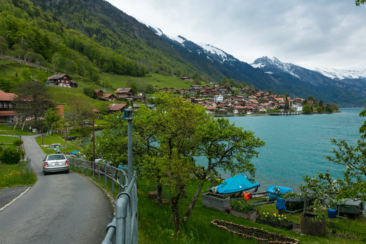
At one the beautiful villages lining the shores of Lake Brienz

Lakeside village at Brienz
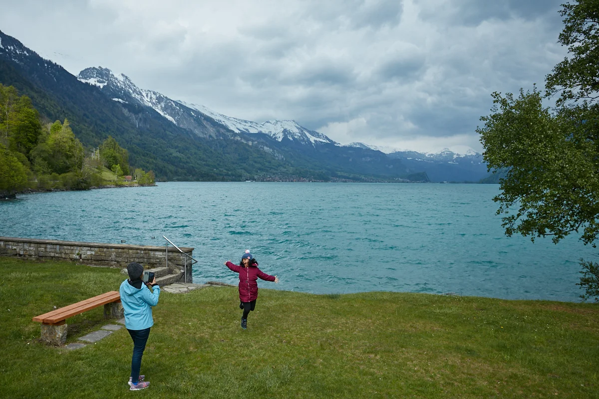
Kids enjoying the weather and beauty around Lake Brienz
Giessbachfälle
The Giessbachfälle is a beautiful and popular waterfall which runs into Lake Brienz. The Grand Hotel Giessbach is located such that you access the waterfall through the hotels car park.

Giessbachfälle, Waterfall can be accessed from the car park of the Grand Hotel Giessbach

Landscape around Lake Brienz
Exploring Zurich

Pier at Zurich Old Town

Zurich Old Town
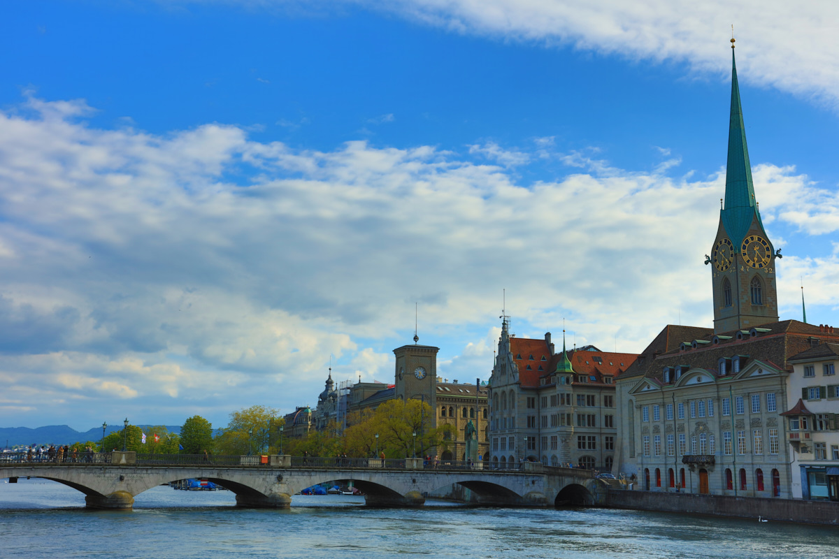
Zurich Old Town scene
Where to Stay in Zurich

The Dolder Grand hotel, Elite Luxury, Zurich
Luxury
Hotel Schweizerhof Zürich
Le Bijou LQ82 Spectacular Limmatview Penthouse
Park Hyatt Zurich
Mid Range
Crowne Plaza Zürich
Budget
iQ130 Guesthouse
Suggested City Tours of Zurich
Zurich Tour Including Lake Cruise and Lindt Chocolate Factory Outlet
Fondue and Wine Tuk Tuk Tour in Zurich
What was in my Camera Bag
As this was a holiday primarily I was traveling with just the minimum of cameras gear. I had with my trusted Canon 5DS-R and a couple of zoom lenses which I can’t live without. The Canon 70-200mm f2.8 L IS II and a wide angle zoom the Canon 17-40mm F4 L which has served me well over the last several years but will be upgrading soon. I also carried with me the superb Zeiss Otus 55mm f1.4 which I like to shoot detailed street and sharp portraits with.


A Summer Down Under - 2 Weeks in Sydney, Melbourne and Gold Coast
May in Australia isn’t summer actually but it is summer in the Indian Subcontinent and most of South East Asia where I am based. In tropical Australia, the dry season from May to October has clear blue skies and sunny days. The temperatures are cooler. In May, the average daytime temperatures in Sydney are generally around 16°C and hardly fall below the average minimum temperatures of 12°C. The peak temperature of the month can reach a pleasant 20°C. Sydney in May is generally sunny and perfect for hitting the beach.

Harbour Bridge at Sunset, Sydney
May in Australia isn’t summer actually but it is summer in the Indian Subcontinent and most of South East Asia where I am based. In tropical Australia, the dry season from May to October has clear blue skies and sunny days. The temperatures are cooler. In May, the average daytime temperatures in Sydney are generally around 16°C and hardly fall below the average minimum temperatures of 12°C. The peak temperature of the month can reach a pleasant 20°C. Sydney in May is generally sunny and perfect for hitting the beach.
We had two weeks to spend including travel. We decided to distribute that between Sydney, Gold Coast, Melbourne and Stopover at Singapore on the way back. That gave us about 10 days in Australia itself.

Concert in Progress near Opera house at Sydney Harbour
Sydney

View of Harbour Bridge , Sydney Harbour
We flew from Bombay to Sydney via Singapore on Singapore Airlines. We landed at Sydney where we were staying with friends and after a good nights rest we set off to explore the Sydney Harbour Area.
Where to Stay in Sydney
Sydney has a wide variety of accommodations to suit most budgets. Here are a few popular options.
Luxury Options
Meriton Suites Kent Street
The Grace Hotel
Radisson Blu Plaza Hotel Sydney
Mid Range
Rendezvous Hotel Sydney Central
Macleay Hotel
Budget
Bondi Beachouse YHA
Manly Central Apartment
Sydney Photo Ops
On my previous trip to Australia I had spent most of my time around Darling Harbour so tis time i decided to focus on Sydney Harbour area for my photography. The Sydney Harbour and Harbour Bridge create so may different photo ops I could spend a few days just coming back and capturing the different moods and vistas here. It is also great for street photography with so many people from all over the world visiting.

Sydney Harbour Scene
Specially during weekends the entire harbour area has a high energy feel to it. But on weekdays you can enjoy a more relaxed atmosphere conducive to landscape photography. Come her at dawn and dusk to capture the lovely vistas of the Harbour, Harbour Bridge and the Opera House. Yes all these have been shot extensively already but you can enjoy the challenge of crating that unique image.
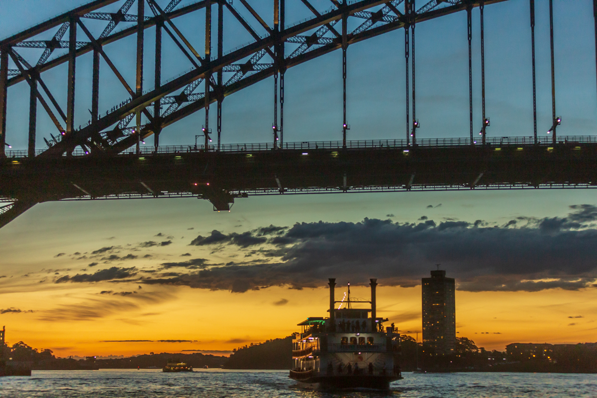
Ferry and Harbour Bridge at Sunset, Sydney Harbour
After the hustle and bustle of Sydney harbour we took time to explore the Urban Parks in Sydney such as Harmony Point . You’ll find many more gardens and parks to enjoy in Sydney. Centennial Parklands in Sydney’s east is popular for picnics, cycling and horseriding. The Chinese Garden of Friendship is perfect solitude in Darling Harbour and Sydney Olympic Park in Sydney’s west is great for outdoor activities and sports.

Cycling Path at Harmony Point, Cabarita
Take a ferry across the harbour to Neutral Bay and Nutcote, the charming home and garden of Snugglepot and Cuddlepie author and illustrator May Gibbs. Wendy's Secret Garden, a secluded oasis in nearby Lavendar Bay, is another living artwork that offers tranquility, winding pathways, views and lovely picnic spots.

Near Cabarita Beach, Sydney
For a delightful daytrip take a train or rivercat to Parramatta for Parramatta Park, a beautiful family park and World Heritage-listed convict site.

Barbeque and Picnic Area At Olympic Park
We also visited the Taronga Zoo which has a great collection of Animal life to view if that’s your thing. I was more interested in the views from the ferry and the island on which the Zoo is located. Taronga Zoo Sydney is located in Sydney, New South Wales, Australia in the suburb of Mosman, on the shores of Sydney Harbour.
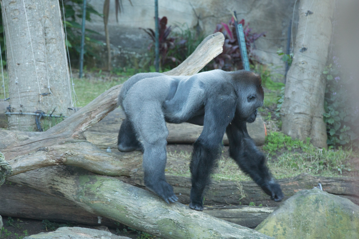
Gorilla at Taronga Zoo, Sydney
It was officially opened on 7 October 1916. Taronga Zoo Sydney is managed by the Zoological Parks Board of New South Wales, under the trading name Taronga Conservation Society, along with its sister zoo, the Taronga Western Plains Zoo in Dubbo.

Mountain Goat
Divided into eight zoogeographic regions, the 28-hectare (69-acre) Taronga Zoo Sydney is home to over 4,000 animals of 350 species. It has a zoo shop, a cafe, and information centre.

Male Lion at Sydney Zoo

View of Sydney Skyline from Sydney Zoo

Sunset View of Sydney Skyline
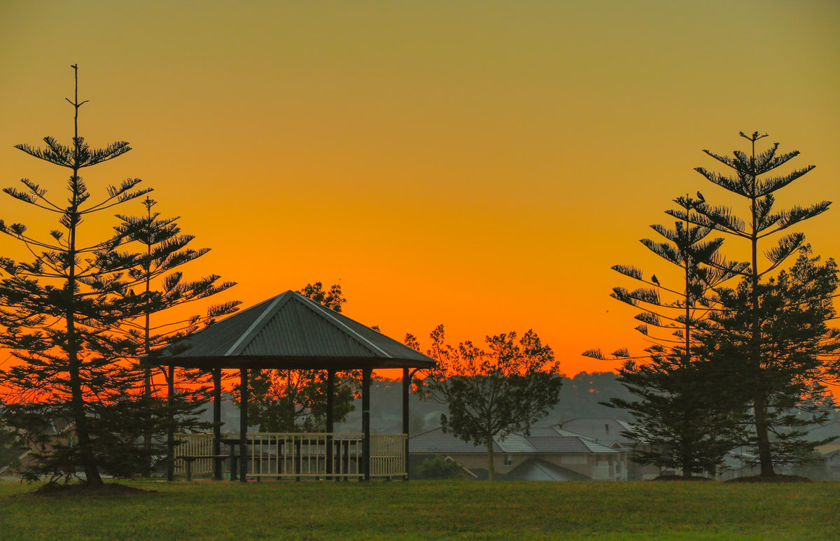
Dawn at a Residential Suburb of Sydney
Gold Coast
After a few days at Sydney we decided to head to the Gold Coast along with our friends. It was off season at the Gold Coast meaning flights and accommodation were cheaper than normal as long as one didn’t mind the less than perfect weather.
Where to Stay at Gold Coast
Luxury
Meriton Suites Broadbeach
The Star Grand at The Star Gold Coast
Mid Range
Private 1 bedroom Carlton Apartment
The Ruby Collection
Surfer’s Paradise Beach

Surfer’s Paradise Beach, Gold Coast
Colloquially known as 'Surfers', the suburb has many high-rise apartment buildings and a wide surf beach. The feature of the heart of the suburb is Cavill Mall, which runs through the shopping and entertainment precinct.

Sunrise and Receding Storm, Gold Coast
Surfers Paradise is the Gold Coast's entertainment and tourism centre and the suburb's high-rise buildings are the best known feature of the city's skyline.

Cavill Avenue Shopping
Cavill Avenue, named after Jim Cavill, an early hotel owner, is one of the busiest shopping strips in Queensland, and the centre of activity for night life. One of the features of the area is the Surfers Paradise Meter Maids designed to build goodwill with tourists.

A lazy Afternoon at Gold Coast
The "Gold Coast Nightlife Precinct" offers many after-dark activities for visitors. The precinct is considered Australia's nightlife capital and attracts close to 20,000 visitors daily. The area also hosts the largest Schoolies week event in the country, attracting tens of thousands of school leavers to the precinct.
Hot Air Ballooning (the highlight of the Gold Coast Trip)
Skypoint Observatory

Beautiful View of Gold Coast from SkyPoint Observatory
SkyPoint located on top of the iconic Q1 Building, one of the world's tallest residential towers, takes you to the highest point above the Gold Coast and offers spectacular 360 degree views from the surf to the hinterland and beyond.
Q1 Gold Coast History

View of Gold Coast Town from SkyPoint
In 1998, the Anderson family acquired the properties on a central Surfers Paradise site bound by the Gold Coast Highway, Clifford Street, Hamilton Avenue and Northcliffe Terrace – the latter streets named in the late 1920s in honour of members of Australia’s champion Olympic sculling team. Some 139 lots were amalgamated and until 2002, when construction of Q1 commenced, the properties remained as they were.
The project to build the world’s tallest residential tower was officially launched on the 28th June 2002. Sunland Construction team began work immediately, with a workforce of 500 labouring for over 3 years, or a total of 2.5 million man hours. More than 2500 people were involved in the project. Q1 Resort and Spa officially opened on the 26th of October 2005.
The Q1 Spire
The Q1 Spire is one of the world's longest at 97.7m. It commences at level 75, is made up of 12 sections and weighs 87.2 tonnes. The oval shaped spire starts at level 76/225m high and extends 47m above the glass fin. Powerful arc lights illuminate the spire which can be seen from 200kms away.
Design of the Q1 Gold Coast
Q1 was designed by Atelier SDG. As the design process proceeded during the year of the Sydney 2000 Olympics, the desire to create something intrinsically Australian took hold. In its final form, Q1 draws inspiration from the upswept curves of the Sydney 2000 Olympics torch – which itself is reminiscent of the overlapping curves of the Sydney Opera House.
The Q1 Building Gold Coast
The Q1 Building is taller than the Chrysler building in New York City.
Q1 is one of the tallest residential buildings in the world.
Q1 is 322.5 metres high.
SkyPoint has one of the World's fastest elevators taking you from ground to Level 77 in 42.7 seconds.
Australia's only beachside Observation Deck .
Offers stunning 360 degree views of the entire Gold Coast, from the surf to the hinterland and beyond.
SkyPoint is 230 metres above sea level.
There are 1331 steps from the ground to Level 77.

Surfer’s Paradise Beach, Gold Coast
Hot Air Ballooning

Hot Air Ballon ready for passengers
A great way to start your morning in the Gold Coast is to go Hot Air Ballooning. Float up to watch the sun rise over the rolling hills of the majestic Gold Coast hinterland; enjoy sweeping views of Tamborine Mountain, Lamington National Park and to the east see the shimmering tall towers of the Gold Coast skyline.

Aerial view of farms at the Gold Coast

This scene from Australias Gold Coast reminds me of images from the Serengeti

Packing up the balloon post flight is a team effort
Melbourne and The Great Ocean Road
Getting there
By Flight
Melbourne is well connected Internationally by many major international Carriers including Singapore Airlines, Qantas, Scoot, Air Asia. It is also serviced by all the regional airlines such as Jetstar, Virgin Australia, RegionalExpress etc.
By Road
While it is easier and faster to travel between Sydney and Melbourne by taking a one-hour direct flight, driving has its own advantages with little trips and diversions that may be taken along the way. The most direct route is 874 km on the Hume Highway (M31), a dual-carriage highway. For those with time to spare, there is the Princes Highway which follows the coast for most of its length, a distance of 1,032 km (640 miles), although not necessarily within sight of the sea. Other alternate inland roads include the Olympic Highway between Albury and Sydney via Cowra and Bathurst, and also the Monaro Highway route via Canberra.
Where to Stay at Melbourne
Here are a few popular accommodations to meet most budgets.
Luxury
Grand Hyatt Melbourne
Pan Pacific Melbourne
Mid Range
Flinders Street Apartments
Pars Apartments - Collins Wharf Waterfront, Docklands
Budget
Summer S Holiday Inn
Melbourne Beach Side Apartment

Along the Great Ocean Road, Victoria
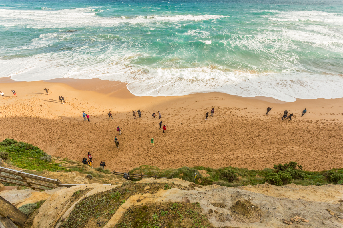
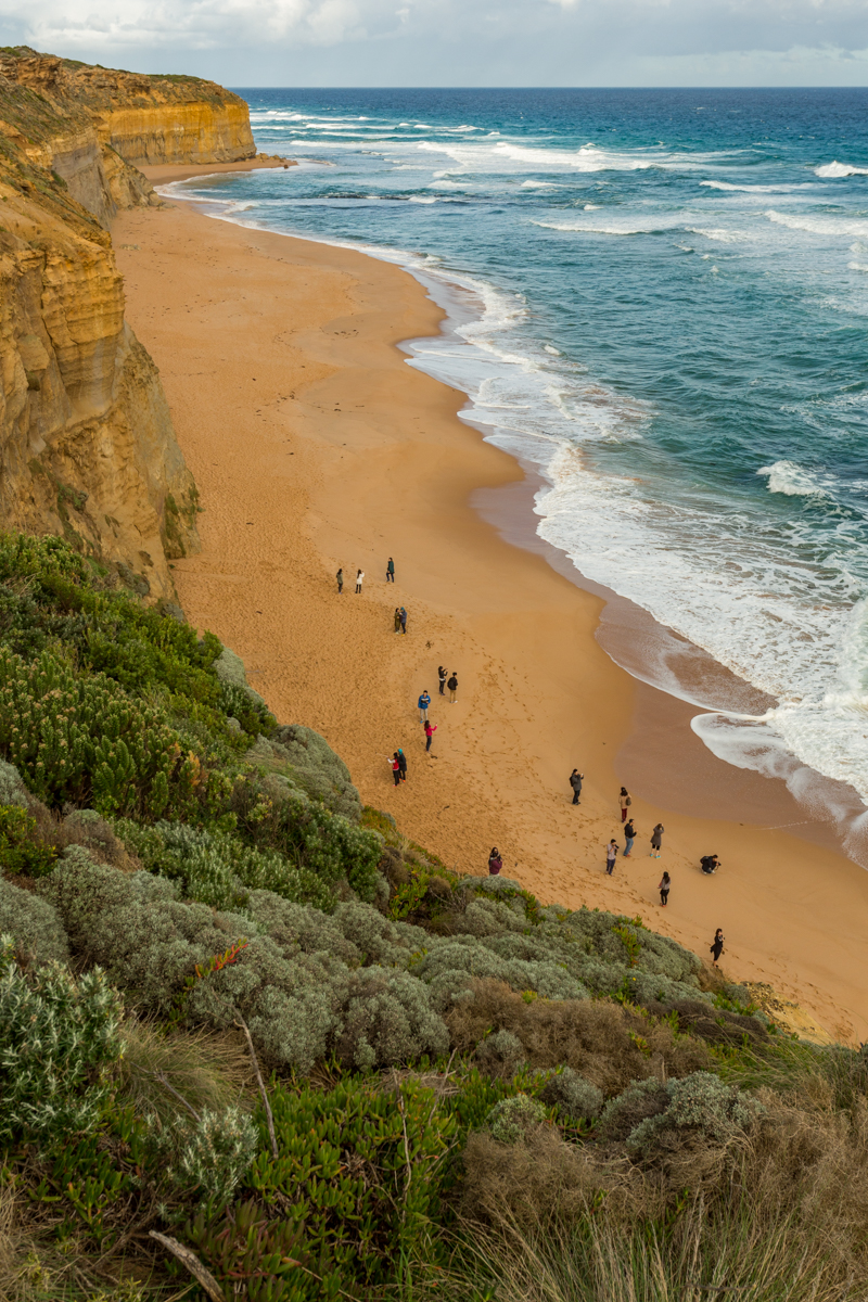
The Great Ocean Road is an Australian National Heritage listed 243-kilometre stretch of road along the south-eastern coast of Australia between the Victorian cities of Torquay and Allansford. Some of the attractions along this road are
The 12 Apostles-Limestone cliffs
Created by constant erosion of the limestone cliffs of the mainland beginning 10–20 million years ago, the stormy Southern Ocean and blasting winds gradually eroded the softer limestone, forming caves in the cliffs.
The caves eventually became arches and when they collapsed rock stacks up to 45 metres high were left isolated from the shore. View the 12 Apostles at sunrise and sunset as they change colour from dark and foreboding in shadow to brilliant sandy yellow under a full sun.
How to get there
The 12 Apostles are located 275 kilometres west of Melbourne, approximately a four-hour drive along the Great Ocean Road.
Gibsons Steps
Gibsons Steps
Be dwarfed by the 70-metre high vertical cliffs and marvel at Gog and Magog, the nicknames given to the giant limestone stacks rising up out of the sea. Weather permitting, make your way down to the beach via the 86 steps that were carved into the face of the cliff by local settler Hugh Gibson, who worked on the route originally used by the Kirrae Whurrong people.
At Gibsons Steps near the 12 Apostles
Getting there
Park your car at the Gibson Steps car park or make your way from the 12 Apostles and walk the one kilometre to Gibson Steps, departing from the back of the kiosk. The path passes under the Great Ocean Road near the Gibson Steps viewing platform and beach access.
Loch-Ard-Gorge
Located just three minutes west of the mighty Twelve Apostles, Loch Ard Gorge is a treasure trove of natural beauty, coastal wilderness and maritime history. Take some time to wander the trails, exploring the blowholes, offshore limestone stacks and towering cliffs. Visit at dusk to watch the short-tailed shearwaters (muttonbirds) fly home. Hear the story of the Loch Ard shipwreck and learn about the rich maritime history of the area at the nearby Port Campbell Visitor Information Centre.
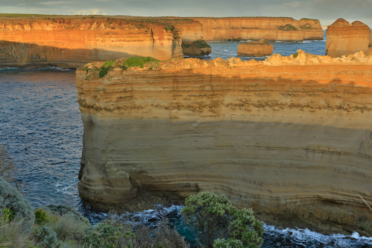
Views from top of the cliff near Loch And Gorge
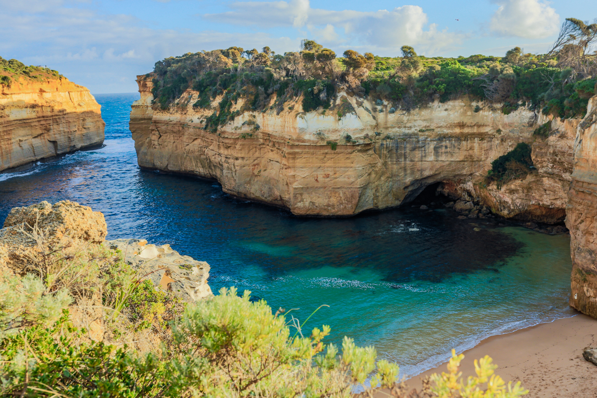
Loch-Ard-Gorge

12 Apostles and Great Ocean Road Helicopter Rides*
Melbourne Museum
Melbourne Museum is a natural and cultural history museum located in the Carlton Gardens in Melbourne, Australia. Located adjacent to the Royal Exhibition Building, it is the largest museum in the Southern Hemisphere.

Melbourne Museum showcases Australian social history, Indigenous cultures, science and the environment. Located adjacent to the World Heritage listed Royal Exhibition Building and Carlton Gardens, and home to IMAX Melbourne.
Major features of Melbourne Museum include celebrating Victoria's local Koorie culture in Bunjilaka, Aboriginal Cultural Centre. Explore Melbourne's rich history in the Melbourne Story exhibition; be immersed in evocative stories and discover the icons and personalities that have shaped Melbourne since the early 1800s.
See Phar Lap, Australia's legendary racehorse, in the flesh. Walk amongst skeletons of amazing animals from the past; from dinosaurs, flying reptiles and megafauna.
Take a close look at bugs, from stick insects to red-back and funnel-web spiders in Bugs Alive. Wander through a living forest with resident wildlife inside the Forest Gallery. Journey into the mind and explore a world of emotions, thoughts, memories and dreams in The Mind exhibition.
Visit the Museum Shops for a unique range of books, toys, games, as well as locally produced crafts and souvenirs you won't find anywhere else.
The Theatre Scene at Melbourne
From Big Budget Musicals to indie stage shows, Melbourne has it all. Catch theatre, comedy and musicals at this elegant theatre on Exhibition Street. Built in 1928, the Comedy Theatre has hosted local and touring shows for generations. Popular hits include Calendar Girls, The Rocky Horror Show, Avenue Q, Rock of Ages and Waiting for Godot.

Comedy Theatre, Melbourne
The Melbourne Food Scene
Experience Melbourne's mix of cultures in its myriad restaurants, cafes, bistros and bars. Whether you're after modern, traditional, exotic or homespun flavours – Melbourne's eclectic dining scene offers a startling array of the world's great cuisines, from popular favourites to the truly groundbreaking.
Share a drink while snacking on high end tapas in a laneway eatery, take on a Szechuan chilli dish in Chinatown, or break out of the CBD and discover the city's specialist eating destinations – Richmond for Vietnamese, Carlton's 'Little Italy', Fitzroy for Spanish and Brunswick for Lebanese. The Melbourne food scene is so great that I think it deserves a separate culinary exploration trip to do it justice. Watch this space for updates on that. :)

Chin Chin Thai Eatery Melbourne - This Thai diner has a cool but unfussy vibe. The menu is mostly sharable and you can order wine by the carafe from the 'Wine Guy'. Crispy school prawns and suckling pig pancakes make great lazy afternoon drinking food. The air zings with spices and buzzes with conversation. Look out for fun touches like vintage propaganda posters and a Vietnamese cyclo by the door. *Visit Melbourne
What was in my Camera Bag for this trip?
For this trip I had carried with me my trusty Canon 5D MARK III and the classic combination of 3 Canon Zooms lenses namely the 17-40MM F4L, 24-70 F2.8 L and the superb Canon 70-200mm F2.8 L IS USM II and a Canon G15 Compact camera as a backup.
I also had with me my Hasselblad H4D40 with 80mm HC lens.
Other accessories included
Macbook Pro 15 in Laptop
Lacie Rugged 1 TB external drive
SAN DISK and LEXAR CF and SD cards
Gitzo Tripod and Arca Swiss Ball Head
*Sources : Visit Melbourne, Visit Australia, Wikipedia
Like this blog? Do share it with your friends on social media. Here are some quick links to the popular social media.

Spring Photography Guide to Grand Tetons and Yellowstone National Parks, USA - by Kamal Chilaka
Yellowstone and Jackson Hole National Parks have long attracted all types of people ranging from Native Americans , European Fur Trappers , Conservationists , Nature lovers and Photographers alike. They are right there on top of the list of National parks which provide great photo ops.
After they had been on my bucket list for a couple of years I finally decided to make the trip with a photography enthusiast friend from Boston.

Classic View of the Tetons from Schwabacher Landing, Grand Tetons

Yellowstone and Jackson Hole National Parks have long since attracted all types of people ranging from Native Americans , European Fur Trappers , Conservationists , Nature lovers and Photographers alike. They are right there on top of the list of National parks which provide great photo ops.
After they had been on my bucket list for a couple of years I finally decided to make the trip with a photographer friend from Boston.
Getting There and Getting Around
We flew to Jackson Hole from Boston via Denver. As we had decided to travel in late spring the tourist season had not officially begun as we wanted the park to ourselves and avoid the summer crowds. Other option is to fly to Salt Lake, Utah and drive from there.

Grand Tetons National Park Road
The views as you prepare for landing are just amazing. We were on a smaller commuter Jet from Denver to Jackson Hole which doesn’t allow for even have enough storage for a 26 L backpack and I ended up having to check it in at Gate.
I did manage to take my camera bodies and a couple of lenses in my hand and stowed them under the seat. Something to keep in mind while packing your gear for a trip to Yellowstone specially if you are flying on on the smaller jets.
At Jackson Hole Airport we picked up our rental car for the week a nice compact SUV which would be our ride for the duration of the trip.

Where to Stay at Jackson,WY

We stayed at the Rustic Inn Creekside during the first leg of our trip which was a 3 day stay at Jackson Hole. The inn had all the creature comforts one would need on such a trip. The rooms were spacious. The layout allows for easy access to the car park without too much walking from the rooms which were split level chalets. The lobby had hot coffee ready to take out early in the morning which is typically when photographers and adventure lovers like to head out to take in the best scenery . The Buffet breakfast was ample and was the perfect way to charge ourselves after a nice early morning shoot in the still chill Spring Air.
Jackson Hole has a wide selection of accommodations to choose from specially once the tourist season begins. During the shoulder season the options would be significantly lower.
Here are a few more options to choose from
Luxury
The Rusty Parrot Lodge and Spa
Budget
Jackson Hole and Grand Tetons Scenic Locations

Grand Tetons Park
While choosing which locations you want to visit within the park you have to decide on what your interest is. The choices would vary depending what you want to do be it back country camping or spotting wildlife or shooting scenery . Here i focus on my interest which is Landscape photography. Some of these locations would also be good for spotting buffalo , moose, and the occasional Coyote .

Mormon Row
The first afternoon were there we did a bit of exploring by driving around the area between Jackson and the airport. We had our first sighting of a Bull Buffalo just as we were turing in a bend in the road to Mormon Row. What was that? When you get up close to American Buffalo for the first time it hits you hard just how big and dangerous these animals are.
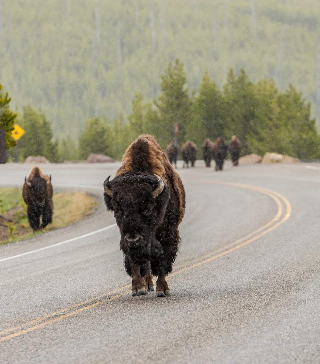
These are wild animals and you must maintain a minimum distance from them when you are observing them or trying to photograph them. To ignore that advice is putting yourself at peril as many over enthusiastic tourists have found out the hard way.

Mormon Row Scene at Sunrise
For our first full day of photography at Grand Tetons we had lined up the services of a local guide as we wanted to get quickly acquainted to the lay of the land in as short a time as possible. Our guide promptly picked us up before sunrise and took us to some of the spots mentioned here.

Schwabacher Landing
Not only did he take us to the best spots but also times that to coincide with when the light was optimum. We managed to get a few pics but planned to get back to the same locations again for shooting at dusk for a different mood.

Snake River Outlook ..The Spot for which Ansel Adams shot his iconic image
The Location from where Ansel Adams shot his iconic image of Snake River with the Tetons in the background is a look out point but the car park is further back now meaning one can’t really take the same image without the help of a drone.

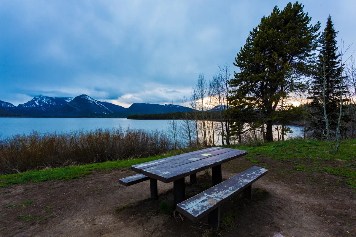
Sunset at Jackson Lake
We had a half day to explore and shoot in and around Jackson before heading off to West Yellowstone in Montana for access to Yellowstone National Park through the west Entrance. The road from Grand Tetons to Yellowstone is closed till further in May . So we had to access Yellowstone via the west entrance .

Back country scene

Back country scene

Farmhouse in the backroads around Jackson,WY
We were able to capture scenes in the back roads around Jackson and also enroute to West Yellowstone.

Horses and Cattle at a farm
Yellowstone National Park

The Yellow coloured Rock that gives the park its name
On day 3 after a morning photo outing at the Tetons we checked out of the hotel and started driving towards West Yellowstone through the rolling meadows of Idaho with a ceiling of puffy white clouds against a backdrop of big blue sky we reached our Hotel in the evening and rested for the night.

Driving through Idaho to West Yellowstone
Where to Stay at West Yellowstone

We stayed at the Kelly Inn West Yellowstone a nice premium inn just a short distance from the West Entrance to Yellowstone Park and also 5 minute walk from the Grizzly and Wolf Discovery Center.
Other Stay Options
Luxury
Explorer Cabins at Yellowstone
WorldMark West Yellowstone
Budget
Evergreen Motel
Moose Creek Inn
We had a surprise snowfall our first morning in West Yellowstone. The Landscape had changed overnight. There was a nice blanket of snow covering everything which made our first drive into Yellowstone magical. We had gotten a taste of winter when we were not expecting it.

After a late Spring Snowfall

At Yellowstone just after a snowfall

Waterfall at Yellowstone
Yellowstone National photo Locations
On our first day we decided to explore the valleys and wildlife and waterfalls of Yellowstone.
Lamar Valley

Lamar Valley
This wide, expansive valley is home to bison, elk, coyote, grizzly and wolf, and is must visit area for serious wildlife watchers. Bison and elk are readily visible, and coyotes can oftentimes be spotted.

Buffalo near Lamar Valley
Visitors who are willing to rise early in the morning or wait up until dusk also may have the opportunity to see bears and wolves. In fact, Lamar Valley is the no 1 destination for viewing wolves. There are also abundant fishing opportunities in the Lamar Valley.

American Wild Buffalo at Yellowstone
Yellowstone Falls

Yellowstone Falls
How to Get There
The Lower Falls area is located just to the east of Canyon Village. A one-way loop drive takes you to the brink of the Grand Canyon and offers four views, with the last stop at the trail that leads to the top of the Falls.
Brief Description
Lower Falls, the biggest waterfall in Yellowstone, is the most famous in the Park, hands down. In fact, the 308-foot tall waterfall it is most likely the second most photographed spot in Yellowstone, with Old Faithful Geyser being the first. There are numerous views of the Falls from both the east (Inspiration Point, Grandview Point and Lookout Point) and west (Artists Point) sides of the Grand Canyon, most of which require only a short walk or virtually no walk to see. The trail to the top of the Falls (3/4 of a mile roundtrip, but steep with many switchbacks) is a must, as the experience of standing atop the Falls is one of the most breath-taking experiences in the entire Park.
Inspiration Point
Inspiration Point is a promontory cliff on the north rim of the Grand Canyon of the Yellowstone east of Yellowstone Falls on the Yellowstone River in Yellowstone National Park. The point was originally named Promontory Point in 1878 by W. H. Holmes but later given the name of Inspiration Point by G.L. Henderson, a park concessionaire in 1887. The point is a natural observation point over the rim of the Grand Canyon of the Yellowstone.

Grand Canyon of Yellowstone

Waterfall in yellowstone
The Geothermal Attractions of Yellowstone
On day 2 we decided to cover the more photogenic Geysers. Yellowstone National Park’s thermal features can be seen as the product of millions of years of geology at work. Much of Yellowstone sits inside an ancient volcanic caldera (the exploded crater of a volcano).

Old Faithful shooting steam into the Sky
The last major caldera forming eruption occurred 600,000 years ago. For hundreds of thousands of years following that, subsequent lava flows slowly filled in most of the caldera. Even now, in some places, nearly molten rock resides as little as 2-5 miles below the surface. Heat from the volcanic activity makes its presence known by heating ground water and creating the thermal features we now see.
The four basic types of thermal features present in the Park are geysers, hot springs, fumaroles, and mudpots. Many of these are concentrated in Yellowstone’s major geyser basins: Upper, Midway, Lower, Norris, West Thumb, Shoshone and Heart Lake.

Old Faithful entertaining tourists
Geysers are hot springs that erupt periodically. The eruptions is the result of super-heated water below-ground becoming trapped in channels leading to the surface. The hottest temperatures are at the bottom of these channels (nearer the hot rock that heats the water) but the deep water cannot vaporize because of the weight of the water above. Instead, steam is sent upwards in bubbles, collecting in the channel’s tight spots until they essentially become clogged, leading to a point where the confined bubbles actually lift the water above, causing the geyser to overflow.

Cliff Geyser Erupting
This causes the pressure to decrease until suddenly violent boiling occurs throughout much the length of the column, producing a tremendous volume of steam which forces the water out of the vent in a superheated mass. This is an eruption. As the eruption continues, the heat and pressure gradually decrease, and the eruption stops when the water reservoir is depleted or the steam runs out. The two types of geysers are fountain geysers (which shoot water out in various directions through a pool) and cone geysers (which shoot water out in a fairly narrow jet, usually from a cone-like formation).

Emerald Pool

Chromatic Pool hot spring in the Black Sand Geyser Basin in Yellowstone National Park
Hot Springs are similar to geysers, but their underground channels are large enough to allow rapid circulation of water. Rising hot water releases heat energy by evaporation or hot water runoff, while convection currents return the cooler water to the underground system, thus maintaining equilibrium.

Grand Prismatic Spring, Yellowstone
The microorganisms which live in and around the hot springs often make the pools very colorful.
Fumaroles are holes or vents from which steam rushes into the air. It is like a hot spring, but lacks liquid water. Either there isn’t enough water or the underground rock is too hot and boils off all of the water so a pool can’t form. The small amount of water that does seep into the area is converted to steam and expelled from the vent, oftentimes creating a hissing noise.

Pink Geyser
Mudpots are thermal areas where water-saturated sediment (similar to clay) is affected by super-heated steam below. Rising steam forces its way upwards through the mud and ground water, bursting upwards sending showers of mud into the air, as if in a small explosion.

Buffalo grazing near Steam Vents, Yellowstone
Steam Vents are cracks in the surface of the ground through which pressurized steam from below escapes to the surface, oftentimes with a hissing sound.
Mammoth Hot Springs
Mammoth Hot Springs are a surficial expression of the deep volcanic forces at work in Yellowstone. Although these springs lie outside the caldera boundary, scientists surmise that the heat from the hot springs comes from the same magmatic system that fuels other Yellowstone thermal areas.
A large fault system runs between Norris Geyser Basin and Mammoth, which may allow thermal water to flow between the two. Also, multiple basalt eruptions have occurred in this area. Thus, basalt may be a heat source for the Mammoth area.

Mammoth Hot Springs, Yellowstone
Thermal activity here is extensive both over time and distance. Terrace Mountain, northwest of Golden Gate, has a thick cap of travertine. The Mammoth Terraces extend all the way from the hillside where we see them today, across the Parade Ground, and down to Boiling River.

Patterns in the Geothermal waters of Mammoth Hot Springs
After 6 days of break taking views and enjoyable photography it was time to head back to Jackson and catch a flight home.
Tips for Travel to Grand Tetons and Yellowstone National Parks
What was in my Camera Bag and what did I end up using

This screenshot from Lightroom shows what gear I used for the trip…
My tripod was moderately used specially for the Landscapes near Jackson and Grand Tetons and the Views of Yellowstone Falls and Grand Canyon of Yellowstone. For the rest I choose to remain fluid and agile and shoot at higher shutter speeds to counter shake.
Clothing for Spring Weather
Pack Layers and a good lightweight and waterproof jacket. Definitely carry a good pair of photography gloves. The temperatures can dip low making it difficult to handle the camera and tripod without gloves.
If you plan to hike carry a good comfortable pair of hiking boots.
Safety
Both parks are Bear Country and it advisable to carry Bear Spray with you. This can be purchased in gas stations and convenience stores at Jackson or West Yellowstone. Handle with care.
These are large parks and mobile phone coverage is weak or not available except in some areas.
Travel with a friend or as a group but if you have to travel alone let people know where you will be.
I had a great time photographing at these locations and definitely plan to head back there sometime. Possibly in Winter to experience and capture a different perspective.
Order Prints of select Images from Grand Tetons and Yellowstone here
Buy Stock images from Grand Tetons and Yellowstone here
Source References
Wikipedia
Yellowstone.net
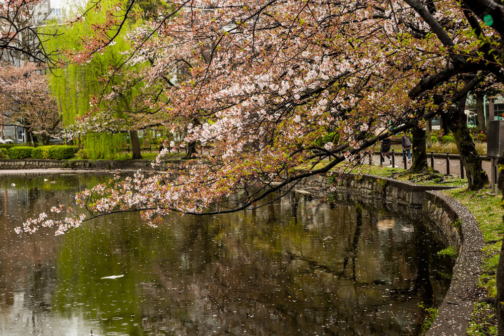
Sakura time in Japan
Spring in Japan is the time when the Cherry Blossoms bloom. The lovely Cherry blossoms range in colour from white to vibrant shades of pink. The cherry blossoms in full bloom are a spectacular sight to behold. Hanami or Cherry Blossom viewing is a Japanese tradition where families and friends gather , sometime dressed in traditional Japanese Kimonos and after praying at their favourite shrines have picnics with food drink and song under the canopies of cherry blossom trees

Spring in Japan is the time when the Cherry Blossoms bloom. The lovely Cherry blossoms range in colour from white to vibrant shades of pink. The cherry blossoms in full bloom are a spectacular sight to behold. Hanami or Cherry Blossom viewing is a Japanese tradition where families and friends gather , sometime dressed in traditional Japanese Kimonos and after praying at their favourite shrines have picnics with food drink and song under the canopies of cherry blossom trees.
After seeing some inspiring images of Sakura(Cherry Blossoms) from Japan during an exhibit by another photographer I was so taken in by the photographic potential that I decided to travel to Japan during the Spring of 2015.

Shinjuku Gyoen Scene
Getting the best Sakura viewing takes some planning and a little luck too. Predicting the exact peak of the season is difficult as the blooms are effected by the weather around the time. The Temperature, humidity and precipitation all determine when the blossoms are in full bloom and the peak lasts just a day or two before the trees start shedding the flowers.
Also the location and type of trees in the region also dictate when the the blossoms will peak. The trees in the south bloom first progressing north as the temperatures rise . The Sakura time is anywhere between the end of March to the first half of April.
The Japan Meteorological Corporation cherry blossom releases a forecast based on various factors, such as the low temperatures during autumn and winter, cumulative temperatures, past area data, and cherry tree growth status.
For 2019, Tokyo’s sakura blossoms are expected to start opening around March 21, with peak bloom around March 29.
Getting There
I travelled to Tokyo on Singapore Airlines. The Singapore to Tokyo flight takes about six and half hours. I reached Tokyo in the morning and reached my hotel before check in time so had to wait a a little while before I got my room. I had planned to stay in Tokyo for just a couple of nights to get my bearings before heading off to Kobe which would be my base for the first half of my Sakura Photography.

Kobe Waterfront scene
Kobe is a coastal town located on the North Side of Osaka Bay and forms part of the Keihanshin metropolitan area along with Osaka and Kyoto. The city is the point of origin and namesake of Kobe beef, as well as the site of one of Japan's most famous hot spring resorts, Arima Onsen. Kobe was one of the main cities for trade with the West after the end of Japan’s Seclusion policy in 1853. Kobe’s role has diminished since then but still remains an important port city and has reminders of it heyday such as the Oriental Hotel where i stayed. Chinatown in Kobe is a great place to get some good food.
Where to Stay at Kobe
Luxury
Kobe Meriken Park Oriental Hotel
Hotel La Suite Kobe Harborland
Budget

Kobe Waterfront Scene
From Kobe I travelled to Kyoto and Osaka by the Shinkansen (Bullet Train) to photograph the Cherry Blossoms. The Shinkansen is the best mode of travel in Japan for Point A to B travel. Highways can be very congested at times. The Subway is a good way to get around inside Tokyo. I decided on when to visit each location based on the peak blooming calendar by the Japanese Met department. I made the peak correctly for Osaka but missed the peak by a day or two in Tokyo and Kyoto. i Still managed to get some decent photographs but i will be going back again as I feel there are much better images to be taken.
Night Scene at Kobe
Kyoto
Kyoto City , is the capital city of Kyoto Prefecture, located in the Kansai region of Japan. It is best known in Japanese history for being the former Imperial capital of Japan for more than one thousand years, as well as a major part of the Kyoto-Osaka-Kobe metropolitan area.
Getting there
Take the Shinkansen train from Tokyo to Kyoto.
Where to Stay in Kyoto
Here are a few accommodations with high ratings
Luxury
Budget

Tourists taking in the beauty of the Cherry blossoms along Philosophers path, Kyoto

In traditional dress for Hanami

Japanese Girl in Traditional Kimono as part of the Spring Celebrations

Cherry Blossoms and Sign along the Philosophers Path
Kyoto has a long recorded history dating as far back as the 6th century A.D . Kyoto was the capital of Japan till the imperial court was moved to Tokyo in 1869.
Kyoto has some of the best Hanami spots in Japan. These include The Philosophers Path, Maruyama Park, Arashiyama, Haradani-en Garden, Okazaki Canal,Kyoto Botanical Garden, Ninnaji and other spots.
I entered my efforts around the Philosophers Path as I was there for just a day trip.
The Philosopher's Walk ( Tetsugaku-no-michi) is a pedestrian path that follows a cherry-tree-lined canal in Kyoto, between Ginkaku-ji and Nanzen-ji. The route is so-named because the influential 20th-century Japanese philosopher and Kyoto University professor Nishida Kitaro is thought to have used it for daily meditation.
It passes a number of temples and shrines such as Hōnen-in, Ōtoyo Shrine, and Eikan-dō Zenrin-ji. It takes about 30 minutes to complete the walk, although many people spend more time visiting the sights along the way.
On the northern part of the walk, there are good views of the nearby Daimonji. The walk is a popular destination for tourists and locals, especially during hanami.
Osaka
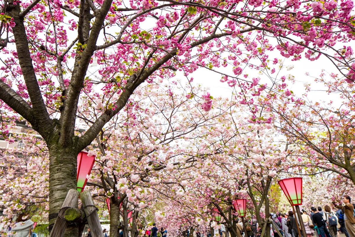
Cherry Blossoms at Osaka Mint Bureau
Osaka is a city in the Kansai region of Japan. It is the capital city of Osaka Prefecture and the largest component of the Keihanshin Metropolitan Area, the second largest metropolitan area in Japan and among the largest in the world with over 19 million inhabitants.
Osaka too has a long history with records from the 6th Century AD.
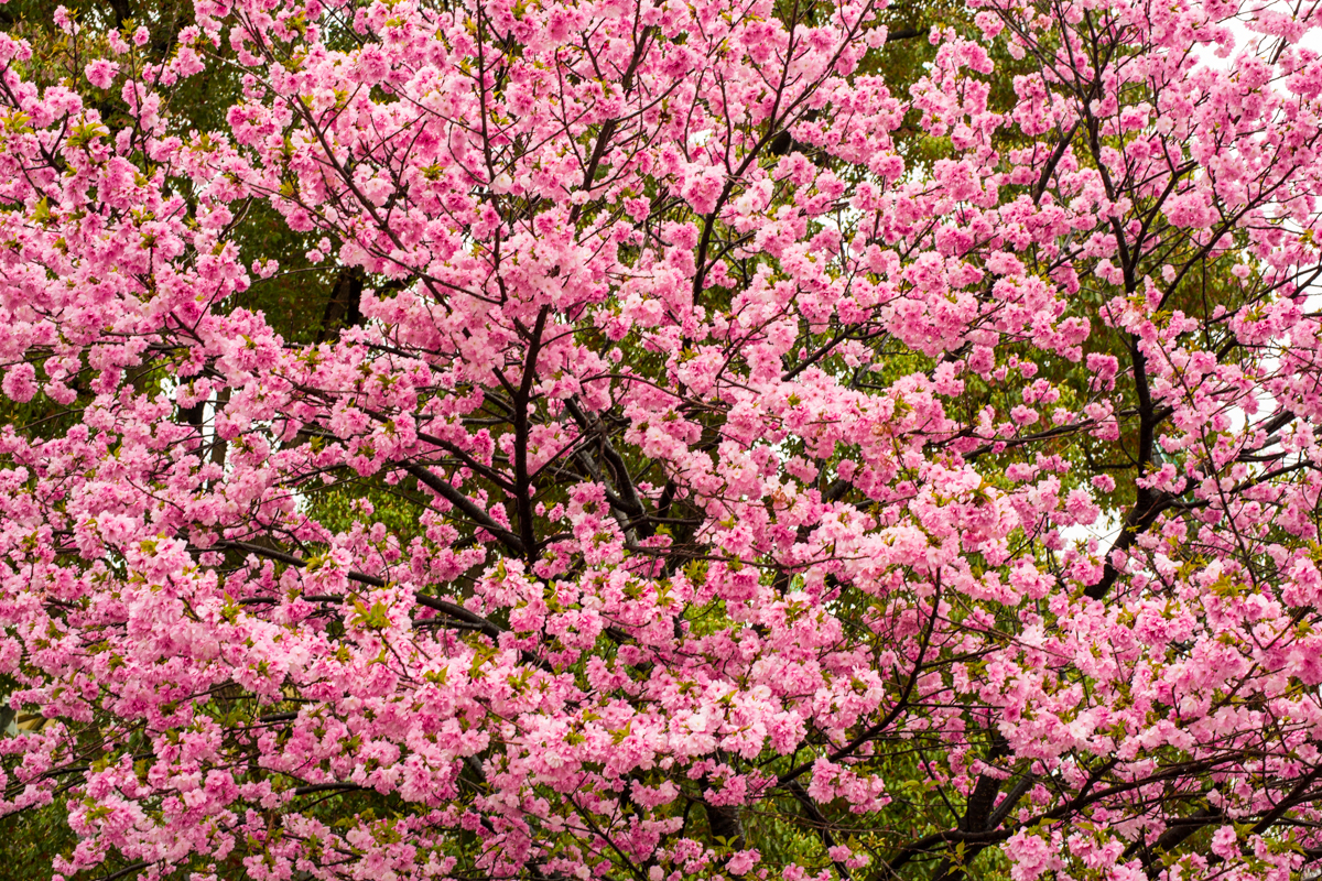
Pink blossoms in peak at Osaka Mint Grounds
The best Sakura viewing locations in Osaka include Osaka Mint Bureau, Kema Sakuranomiya Park, Osaka Castle, Expo 70 commemorative Park. I focused my visit on the Osaka Mint Bereau and Kema Sakuranomiya park locations.
For 2019 the expected peak viewing period is March 29 - April 6

Kema Sakuranomiya Park along the Osaka Riverside

Osaka River cruises are a great way to take in the Cherry Blossom trees lining the riverside
Tokyo

Tokyo, Japan’s busy capital, mixes the ultramodern and the traditional, from neon-lit skyscrapers to historic temples. The opulent Meiji Shinto Shrine is known for its towering gate and surrounding woods. The Imperial Palace sits amid large public gardens. The city's many museums offer exhibits ranging from classical art (in the Tokyo National Museum) to a reconstructed kabuki theater (in the Edo-Tokyo Museum).

The best spots for cherry blossom viewing include Ueno Park , Shinjuku Gyoen, Chidorigafuchi and Kitanomaru Park, Sumida Park , Meguro River , Rikugien Garden etc. I visited Ueno Park and Shinjuku Gyoen during my trip. Plan to visit some of the other locations during my next trip.
Where to Stay in Tokyo
There are a wide variety of hotels to choose from in Tokyo. And there are a number of localities to choose from. Decide what you will be doing first and then decide on your place of stay accordingly.
The Hyatt Regency Tokyo is one of the best hotels in Tokyo with massive luxurious rooms and is well located with a short walk from parks, restaurants and shopping and also presents good value for money.
other options include
Luxury

Hyatt Regency Room
Capsule Hotel First Cabin Nishiazabu
Tokyo is famous for its Capsule Hotels which are tiny rooms which tend to be very affordable and a good option if you are traveling single or with friends and want to save some money. These are very popular with people coming from out of town town to work in Tokyo during the week. These have also now become popular among backpackers and digital nomads.
First Cabin Nishiazabu for men
nine hours woman Kanda for women
Ueno Park

Ueno Park Scene
The park has some 8,800 trees, including Ginkgo biloba, Cinnamomum camphora, Zelkova serrata, Formosan cherry, Somei-Yoshino cherry, and Japanese cherry. There is a further 24,800 m2 of shrubs. Shinobazu Pond is a small lake with an area of 16 ha, extensive lotus beds, and marshland. It provides an important wintering ground for birds. Species commonly found include the tufted duck, Eurasian wigeon, northern pintail, common pochard, little grebe, great egret, and great cormorant. The Baer's pochard, ring-necked duck, and American wigeon have also been recorded.

Sakura viewers at Ueno Park
The central island houses a shrine to Benzaiten, goddess of fortune, modelled on Chikubu Island in Lake Biwa. The area was once full of "rendezvous teahouses", equivalent of the modern love hotel.
Shrine Near Ueno Park
After the Pacific War the pond was drained and used for the cultivation of cereals and subsequently there were plans to turn the site into a baseball stadium or multi-storey carpark. The lotus pond was restored in 1949, although much of it was again accidentally drained in 1968 during work on a new subway line.

A wedding Photoshoot on at Ueno Park
In all there are some eight hundred cherry trees in the park, although with the inclusion of those belonging to the Ueno Tōshō-gū shrine, temple buildings, and other neighbouring points the total reaches some twelve hundred.
Shinjuku Gyoen

Shinjuku Gyo-en is a large park and garden in Shinjuku and Shibuya, Tokyo, Japan. It was originally a residence of the Naitō family in the Edo period. Afterwards, it became a garden under the management of the Imperial Household Agency of Japan. It is now a national park under the jurisdiction of the Ministry of the Environment.
On May 21, 1949, the garden became open to the public as a national park. It came under the jurisdiction of the Ministry of the Environment in January 2001, with the official English name "Shinjuku Gyoen National Garden". The official Japanese name remains Shinjuku Gyoen, where gyoen means "imperial garden".
The garden, which is 58.3 hectares in area with a circumference of 3.5 km, blends three distinct styles: a French Formal and English Landscape in the north and to the south a Japanese traditional. A traditional Japanese tea house can be found within the gardens.

Typical Spring scene in Tokyo
Tips for planning your Sakura Viewing
I decided on when to visit each location based on the peak blooming calendar by the Japanese Met department. I made the peak correctly for Osaka but missed the peak by a day or two in Tokyo and Kyoto. i Still managed to get some decent photographs but i will need to make another trip sometime and plan for a longer stay and hopefully make the most of it.

Japan the Capital of Vending Machines. The only place I have seen hot canned coffee in a vending machine.perfect for the cold mornings during spring.
As Sakura time is a peak season in Japan all the hotels in Kyoto and other popular Sakura Viewing places tend get booked early. I ended up staying at Kobe and use that as a base due to lack of availability of good rooms in Kyoto. I travelled to Kyoto and Osaka on the Shinkansen (Bullet Train) which was a very cost effective and quick way to travel. The services work like clockwork and are very comfortable.
Check the various Sakura viewing guides before you book your tickets and accommodation. Here is a link to a Sakura viewing guide for 2019.
Get an English Speaking Guide to get the most out of your trip. I plan to do that during my next trip.
Sakura viewing is very popular among the locals and tourists alike. Expect to see crowds in most venues. So get there early to get people free shots.
Japan is expensive You can save money in Japan by living like a local. Staying in a hostel or capsule hotel , buying a rail pass, eating relatively cheap food, and visiting a few attractions will cost around $100 USD per day minimum. I would budget at least 150$USD per day and if you are looking for amore luxury experience budget $300-400 per day .
Japan Currency : YEN
100 $USD = SGD 137.2, = INR 7000 = 11,112.86 YEN as of this writing.
Japan Time : Japan is known as the land of the rising sun as it one of the first places to see sunrise in the world at GMT+9
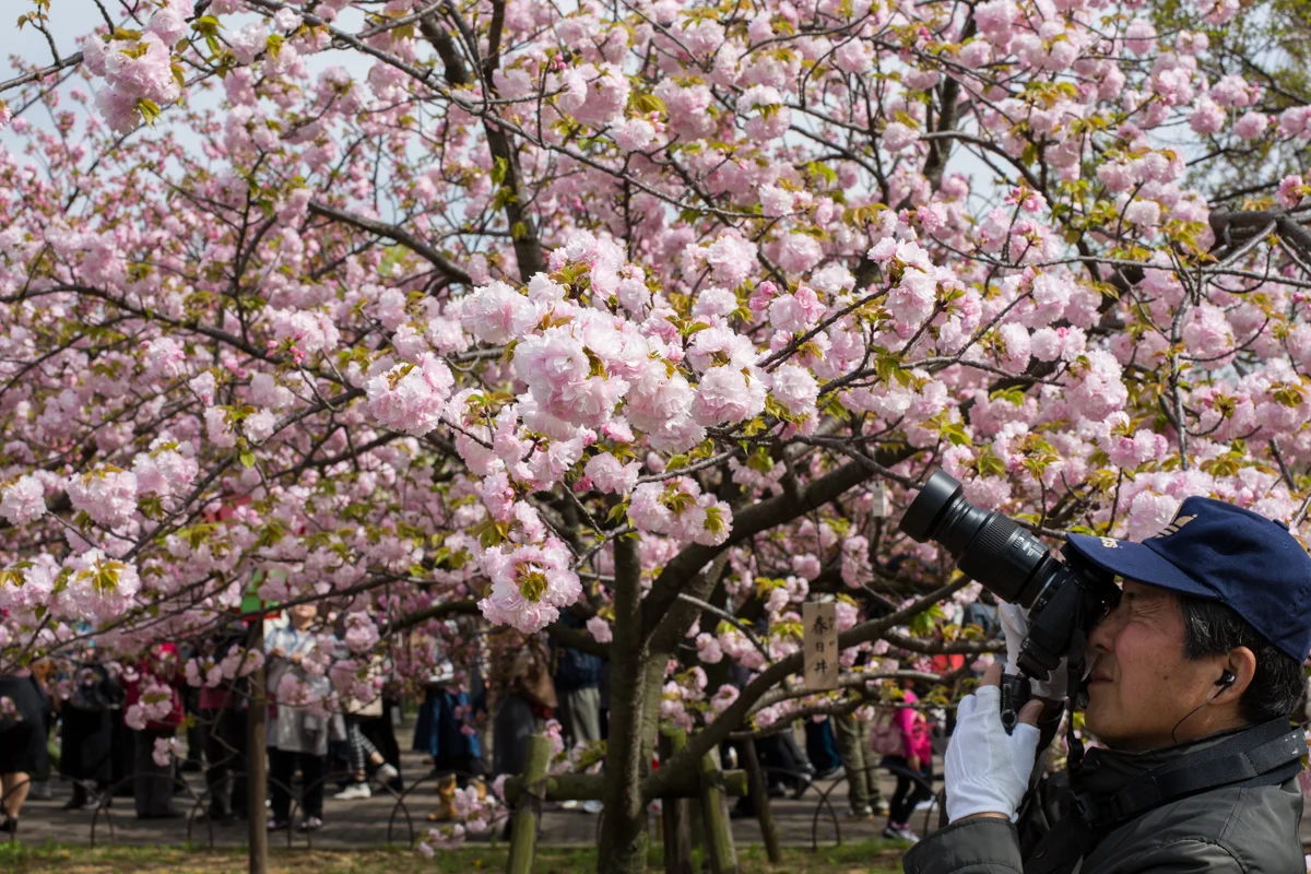
One of many photographers who come to shoot the Cherry Blossoms

Cruising through Scandinavia - 2 weeks through Norway, Denmark and Sweden
Scandinavia had been on my bucket list for a couple of years. And finally when I got a chance to travel there I decided to visit Copenhagen, Bergen and Stockholm with a short cruise through the fjords thrown in. This was to be a preview for a longer trip to Scandinavia at a later time. I decided to start with Copenhagen.

Frederik's Church , popularly known as The Marble Church for its rococo architecture, is an Evangelical Lutheran church in Copenhagen, Denmark
COPENHAGEN, DENMARK
Scandinavia had been on my bucket list for a couple of years. And finally when I got a chance to travel there I decided to visit Copenhagen, Bergen and Stockholm with a short cruise through the fjords thrown in. This was to be a preview for a longer trip to Scandinavia at a later time. I decided to start with Copenhagen.
Getting there
Copenhagen Airport Is the busiest airport in Scandinavia handling around 60,000 travellers every day.
The Major Airlines with connectivity to Copenhagen Airport are Singapore Airlines, British Airways, Lufthansa, Emirates, SAS, Finnair, Air India, Qatar Air, Cathay Pacific , Air China etc

Copenhagen Airport Image Courtesy: Copenhagen Media Center Photo By : Ty Stange
The best airline within Scandinavia itself is SAS. So my suggestion is to fly to one of the main European centres like London , Amsterdam or Frankfurt and fly SAS to Copenhagen and other destinations within Scandinavia.

SAS AIRLINE Image Courtesy: Copenhagen Media Center
Where to Stay at Copenhagen
Copenhagen Admiral Hotel
NYHAVN and INDRE BY are the main Tourist Hubs for Copenhagen . So I decided to stay at Nyhaven due to the convenience of the location. It is close the the Palace, Opera, Nyhaven Waterfront dining options. Also a lot of the tour operators have pickup points there so it is easy to get onto different tours and daytrips.

Statue of CARL FREDERIK TIETGEN, Danish Industrialist who founded a number of companies and also introduced the concept of “cheque” to Denmark

Calm Night at Nyhavn
INDRE BY is the old City which has beginnings in the 12th century. You will find the famous museums and churches here. It is also close to the Tivoli Gardens. But there are other options for stay too such as INDRE NØRREBRO, VESTERBRO, SLOTSHOLMEN, CHRISTIANSHAVN it depends upon your preference and which area you will be spending more time at.
Nyhaven Options (New Harbour)
INDRE BY Options (old city)
Best Western Plus Hotel City Copenhagen
Budget
Getting Around Copenhagen
Walking and cycling are real options for exploring Copenhagen. The public transport system in Copenhagen is well developed. For more information on tickets and pricing for the buses and water taxis check out the official tourism site of Copenhagen. You can also hail an Uber or call in a taxi if you so please. There are sightseeing buses which do loops around the city with stops at places of interest so that is a great way to explore the city if time is short.

Copenhagen Metro Train Image Courtesy: Copenhagen Media Center
Places to Visit and things to do in Copenhagen
Copenhagen has something for everyone. From waterfront cafes to Grand Palaces , Museums and Art Galleries. There are too many to list in this blog but here are are few highlights
Visit Rosenborg Castle and Explore the palace grounds and King’s gardens.
Rosenborg Castle and Gardens one of the oldest gardens in Copenhagen
Take in the Grandeur of Danish Aristocracy at Amalienborg Palace

Amalienborg Palace
Amalienborg Palace Museum, Copenhagen Photo By : Kamal Chilaka
Revel in the energy of Nyhavn

Nyhaven Weekend Scene

Nyhavn is full of Dining and Drinking Options.
Become a kid again at Tivoli Gardens one of the oldest theme parks in the world. Walt Disney himself found inspiration for the Disney World here.
Tivoli, the 170-year-old amusement gardens in central Copenhagen, used to be only a summer pass-time, but since 1994 it is open all year round. With thousands of lights adorning the historic buildings and gardens, and with charmingly themed villages and shops full of tasty treats and dazzling decorations, Tivoli oozes Christmas. Add to that the wonderful restaurants and the many thrilling rides, and you are set for a day’s adventure.

Tivoli Gardens at Night Image Courtesy : Copenhagen Media Center Photo By : Eleonora Costi

Carousel at Tivoli Image Courtesy: Copenhagen Media Center Photo By : Anders Bøgild
The Little Mermaid and Geflon Fountain
The Little Mermaid is a bronze statue by Edvard Eriksen, depicting a mermaid becoming human.

Near Geflon Fountain

The Gefion Fountain is a large fountain on the harbour front in Copenhagen, Denmark. It features a large-scale group of animal figures being driven by the Norse goddess Gefjon
Absorb the Art of Danish and International Masters at SMK - The National Gallery of Denmark
Feel the wind against your face during a Canal and Harbour Cruise

Tourists waiting for Canal and Harbour Cruises , Copenhagen

Old Opera Ferry and Building
Go Back in time at the Christiansborg Palace.
Frederiksborg Castle is situated in Hillerød, north of Copenhagen. This impressive Renaissance castle was built in the first decades of the 17th century by the Danish King Christian IV.
Frederiksborg Castle has housed The Museum of National History since 1878, when it was established by brewer J.C. Jacobsen, the founder of Carlsberg. The beautiful decorated rooms with portraits, history paintings, furniture, and decorative art invite visitors on a journey through Danish history and culture from the late Middle Ages to the present. The historical interiors and the splendorous rooms give a sensuous impression of changing styles and epochs. The collection of portraits is the largest and most significant in Denmark, with new works continually added to the collection.

Christiansborg Palace Image Courtesy : Copenhagen Media Center Photo by : Martin Heiberg
Be moved at the The Royal Danish Opera.

The Royal Danish Opera House which cost over 500$Million to build.

Opera House Inside. Image Courtesy: Copenhagen Media Center. Photo by : Terry Mclaughlin
Shop for souvenirs and gifts at the High Street shops.

High Street Shopping at Nyhaven
Stroll around Copenhagen Harbour and enjoy the fresh air as you take in the sweeping views of the sea.

Copenhagen Harbour Scene
All in all I had a great weekend in Copenhagen and before I knew it it was time to continue on to the second leg of my journey which was to fly from Copenhagen to Bergen,Norway.
BERGEN, NORWAY

Bergen in my opinion is the most beautiful city in Norway possibly even Scandinavia. I decided to start my journey through Norway here as it is the gateway to the fjords and also for its fantastic views.
Getting there
By Air
There are direct flights to Bergen from Copenhagen, Stockholm, New York, Helsinki, Amsterdam , London and many more centers of Europe.
Bergen Airport Flesland is located 18 kilometers south of Bergen. The airport buses depart every 15 - 20 minutes and takes about 30 minutes to the Bergen city center.
By Bus
Kystbussen has services from Stavanger, Haugesund or Stord (Leirvik) to Bergen. Buses also run between Oslo and Bergen. And, like travelling by car, you get to see a lot of Norwegian scenery en route.The NOR-WAY express bus company's Haukeliekspressen gets you from Oslo to Bergen.
By Cruise or Ferry
Hurtigruten is the main Cruise company that has sailings to Bergen right from Copenhagen or Oslo.
You can also catch one of the many high speed ferries from the ports along the Norwegian Coast. The approach to Bergen from the sea through fjords past charming fishing coastal villages is something special.
Driving there
One can drive to Bergen from Stavanger or from Oslo. The drive from Oslo to Bergen taken between 7 to 8.5 hours depending upon the route. Driving gives you more freedom to make the journey at your own pace and enjoy the scenery en-route.
Where to Stay at Bergen
I stayed at the Scandic Ornen Hotel which is a modern hotel located a 10 minute walk from City Center and a 15 minute walk from the harbour. But I noticed there were a lot of hotels closer to the city center and the Radisson Blu specially was very well located near Bryggen Harbour. It would probably be my choice if I were to go there again.
Other hotels which have good user ratings are
Luxury
Budget
Dining at Bergen
Bergen being a coastal town has some of the best sea food restaurants. The Bryggen Harbour area is filled with restaurants, cafes and pubs. You can get continental food as well as traditional norwegian food here. There is a TGIF near the city centre which became my favourite spot to have familiar comfort food as i’m not much of a seafood person. There are also tiny hole in the wall type of places for a quick bite. There are a number of Restaurants for Indian and Asian food as well so there is something for all palates.

TGIF Bergen

Coffee Shop at the Fish Market

Bergen Photo Ops
Bryggen Harbour and Waterfront

Bryggen Waterfront Area
Bryggen is one of Bergen's and Norway's main attractions. Bryggen was built after the great fire in 1702 and is included on UNESCO's World Heritage List.
The very first buildings in Bergen were situated at Bryggen, which has been a vibrant and important area of the city for many centuries.
Bryggen has been ravaged by many fires, the great fire of 1702 in particular. It reduced the whole of the city to ashes. The area was rebuilt on the foundations that had been there since the 12th century, which means that Bryggen is basically unchanged despite the passing centuries.
Bryggen is now part of our common heritage and has a place on UNESCO’s World Heritage List, and the city of Bergen is a designated World Heritage City. The world heritage site consists of the old Hanseatic wharf and buildings, and one of the best known urban areas from the Middle Ages in all of Norway.
In 1360, the German Hanseatic League set up one of its import and export offices at Bryggen, dominating trade for almost 400 years. To stroll through the narrow alleyways and overhanging galleries is to step back into the mists of time and a bygone era.
Bergen Waterfront
Bryggen is very much a living part of the cultural heritage that is still in active use in this historical area of the city. Today, there are several attractions in the area, from the Fish Market to Bergenhus Fortress and there are many cafés, restaurants and shops to choose from. Many of the shops sell traditional and unique crafts.
Explore by walking through the lanes of Bergen

Quaint by Lanes of Bergen
Take the funicular up to the Mt Floyen View Point for fantastic views of Bergen and the fjords.
The Funicular station is located right near Bergen Harbour so is a short walk from most places in city centre.
Make sure you keep track of time while the top of the hill because the trains stop at around 10pm so if you miss the last train it is a long walk back down the hill.

Funicular up to Mt Floyen
Sunset in summer is quite late around 9 pm and it can be quite sunny up at the view point even if you get up there by 6 pm. But its worth the wait and you can ensure you have a good spot reserved to view the Sun set over the fjords.

Tourists and Jogger enjoying the sunset at Mt Floyen Viewing Point
View from Mt Ulriken
Take the Cable car up to the top of Mt Ulriken for the best views of Bergen and the Fjords.

People Watching at Bergen Center

Bergen City Center

Street Musician at Lille Lungegårdsvannet , Bergen

School kids out on a trip
Kids cooling off at a fountain near city center
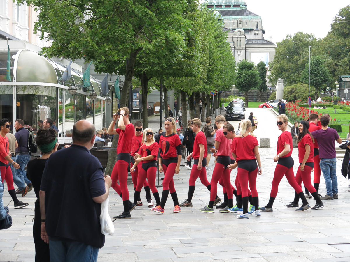
Youngsters having fun masquerading

A Wedding group at Bergen.
After 3 days of a fairy tale stay at Bergen and with a promise to return for a longer stay that I set off onto the next leg of my journey which was the cruise on Hurtigruten from Bergen to Alesund and Trondheim.
Hurtigruten Cruise
BERGEN-ALESUND-TRONDHEIM

Inside Hurtigruten Terminal at Bergen.This where the passengers check in and wait to board the Cruise Ships
Hurtigruten has sailings from Bergen to KIrkenes and back via Alesund and Trondheim (Norwegian Discovery Voyage)which is a 11 day voyage. I had only a couple of days and nights to spare for the cruise so decided to sail just the Bergen -Alesund-Hardangerfjord-Trondheim section which was 2 nights and 1.5 days.
You can see more details on the Hurtegruten website.
To explore the fjords and the surrounding countryside further take a day trip or two during the cruise. They are a little pricey but the arrangements are excellent and leaves you free to just take in the scenery.

lounge area on the ship

Dining Area in the Ship
My Sea View Cabin for the Cruise
upper viewing deck

Typical Norwegian Fishing Hamlet in the fjords
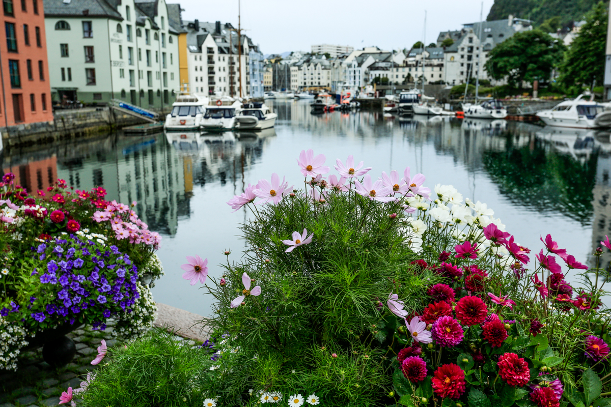
Alesund Scene

Alesund
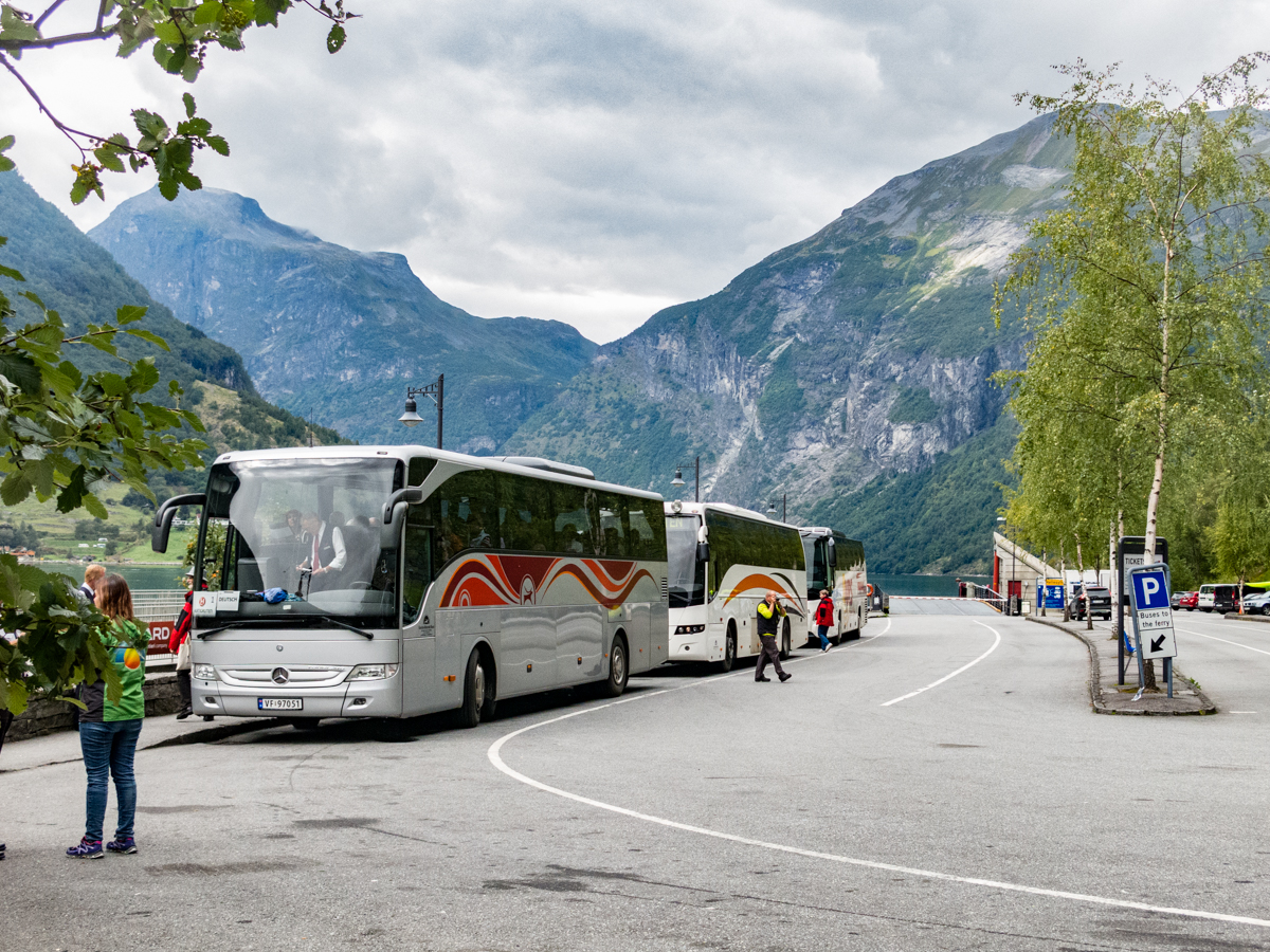
Coaches Ready to take Cruise Passengers on a day trip

View of Hardengerfjord from a view point.

Near Trollstigen Pass

Visitor Center and Curio Shop at Trollstigen Pass

Trondheim Walkway
Summer Flowers at Trondheim

Trondheim Scene
At Trondheim I parted with the Cruise and rested for a night before flying on to Stockholm.
Stockholm
Where to Stay at Stockholm
Luxury
Radisson Blu Waterfront Hotel, Stockholm
Radisson Blu Royal Viking Hotel, Stockholm
Budget
Getting around Stockholm
By Subway
Stockholm's subway is probably the quickest way to get around town.
A single ticket is valid for 75 minutes and you can also buy passes for 24, hours, 72 hours and 30 days. The tickets can be purchased at ticket terminals, SL Centers, newsagent kiosks, SMS or the SL app.

Riding the Stockholm Subway
It's not possible to pay cash for tickets on board buses in Stockholm. Failure to show on demand a valid ticket during a control will result in a penalty fee of 1500 SEK.
The same tickets and passes can also be used to travel by bus, tram, commuter trains and the ferries from Nybroviken and Djurgården.
By Boat
Travelling by local ferries is a fantastic way to experience a city built on islands. Ferries are used by both commuters and tourists wanting to take a better look around.
Cycling
There are several rental options; City Bikes simply lets you borrow a bike from any of their 140 public-sites via a three-day or season pass, Bike Sweden is both a bike rental service and organizer of bike tours; Rent-a-bike offers both bike rentals both for several days or by the hour.
By Taxi
You can easily get hold of a taxi by calling a taxi company, hailing one on the street or by taking a one from a rank. There is a manned taxi center at Central Station that can help you with finding the right service, e.g. if you need child seats in the vehicle.
Photo Ops in Stockholm
Stockholm Waterfront

Stockholm Harbour and Traditional Sailing Ship
Gamla Stan

Gamla Stan Old Town
Gamla Stan, the Old Town, is one of the largest and best preserved medieval city centers in Europe, and one of the foremost attractions in Stockholm. This is where Stockholm was founded in 1252.

Gamla Stan (Old Town)
All of Gamla Stan and the adjacent island of Riddarholmen are like a living pedestrian-friendly museum full of sights, attractions, restaurants, cafés, bars, and places to shop. Gamla Stan is also popular with aficionados of handicrafts, curious, and souvenirs.

Gamla Stan (old Town)
The Stockholm Underground Art
Stockholm’s subway system is truly one of a kind. One hundred stations, each with unique art on its platform, walls or waiting hall. Since 1957 artists have played a key role when new stations have been built.

T-Centralen Station
And over time the metro’s older stations – planned and built without any art – have been spruced up with beautiful statues, murals, and installations.

Kungsträdgården on the blue Line is one of the most photographed
So spending a day in Stockholm’s metro is basically like visiting the world’s longest art exhibition.

Solna Centrum station
Canal Boat Cruises

Historical Canal Tour Boat
Fotografiska, Stockholm

Fotografiska, Stockholm, Possibly the worlds best photography Gallery

Inside Fotografiska
Inside Fotografiska
Archipelago
My Gear for this trip
Canon 5D Mark 3 DSLR
Canon 70-200mm f2.8 L IS Lens
Canon 2x Teleconverter
Canon 17-40mm f4 L lens
Canon G12 Compact Camera
Gitzo Tripod
Arca Swiss C1 tripod head

Getting Acquainted with Ladakh
Ladakh is truly the ceiling of the world. Ladakh boasts of the highest motor-able road and the two highest passes in the world. Sometime its feels like one can reach up and touch the clouds. This mountain Kingdom in Jammu and Kashmir state of India is a land of high altitude deserts, sweeping panoramas, alpine lakes and magical light. Here I share with you my experiences during my photography trip to Ladakh during August 2016.

Lamayuru Monastery, Ladakh
Canon 5D mark iii, 70-20mm f2.8 L IS II , 1/640 sec @ f5.6
Ladakh is truly the ceiling of the world. Ladakh boasts of having seven of the top twelve highest motor-able roads in the world. Sometime its feels like one can reach up and touch the clouds. This mountain Kingdom in Jammu and Kashmir state of India is a land of high altitude deserts, sweeping panoramas, alpine lakes and magical light. Here I share with you my experiences during my photography trip to Ladakh not too long ago so that you might plan your Ladakh trip better.
Getting There
Leh is the main gateway to Ladakh.
By Air
Kushok Bakula Rimpochee Airport is the main Ladakh Airport at Leh. It is operated by the Indian Military but receives Civilian Flights too. Air India, Indigo Airlines, Jet Airways, SpiceJet, Go Air, Indian Airlines,Jet Konnect and Air India Express all have services to Leh. Flying into Leh is the most convenient way to get there.
The other popular options are to fly into Srinagar or Manali and to drive from there. Both Routes are very scenic and take you through some of the highest passes in the world. Both routes are between 400 and 500 kms long and can take 20 to 24 hours.

Leh-Srinagar Highway
Canon 5D Mark iii, Canon 17-40mm f4 L @ 17mm, f11 1/200 sec ISO 100
By Road
Best time to travel to Leh by Road is during the summer months from May to September. Roads are mostly closed rest of the year to landslides or snowfall. You can travel to Leh Via New Delhi and Chandigarh.
By Rail
The Nearest Rail head is Jammu Tawi Which is 700 km from Leh. You can then travel by Jeep or Bus from Jammu Tawi.

Leh Valley, Ladakh
Canon 5DSR , 70-200 f2.8 L IS II, 1/60 SEC @ f11, ISO 400
Where to Stay at Leh
Leh is a good place to stay for a couple of days to get acclimatised to the high Altitudes of Ladakh. Leh offers more creature comforts than any other location. Once you leave Leh things tend get very basic and sometimes really rough. There are plenty of options for stay at Leh. Here are a few listed below.
Luxury
Budget

View of Namgyal Tsemo Monastery from Shanti Stupa
Canon 5DSR , 70-200 f2.8 L IS II, 1/800 SEC @ f8, ISO 400
Places of Interest at Leh
Shanti Stupa
Thiksay Monastery
Leh Palace
There are also a number of cafes and restaurants that serve really tasty food to explore and experience at Leh.
Away from Leh
Here are some of the places that present nice photo ops. As a Landscape photographer I am always looking to get out of the city and into nature but some of the other locations also present interesting photographic opportunities.
Lamayuru Monastery
Alchi Monastery
Pangong Tso
Tso Moriri
Khardung La Pass
Nubra Valley
Kargil
Aryan Valley
Lamayuru Monastry

View from Lamayuru Monastery

Young Monk at Lamayuru Monastery
Zanskar River
At the Confluence of Zhanskar and Indus Rivers
Kargil

Cloud Burst Near Kargil
Canon 5DS-R, 17-40mm f4L, 1/400 sec @ f8 ISO 100

Cave Monastery near Kargil
TSO KAR
The Tso-Kar Lake is one of the three high altitude salt water lakes in Ladakh.The Tso-Kar Lake is known as 'White Lake' because the white salt of the water deposits all over the lake shores. Tso-kar Lake is about a ninety minute drive from Tso-moriri Lake.
The area surrounding Tso-kar lake is rich with wildlife and birds. The most easily spotted mammals here are Kiangs, the largest of the wild asses. I spotted a lovely pair of the wild asses during my trip . The hills and mountains around Tso Kar are also home to ibex, snow foxes and snow leopards. Surrounded by hills and mountains on all sides, the lake with its unique colouration and the pinkish tint of the soil surrounding the lake make for amazing landscapes.

Gravel Road Past Tso Kar Lake
Canon 5D Mark iii, 17-40mm f4 L, 1/250 sec @ f8, ISO 100 *copyright Kamal Chilaka All rights reserved

Prayer Flags at the More Plains near Tso Kar
People of Ladakh
Ladakh is an eclectic mix of people of Indo-Aryan and Tibetan ancestry. Tibetan Bhudhists, Shia Muslims and Hindus form the majority of the population. The different cultures mostly manage to live together in peace but there have been bloody clashes from time to time. People of Ladakh are used to tourists and are usually friendly and take time to stop for a chat if approached. They live with scarce means in very harsh mountain environs but have a healthy attitude towards life.
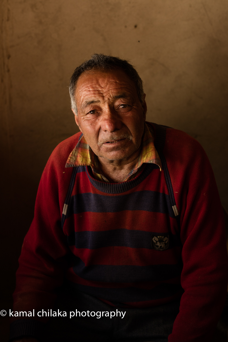
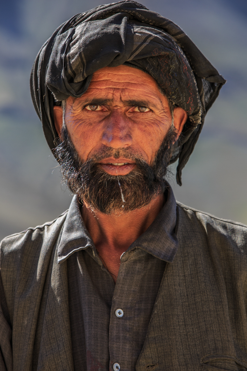
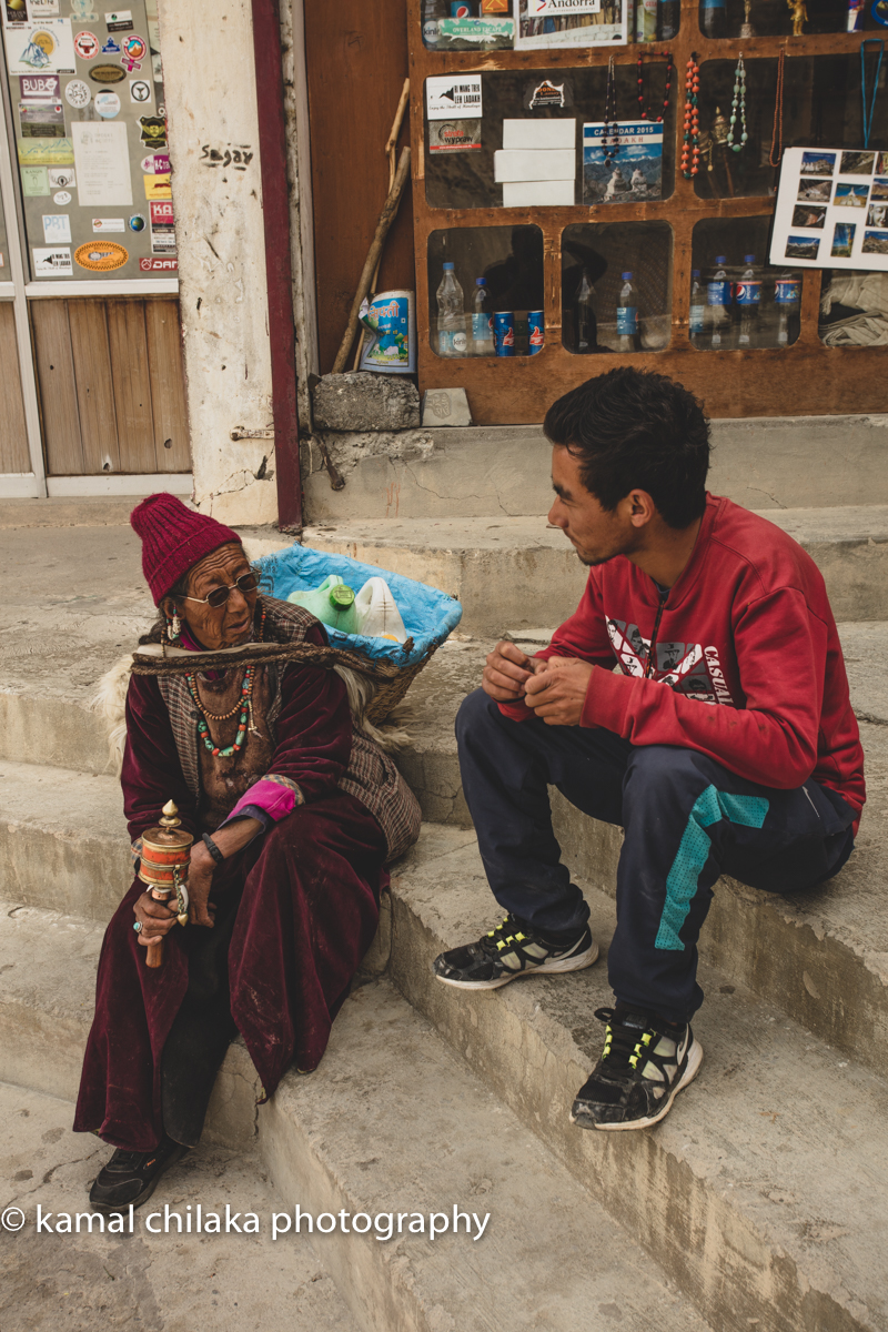
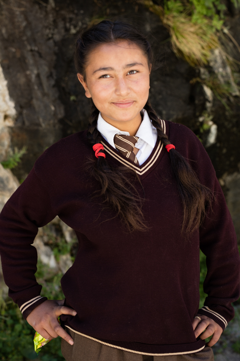
Nomadic Tribesmen of Ladakh who keep moving to where the pastures are green.

Roadside Tea Stall. Like the Ornamental Tea Flasks.
Shades of Tso Moriri Lake
Tso Moriri Lake is situated in the middle of the elevated district of Rupshu. The Rupshu valley lies south east of Ladakh on the road from Manali to Leh at altitude ranging from 16,500 feet. The drive from Leh to Tso Moriri takes about 7 to 9 hours. This pretty valley is inhabited by a small population of ‘Changspa’, who are nomadic shepherds. We arrived at Tso Moriri just before sunset and got to see the lake during golden hour. The blue of the Lake seems to get even more vibrant when the sun is at a low angle. The surrounding mountains glow with a golden glow while the water of the lake turns deep blue just before sunset.

Tso Moriri at Dawn
Tso Moriri is also a good site to do astro photography from as there isn’t much light pollution in the area.

Tso Moriri lit up by moonlight.
I was up shooting till late at night and up again on the roof of a hut by 5 am to capture the landscape by the predawn glow. As the sun rises it bathes the shores of the lake with warm light that brings out the greens and blues in the surrounding landscape.
By late morning the light is too harsh to do much shooting except maybe closeups near the waters edge at certain angles with a polariser.

Tso Moriri late morning.the largest of the high altitude lakes entirely within India and entirely within Ladakh in this Trans-Himalayan biogeographic region.
The challenge is to be able to brave the lack of oxygen at the high altitude of over 16000 ft above sea level at this lake. This was the only point where I struggled during the trip. Make sure you or your tour group has oxygen available in case of an emergency.

Tso Moriri at Pre Dawn
Taglangla Pass
Taglang La, elevation 5,328 metres (17,480 ft), is a high mountain pass in Ladakh region of the Indian state of Jammu and Kashmir. As of August 2014, the Leh-Manali highway leading south from Upshi to Tanglang La is paved, with the exception of a very short unpaved section just north of the pass. The pass itself is paved. On ascending the pass from Moore plains the road is well paved too with occasional streams crossing.

Roadwork on at Taglangla Pass. Worlds 2nd Highest Motor-able Pass after Khardungla Pass
The elevation in metres, which is taken from a local sign, is in agreement with SRTM data. The sign claims 17,582 feet, which would be 5,358 metres, and claims to be the world’s second highest motorable pass. The claim is no longer accurate however, and is actually the 12th highest motorable pass. Checkout this article on the worlds highest passes here.

Road Worker at Taglangla Pass. 17,480 ft above sea level.
You just have to tip your hat to the BRO(Border Roads Organization) which maintains these roads in India and the road workers who brave the fluctuating elements in less than ideal clothing and work to ensure the roads are well paved and accessible for both tourists and the army which has a strong presence near the borders.
My Gear For This Trip
Gura Gear Battaflae 32 L Camera Backpack
Canon 5D Mark iii (The 5D Mark IV has now replaced the well used 5D Mark iii in my camera bag)
Canon 5DS-R
Canon 17-40mm f4 L Wide Angle Zoom
LaCie Rugged Mini 1TB External Hard Drive (Orange)
San Disk and Lexar CF and SD cards
Things to be aware of and prepare for
Altitude sickness describes several symptoms that happen to your body when you’re exposed to a higher elevation within a short period of time. Best way to avoid altitude sickness is by climbing slowly and taking two to three days to reach your highest altitude specially when you care going to elevations higher than 10,000 ft above sea level.
If you are planning to fly into Leh starting to take Diamox 2 days prior to travel can help alleviate the problem. Consult your doctor whether you can take Diamox and how often. I didn’t take any Diamox prior to travel and once I reached Leh I could barely get out of bed for the first 24 hours. It took me about 3 days to get acclimatised to the elevation.
Lack of proper Sanitation outside Leh and Kargil and Dedicated Camp Sites
Carry All the medicines you might need for such a trip. Carry first aid kit too.
Border Area with high Army Presence - Permits may be required to visit and shoot in certain areas
Ladakh kinda feeling
Ladakh is a once in a lifetime trip for some but for many it is a place that beckons often be it for for photography with its expansive landscapes, great light or for enjoying the rugged outdoors or to find peace at a Buddhist Monastery. I for one am definitely going back one day soon to explore further what I discovered during that late summer trip.

Summer Road Trip to Kerala
Kerala or God’s Own Country as it popularly called is a south eastern state of India. Malayalam is the official Language of Kerala. I have travelled through Kerala by Train on several occasions and always found the region interesting due to its abundant water bodies, greenery and interesting culture but never actually go tot o spend any time there Finally in the Summer of 2016 i got to go there on a family road trip along with some friends.

Munnar, Kerala, India
Kerala or God’s Own Country as it popularly called is a south eastern state of India. Malayalam is the official Language of Kerala. I have travelled through Kerala by Train on several occasions and always found the region interesting due to its abundant water bodies, greenery and interesting culture but never actually got to spend any time there Finally in the Summer of 2016 I had an opportunity there on a family road trip along with some friends.
We decided to drive down from Chennai and decided to visit Munnar, Kumarakom and Thiruvananthapuram.

Our Route to Kerala and Back
Munnar
The drive from Chennai to Munnar took about 12 hours by road with a few stops for lunch and refreshments on the way. As usual I did the hotel bookings on Booking.com and we were not disappointed. Our accommodations at Munnar were at the Munnar Tea Country Resort . The rooms were spacious and family friendly. The food and drinks were good too.
After a good nights rest at the resort we set off to explore Munnar and the surrounding Tea Plantation region.

Munnar Scenery, Kerala, India
Even though it was summer the temperature at those higher elevations was nice enough for all day excursions.
The countless rows of tea plants with borders of eucalyptus trees are a pleasant sight for eye sore from laptop and mobile phone use. The air was fresh and cool.

We took time to explore the plantations on foot and get a few fun photos with the greenery as a backdrop.
We drove to nearby Lakkam Waterfalls one of several in the area and relaxed for bit there while the kids played in the water.
Where to Stay in Munnar
There are plenty of Hotel options and Home-stays too at Munnar. But the best ones tend to get booked up in advance so make your bookings early to avoid disappointment.
Here are a few accommodations with good reviews.
Luxury


Tea Plantations, Munnar
Kumarakom
From Munnar we set off for Kumarakom the gateway to the extensive backwaters of Kerala. The Drive from Munnar to Kumarakom took about 4 hours. We reached our resort for this leg the well known Vivanta by Taj Kumarakom. After a quick check in we were escorted to our Cottages which were right alongside a manmade waterbody. The cottages were also just a short walk away from the backwaters.

Backwaters and Houseboat, Kumarakom
Taj Kumarakom Resort and Spa Kerala (earlier called Taj Garden Retreat) the first modern tourist resort in Kumarakom was established in the Victorian two storied bungalow built by Alfred George Baker in the year 1881 on huge pieces of Teak wood rafters packed in mud as a base. This house on the lake at Kumarakom was the house of four generations of the Baker family, for over a hundred years. The bird Sanctuary and the two storeyed Bungalow built by Mr.A G Baker on the muddy land are places of interest for tourists from all over the world
Taj Kumarakom Resort and Spa Kerala, Kumarakom
Tourism in Kumarakom largely revolves around the backwaters of the Vembanad Lake. Several luxury and budget resorts lined up on the shores of the lake provide tourists with facilities for boating, yachting and fishing, with panoramic views of the lake. The other major attraction is the Bird Sanctuary, which is open from 6 am to 6 pm and can be visited by canoes arranged by local fishermen at the entrance to the sanctuary. A two-hour rowing canoe trip is quite cheap, and is best undertaken in the evening or early morning to avoid the afternoon sun.

Backwaters and Houseboat, Kumarakom
The Aruvikkuzhi Waterfall and its surrounding rubber plantation are a photographer's delight. There is also the Bay Island Drift Museum near the Kumarakom beach for history lovers, open from 10 am – 5 pm on Tuesdays – Saturdays and from 11.30 am – 5 pm on Sundays.
Where to Stay at Kumarakom
There are a number of Luxury and Budget options and Houseboats to choose from for stay at Kumarakom.
Here are a few popular options
Luxury
Taj Kumarakom Resort and Spa Kerala
The Zuri Kumarakom Kerala Resort & Spa
Budget
Houseboats

Luxurious Interior of a Houseboat

Waterside convenience store.
Thiruvananthapuram
After a relaxing couple of days at Kumarakom we set of for Thiruvananthapuram . The Drive from Kumarakom to Trivandrum takes about 2 hours.
Thiruvananthapuram (or Trivandrum) is the capital of the southern Indian state of Kerala. It's distinguished by its British colonial architecture and many art galleries. It’s also home to Kuthira Malika (or Puthen Malika) Palace, adorned with carved horses and displaying collections related to the Travancore royal family, whose regional capital was here from the 18th–20th centuries.
We wanted to visit the Anantha Padmanabhaswamy Temple.The temple is built in an intricate fusion of the indigenous Kerala style and the Tamil style (kovil) of architecture associated with the temples located in the neighbouring state of Tamil Nadu, featuring high walls, and a 16th-century Gopuram.
The Principal Deity Maha Vishnu-Adi Narayana is enshrined in the "Anantha Shayanam" posture, the eternal yogic sleep on the serpent Adisheshan. Sree Padmanabhaswamy is the tutelary deity of the royal family of Travancore. The titular Maharaja of Travancore Moolam Thirunal Rama Varma is the trustee of the temple. In line with the Temple Entry Proclamation, only those who profess the Hindu faith are permitted entry to the temple and devotees have to strictly follow the dress code. The name of the city of Thiruvananthapuram in Malayalam translates to "The City of Lord Ananta", referring to the deity of Padmanabhaswamy Temple.
Other Places of Interest at or near Trivandrum are :
The Napier Museum and Zoo - The museum houses a rare collection of archaeological and historic artefacts, bronze idols, ancient ornaments, a temple chariot and ivory carvings. It also contains the Sree Chitra Art Gallery, which contains works from Raja Ravi Varma and Nicholas Roerich, as well as examples of Mughal and Tanjore art.
The Museum grounds also hold the famous Trivandrum Zoo, which is one of the oldest zoological gardens in India
Kovalam Beach
Varkala Beach
Kuthira Malika Kuthiramalika is a palace built by Swathi Thirunal Rama Varma on the south-eastern side of Padmanabhaswamy temple, Thiruvananthapuram.
Where to Stay at Trivandrum
Luxury/Business Class
Hilton Garden Inn, Trivandrum (well located near city center and close to attractions)
Budget
Due to the short duration of time for the trip we decided to keep other noteworthy places such as Cochin, Thekady, Kovalam and Varkala for another trip.
Camera Gear for Kerala
As this was primarily a family vacation I decided to travel light
Canon 5D IV , Canon 70-200 F2.8 L IS II, Canon 17-40mm F4 l and Zeiss Otus 55mm f1.4 . In hindsight this was just right for most shooting occasions I encountered during this trip. The Wide Angle lens allowed me to shoot landscapes and the the expanses of the backwaters of Kerala. The telephoto zoom allowed me to zoom in interesting portions of the Landscape and and also shoot the occasional portrait. The standard focal length of the Zeiss Otus was ideal for taking tack sharp portraits of family members. Probably overkill for a family vacation but hey as a photographer I always want my best kit with me just in case.
Subscribe to my newsletter to stay updated of new blog posts and more .

My Top Photography Locations in New Zealand South Island
New Zealand should be on the bucket list of every Landscape photographer, Hiking Enthusiast and people with wanderlust in general. The “ Land of the Long White Cloud” or Aotearoa is it is referred to in Maori can amaze you with its expansive Landscapes, Lush Green Hills and meadows filled with spring flowers. From verdant beaches to snow peaked mountains New Zealand has it all.

NZ South Island
New Zealand should be on the bucket list of every Landscape photographer, Hiking Enthusiast and people with wanderlust in general. The “ Land of the Long White Cloud” or Aotearoa is it is referred to in Maori can amaze you with its expansive Landscapes, Lush Green Hills and meadows filled with spring flowers. From verdant beaches to snow peaked mountains New Zealand has it all.
I decided to skip the North Island and Auckland the most populous City of New Zealand and decided to just explore the South Island for my first trip as I had heard thats thats where the best scenery is. I plan to visit the North Island on my next trip there.
Getting There : Christchurch is the International Airport for the South Island . Many International Airlines have flights to Christchurch including Emirates, Singapore Airlines, Air New Zealand, Jetstar, Qantas, Virgin Australia, Cathay Pacific etc The other option is to fly to Auckland and drive and take a ferry to to the South Island.
New Zealand Time : GMT+13
New Zealand Currency: New Zealand Dollar
New Zealand Visa : See info here
Seasons in New Zealand :
Being located in the car southern hemisphere New Zealand has its seasons opposite from the usual months.
SPRING - SEPTEMBER, OCTOBER, NOVEMBER
SUMMER - DECEMBER, JANUARY, FEBRUARY
AUTUMN - MARCH, APRIL, MAY
WINTER - JUNE, JULY,AUGUST
Summer is the most popular time for tourists to visit New Zealand But I usually prefer to avoid summer for my travel as that tends to be peak tourist season and everything from accommodation to flight tickets and car rentals are expensive and places tend to be more crowded. I prefer the shoulder seasons of Spring and Autumn and sometimes winter too.
For this trip I chose to go during the New Zealand Spring.
I flew from Chennai to Christchurch via Singapore on Singapore Airlines. The flight duration from Chennai, India to Singapore is about 4 hours and the flight from Singapore to Christchurch is about 10 hours. On landing at Christchurch I caught the shuttle bus to the Car Rental place and after a short wait had my car for the trip a compact SUV loaded with my luggage and headed to my Motel for the night .
I had an exciting 9 day road trip planned and wanted to be rested and well prepared before I set off the following morning. Most of my hotel bookings for this trip were done on Booking.com and Hotels.com . I also recommend using Trivago.com and Tripadvisor.com for doing hotel reservations.
At Christchurch I stayed at City Centre Motel and Quality Hotel Elms . As the name suggest the first one is a Motel with basic amenities but is located in the heart of Christchurch. Lots of food options around. The Quality Inn Elms Hotel is more upmarket and has a lovely restaurant. Do try out their Grilled Chicken on Brioche Bun.

Tekapo
My first destination was Tekapo. Lake Tekapo is without doubt one of the highlights of any trip to NZ. I had already researched Lake Tekapo by looking at images online and had some idea of the kind of images I wanted to take.
Where to Stay at Tekapo
My Hotel room at Tekapo at the Peppers Bluewater Resort was a pleasant surprise. It was way bigger than I expected and very well located near the Lake and close to the main shopping strip at Tekapo.
Some Other Stay Options at Tekapo

Lake Tekapo..yes its a lake ..

Church of the good Shepherd and Lupines
Lake Tekapo is the second-largest of three roughly parallel lakes running north–south along the northern edge of the Mackenzie Basin in the South Island of New Zealand (the others are Lake Pukaki and Lake Ohau). It covers an area of 83 square kilometres (32 sq mi), and is at an altitude of 710 metres (2,330 ft) above sea level.
The lake is fed at its northern end by the braided Godley River, which has its source in the Southern Alps to the north. The lake is a popular tourist destination, and several resort hotels are located at the township of Lake Tekapo at the lake's southern end. The Lake Tekapo Regional Park, administered by Environment Canterbury, is located on the southern shore of the lake.
An astronomical observatory is located at Mount John, which is to the north of the town, and south of the small Lake Alexandrina.
Highlights of Tekapo
Lake Tekapo
Church of the Good Shepherd
Situated on the shores of Lake Tekapo is the Church of the Good Shepherd, which, in 1935, was the first church built in the Mackenzie Basin. The church at Lake Tekapo was designed by Christchurch architect R.S.D. Harman, based on sketches by a local artist, Esther Hope. The church is arguably one of the most photographed in New Zealand, and features an altar window that frames views of the lake and mountains.
Stargazing at Mount John Observatory
Mackenzie Basin walking tracks

Rainbow at Lake Tekapo and the Church of the Good Shepherd
Moeraki
Moeraki is now all known for its boulders; magical spherical stones scattered across a beach. Each boulder weighs several tonnes and is up to two metres high.Scientists explain the boulders as calcite concretions formed about 65 million years ago. According to Maori legend, the boulders are gourds washed ashore from the great voyaging canoe Araiteuru when it was wrecked upon landfall in New Zealand hundreds of years ago.

Moeraki Boulders
Where to Stay at Moeraki Boulders
I booked my stay at Moeraki Boulders Kiwi Holiday Park & Motel which is a short drive away from the Moeraki Boulders Beach. See image below. The holiday park has prefab huts which are very comfortable with attached bathrooms. The camp also accommodates camper vans if you choose to use a camper van for your New Zealand Trip. Other nearby options with good ratings on booking.com are Noah's Boutique Accommodation Moeraki and Three Bays Apartment.

Queenstown


Queenstown is the crowning Jewel of New Zealand’s South Island in my opinion. Its a beautiful picturesque all weather resort town. With an elevation of just 310m it still manages to have ski slopes and a magnificent Lake Wakatipu at its doorstep. This terrain allows for so many activities that draws in the tourists. From Skiing in Winter to trekking and water sports in Spring and Summer it has it all. From a Landscape photographers perspective Queenstown and the surrounding areas present a lot of opportunities. Situated a short walk from Queenstown center, the Gondola carries visitors high above Queenstown to the Skyline complex. The best views in the region are found here, spread out in a spectacular panorama with breath taking views of Coronet Peak, The Remarkables mountain range and across Lake Wakatipu to Cecil and Walter Peak.
From a Landscape photographers perspective Queenstown and the surrounding areas present a lot of opportunities. Situated a short walk from Queenstown center, the Gondola carries visitors high above Queenstown to the Skyline complex. The best views in the region are found here, spread out in a spectacular panorama with breath taking views of Coronet Peak, The Remarkables mountain range and across Lake Wakatipu to Cecil and Walter Peak.
Also within a short drive from Queenstown there are locations such as Glenorchy, Arrowtown, Cardrona which present lovely landscapes and viewpoints to explore.
Where to Stay at Queenstown
I divided my stay between these two hotels so as to have access to different photography spots. Both Hotels are superbly located and have great views of Lake Wakatipu.

At the Shore of Lake Wakatipu
Lake Wanaka

Lake Wanaka Scene
Wanaka is just over an hours drive from Queenstown. Lake Wanaka lies at the heart of the Otago Lakes in the lower South Island of New Zealand. The township is situated in a glacier carved basin on the shores of the lake and is the gateway to Mt Aspiring National Park.
Lake Hāwea is a 15-minute drive away, en route to the frontier town of Makarora, the last stop before the West Coast Glacier region. To the south is the historic Cardrona Valley, a popular scenic alpine route to neighbouring Queenstown. I loved the drive from Wanaka to Lake Hawea. There are a number of scenic viewpoints from which to photograph on this drive .
At its greatest extent, which is roughly along a north-south axis, the lake is 42 kilometres long. Its widest point, at the southern end, is 10 kilometres. The lake's western shore is lined with high peaks rising to over 2000 metres above sea level. Along the eastern shore the land is also mountainous, but the peaks are somewhat lower.
Wanaka lies in a u-shaped valley formed by glacial erosion during the last ice age, more than 10,000 years ago. It is fed by the Matukituki and Makarora Rivers, and is the source of the Clutha River. Nearby Lake Hāwea lies in a parallel valley carved by a neighbouring glacier eight kilometres to the east. At their closest point (a rocky ridge called The Neck), the lakes are only 1,000 metres apart.
Where to Stay at Wanaka
Wanaka offers plenty of choices of accommodation from premium lodgings to hostels for back-packers. My hotel of choice was the Edgewater Hotel which is close to Lake Wanaka offering views of the Lake from the Hotel Grounds. Lake Hawea Hotel, Ramada Resort by Wyndham Wanaka etc are all good options.

kids cooling off at Lake Wanaka
Lake Pukaki and Mount Cook

Lake Pukaki
Lake Pukaki is the largest of three roughly parallel alpine lakes running north-south along the northern edge of the Mackenzie Basin on New Zealand's South Island. The others are Lakes Tekapo and Ohau. All three lakes were formed when the terminal moraines of receding glaciers blocked their respective valleys, forming moraine-dammed lakes.
The glacial feed to the lakes gives them a distinctive blue colour, created by glacial flour, the extremely finely ground rock particles from the glaciers. Lake Pukaki covers an area of 178.7 km², and the surface elevation of the lake normally ranges from 518.2 to 532 metres above sea level.

Road to Mt Cook along Lake Pukaki
The mountain is in the Aoraki/Mount Cook National Park, in the Canterbury region. The park was established in 1953 and along with Westland National Park, Mount Aspiring National Park and Fiordland National Park forms one of the UNESCO World Heritage Sites. The park contains more than 140 peaks standing over 2,000 metres (6,600 ft) and 72 named glaciers, which cover 40 percent of its 700 square kilometres (170,000 acres).
The peak is located at the northern end of the Kirikirikatata / Mount Cook Range, where it meets with the main spine of the Main Divide, forming a massif between the Hooker Valley to the southwest and the Tasman Valley east of the mountain. These two valleys provide the closest easily accessible view points of Aoraki / Mount Cook. A lookout point at the end of the Hooker Valley Track located only 10 km from the peak has views of the entire mountainside.

Aspiring National Park home of Mount Cook
My Gear for New Zealand
This is the gear I had carried to New Zealand.
I found that I used the 24-70mm and the 70-200mm lens a little more than the 17-40mm. On my next trip I will probably carry a fast wide angle prime such as my Sigma 20mm f1.4 to shoot landscape and in particular for Astrophotography. Lake Tekapo is a designated dark sky point and that is why they have an Observatory there.
General Tips for Travel to New Zealand
New Zealand is prone to Earthquakes..they are not frequent but they do happen from time to time. Check all travel advisories before going and also be prepared when you are there. Emergency services are very good in New Zealand but just let someone be aware of your itinerary.
New Zealand is a windy place. Specially near Lakes and waterbodies the wind pick up speed as it passes over the water.
While renting a car take the optional GPS package. This will come in handy.
Gas Stations in New Zealand usually have a convenience store so you can stock up water and other snacks there.
Most Hotels have decent wifi. But get the travel data card from the airport cause that will allow you o stay connected even in remote locations.
New Zealand Customs is very particular about not letting anything which can potentially harm their plant life. All your shoes should be cleaned before you pack them.If they find dirt on your shoes they will ask you to clean thematic the airport before handing back to you and may also fine you. Check out NZ customs rules form their official website before you go.
There are restrictions and strict laws on flying drones in New Zealand. Pls be aware of them before you operate one.
NZ is a sparsely populated place specially the South Island. So when you travel it is better to travel with a companion if possible. I travelled Solo and did not have any problems but often found myself thinking it would be nice to have a companion .
New Zealand image Gallery


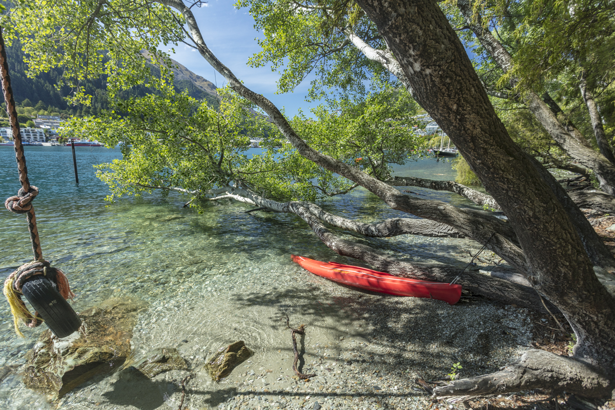
Kamal Chilaka in Association with Eyemage Tours undertakes small group and customised photography tours to New Zealand and other locations suited for photography. Please contact Kamal Chilaka at +91 8778336918 or mail at kamal@eyemage.photography for details.

UK and Paris in Spring - A 21 day photography trip to Wales, London,The Cotswolds, Amsterdam and Paris - Part 1
Being an April Born myself I have always found Spring time to be a wonderful time for travel and photography. There seems to be so much activity going on in nature after the stillness of winter.
After the success of my Photography trip to Yellowstone and The Grand Tetons during the spring of 2015 I decided once again to do a Spring Photography trip but to the UK and Paris this time.

Dusk in the Cotswolds
Being an April Born myself I have always found Spring time to be a wonderful time for travel and photography. There seems to be so much activity going on in nature after the stillness of winter.
After the success of my Photography trip to Yellowstone and The Grand Tetons during the spring of 2015 I decided once again to do a Spring Photography trip but to the UK and Paris this time. After about a month of planning and travel arrangements I was off to the UK to visit friends and also capture the beauty of nature in wales and the Cotswolds. I will talk about the Paris Leg of my trip in another blog.
Getting There
From Singapore
British Airways and Singapore airlines have several direct flights from from Singapore to London.
Many other airlines have connecting flights to London via either the middle east or via their European hubs.
From India
British Airways and Air India have direct flights from most Major Indian Airports. I flew from Chennai to London on British Airways.
Many other airlines have connecting flights to London via either the middle east or via their European hubs.
When to Go to Experience Spring in UK, France and Netherland
3rd week of March to mid of June is generally knows as Spring in the UK.
The Best time in my opinion is between 21st April and 21st May.
Typical Weather in Spring
Average Min/Max Temperatures: 9.3 ˚C- 15.4 ˚C
Average Min/Max Daylight Hours: 11-15 hours
Average Min/Max Rainfall (mm): 60 mm
Clothing
At these temperatures generally you don’t need heavy winter gear. The weather can be wet and cool though. So carry a good waterproof jacket with a bit of insulation.
For Clothing : Patagonia, Columbia, North Face
What was in my camera Bags?
As photographers we are ofter conflicted with what to take and what to leave behind just in case and this time was no different. I think I carried a little more than I should have but here is the list of equipment I carried for the trip.
Cameras
Canon EOS 5D Mark 3
Canon EOS 5DS 50.6 Megapixels Digital SLR Camera (Body Only)
Lenses
Canon EF 70-200mm F/2.8L IS II USM Telephoto Zoom Lens for Canon DSLR Camera
and a 2X Converter
Canon EF 17-40mm f/4L USM Lens
Zeiss Otus 55mm 1.4 Lens
Accessories
Gura Gear Bataflae 32 L Camera Bag
Gitzo Mountaineer Tripod and Arca Swiss Cube
Lee and B&W filters
Remote Release
Battery Grip for 5DSR
Torchlight
San Disk Extreme and Lexar CF Cards and SD cards
Lacie Rugged External Hard Drive for backing up my images
Macbook Pro
My Itinerary

Chennai-London-Cotswolds-Wales-London-Amsterdam-Paris-Chennai
Here I cover the areas i went to in a little more detail.
Cotswolds in UK
The cotswolds have long been a favourite place for artists and poets and even actors to go to get inspired. The cotswolds have held a special place in my hear ever since my first trip there during a trip to the UK during 2009. The Cotswolds is home to some of the most unspoilt, historic and famous towns and villages in England. The honey-coloured stone buildings provide a quintessential English charm found no-where else in the world. It really is a unique experience!

Sunset at Broadway Tower,Cotswolds,UK
Beautiful villages such as Snowshill and Painswick nestle in the Cotswold Hills, are sure to delight any visitor. Historical market towns such as Cirencester, Tetbury, Stroud and Tewkesbury offer excellent local shopping with thriving markets bursting with local produce. For those visitors looking to enjoy the countryside from a more urban base the larger towns of Gloucester, with its historic waterfront, and Regency Cheltenham Spa offers impressive architecture, stylish shopping and world-class horse racing.
There are so many towns and villages to explore, you will need to start planning your next trip before you leave.
The Cotswolds official tourism website https://www.cotswolds.com is a great resource for planning your cotswolds trip.
I used booking.com to book my accommodation for this trip. On this trip I focused my efforts on three main areas namely 1. Bibury 2. Broadway and 3. Cirencester as I had some specific images in mind.
Getting there : The cotswolds are about a two hour drive from London. I rented a car at Heathrow Airport stayed overnight at a hotel the Holiday Inn Express London Heathrow T5 and headed to the Cotswolds in the morning. My base in the Cotswolds was the The Crown of Crucis Country Inn and Hotel at Cirencester. Using this base I was able to visit Bibury and Broadway and also shoot around the Cirencester area which had some nice woods with bluebells. The Image above was shot on a country road close to my hotel.
The highlight of the trip was shooting at sunset at Broadway Tower near Broadway in Worcestershire.I was up on the hill walking around the tower waiting for the right light from about 6pm to till about 9pm when magic happened in the form a fantastic Sunset. I shot the tower and sunset using my 5DS-R set on my Gitzo tripod and the Arca Swiss Cube for a precise composition. Its one of the best images I have ever taken. I also made a trip to the Cotswolds Falconry Center. Cotswold Falconry Centre is located 1 1/2 miles West of Moreton in Marsh, near the foot of Bourton on the Hill. The Cotswolds Falconry Center and the Batsford Arboretum are must visit places during your trip to the Cotswolds whether you are into photography or not.

Sunset at Broadway Hill
Brecon Beacons in Wales
I always hate saying farewell to the Cotswolds but I had the next leg of my trip to look forward to. I set off for Cardiff, Wales which was an hour and a half from cirencester. The Severn Bridge enrolee to Cardiff is an impressive feat of Engineering. The Weather seemed to change the moment I entered Wales the rain started to pour and started questioning my decision to head the Wales. But Luckily the weather improved the next day. After a good nights rest at a friends place at Cardiff we set off to the Brecon Beacons to spend a day exploring and photographing in the Welsh National Park. I hope to come back to the Brecon Beacons for more extensive photography.

Idyllic Country Scene at the Brecon Beacons
On the 2nd Day in Wales I spent time shooting around Lake Roath Park and later in the day at Penarth Pier. Both scenic locations apt for photography. After this short introductory trip to Wales I set of to London and Heathrow .

Penarth Pier on an Overcast Day
More Images from the UK
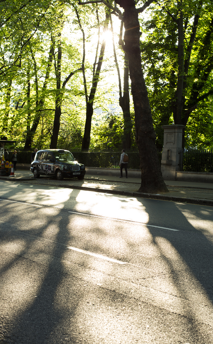
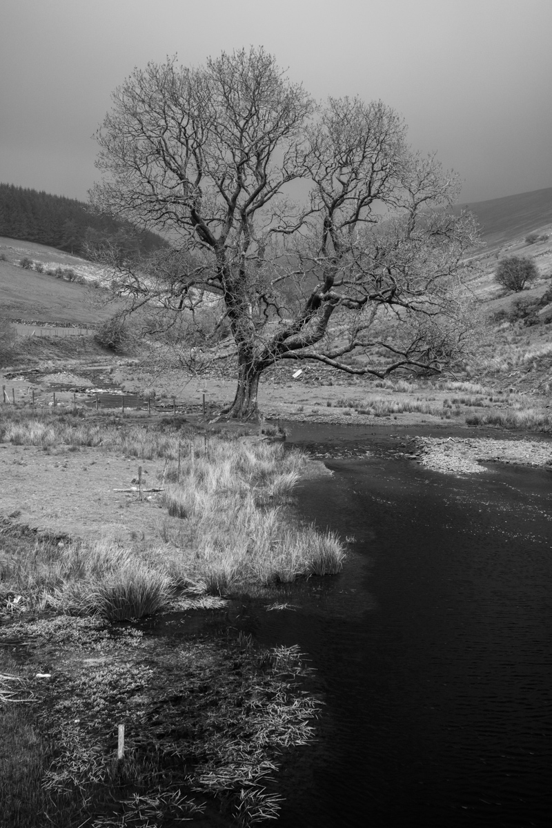
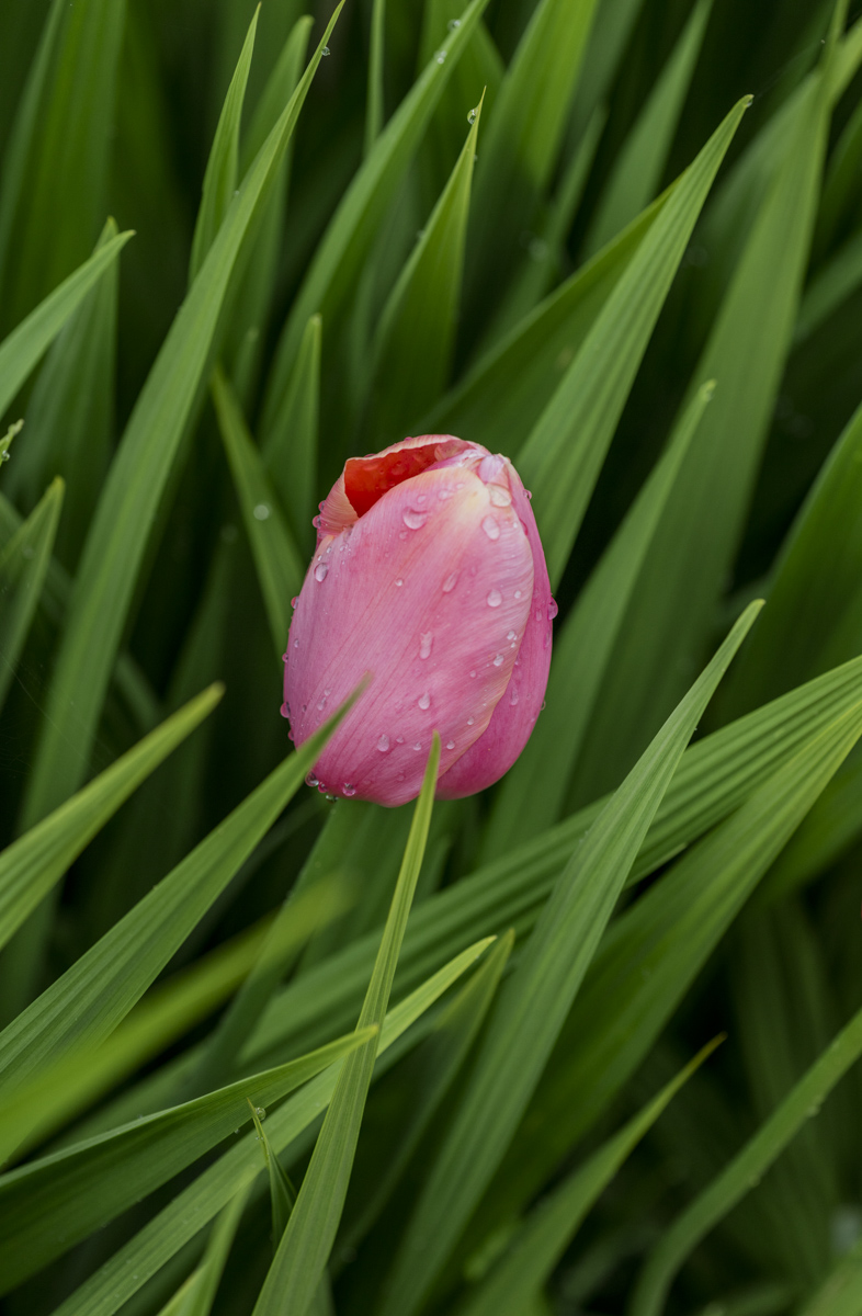
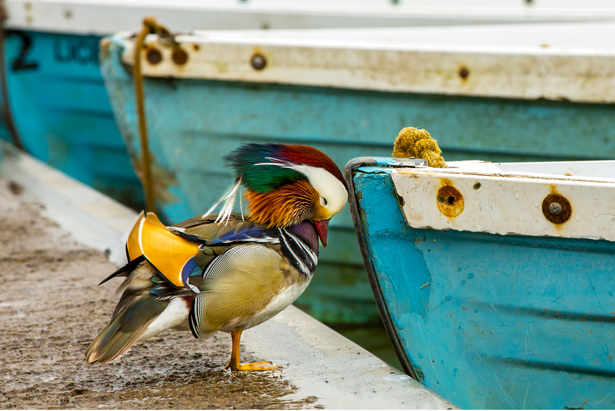
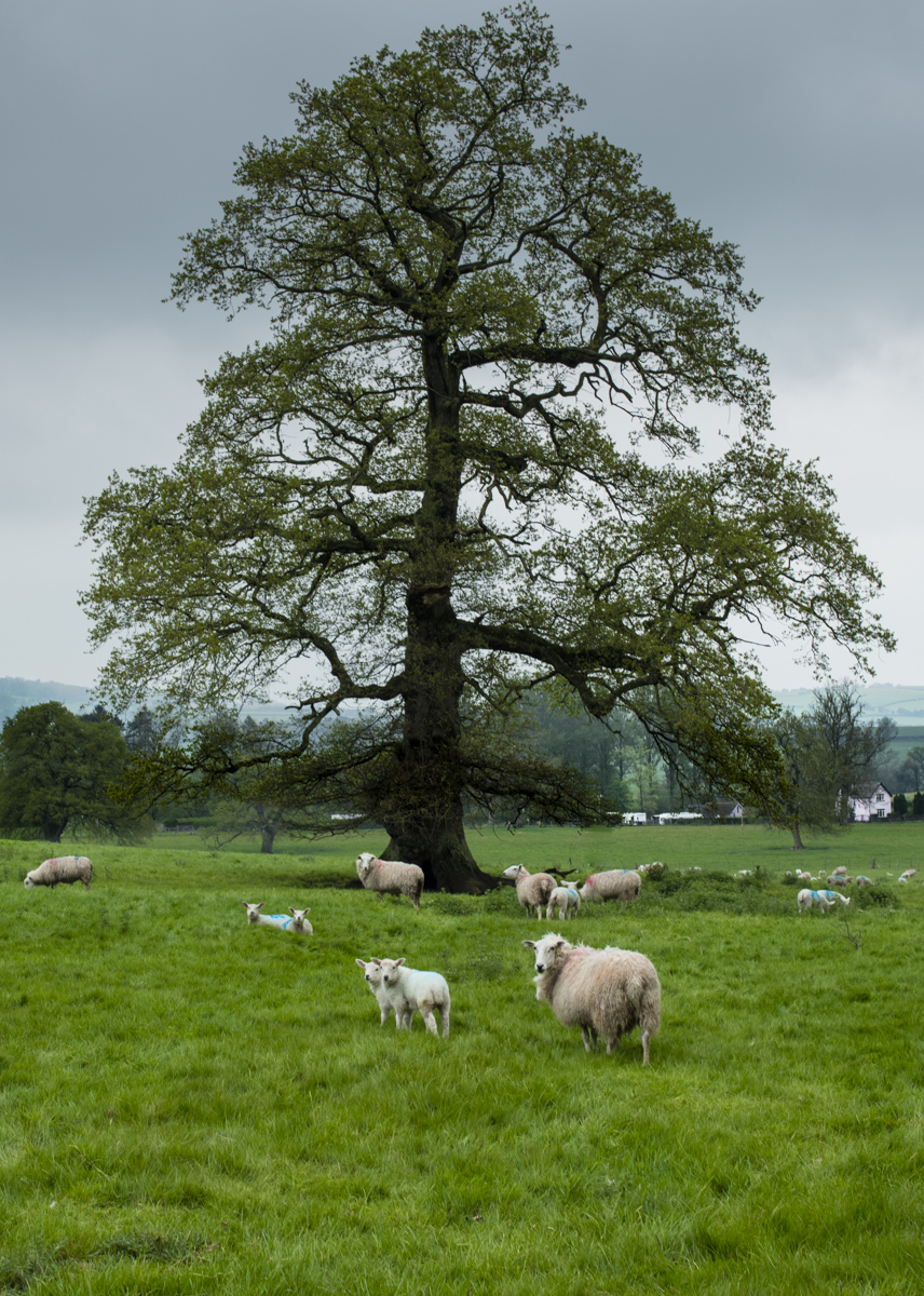


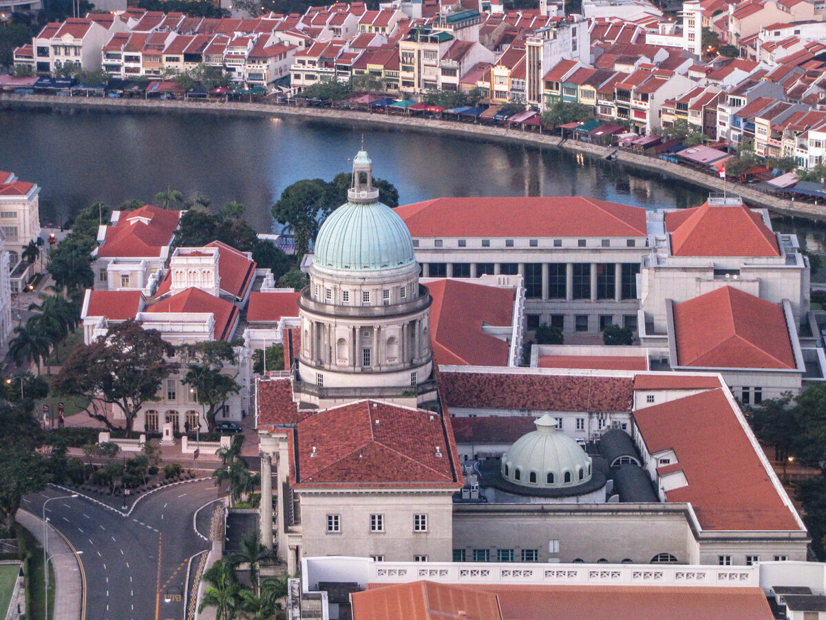

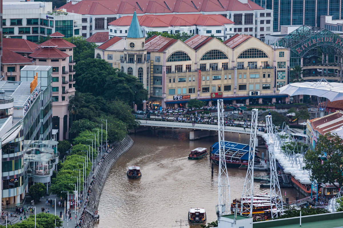


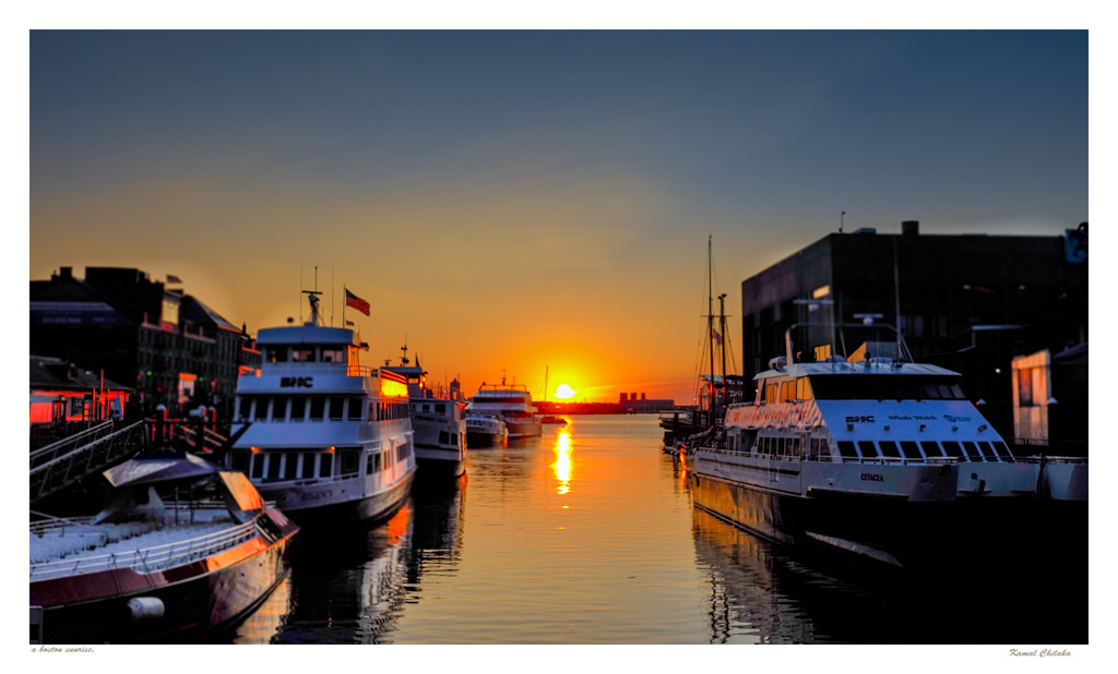
Sunrise at Boston Harbour with a Leica X
The Sun was just beginning to rise as I reached the harbour. It was a clear morning and the sun had an intense orange glow while it hung at the horizon. I shot both in colour first to capture the intense colours.

Old Customs Building and US Flag
It was late summer in 2016 when I found myself traveling to New England for my brothers wedding. It was a beautiful seaside wedding in the quant harbour town of Newport Rhode Island. But we had a few days to spend in Boston prior to the wedding .
While the family was still asleep I snuck out with my camera gear for a dawn shoot along the Boston waterfront. I was carrying just my newly acquired Leica X with its fixed 35mm equivalent f1.7 lens. It didn’t take me long to go through and understand the cameras settings. With ISO, shutter speed dials on the top plate and with aperture control on the lens it is extremely institutive to control the Exposure triangle.
The optional various flex EVF is also pretty good and make shooting in bright conditions easier. Also the live view through the EVF gives a fairly accurate rendition of the how the scene will appear in the image. All this means I was free to focus on things like composition and perspective rather than on exposure.Read more about this camera in my gear reviews.

Sunrise at Boston Harbour
The Sun was just beginning to rise as I reached the harbour. It was a clear morning and the sun had an intense orange glow while it hung at the horizon. I shot in colour first to capture the intense colours.
As the sun rose higher creating more contrast between the highlights reflecting of the water and the shadows created by the boats in the harbour I shifted to shooting in Monochrome to capture the drama created by the light.

A pier at Boston Harbour
Boston Harbour Info
Since its discovery to Europeans by John Smith in 1614, Boston Harbor has been an important port in American history. It was the site of the Boston Tea Party as well as almost continuous backfilling of the harbor until the 19th century. By 1660 almost all imports came to the greater Boston area and the New England coast through the waters of Boston Harbor. A rapid influx of people transformed Boston into a booming city.

Boston Waterfront Scene
Boston Harbor is a large harbor which constitutes the western extremity of Massachusetts Bay. The harbor is sheltered from Massachusetts Bay and the open Atlantic Ocean by a combination of the Winthrop Peninsula and Deer Island to the north, the hooked Nantasket Peninsula and Point Allerton to the south, and the harbor islands in the middle. The harbor is often described as being split into an inner harbor and an outer harbor. The harbor itself comprises fifty square miles with 180 miles (290 km) of shoreline and 34 harbor islands.

Reflections and Speedboat
The inner harbor was historically the main port of Boston and is still the site of most of its port facilities as well as the Boston waterfront, which has been redeveloped for residential and recreational uses. The inner harbor extends from the mouths of the Charles River and the Mystic River, both of which empty into the harbor, to Logan International Airport and Castle Island, where the inner harbor meets the outer harbor.

Boston , Old Customs House and Customs House Tower in background
The Custom House in Boston, Massachusetts, was established in the 17th century and stood near the waterfront in several successive locations through the years. In 1849 the U.S. federal government constructed a neoclassical building on State Street; it remains the "Custom House" known to Bostonians today. A tower was added in 1915; the building joined the National Register of Historic Places in 1973 and was designated a Boston Landmark by the Boston Landmarks Commission in 1986.
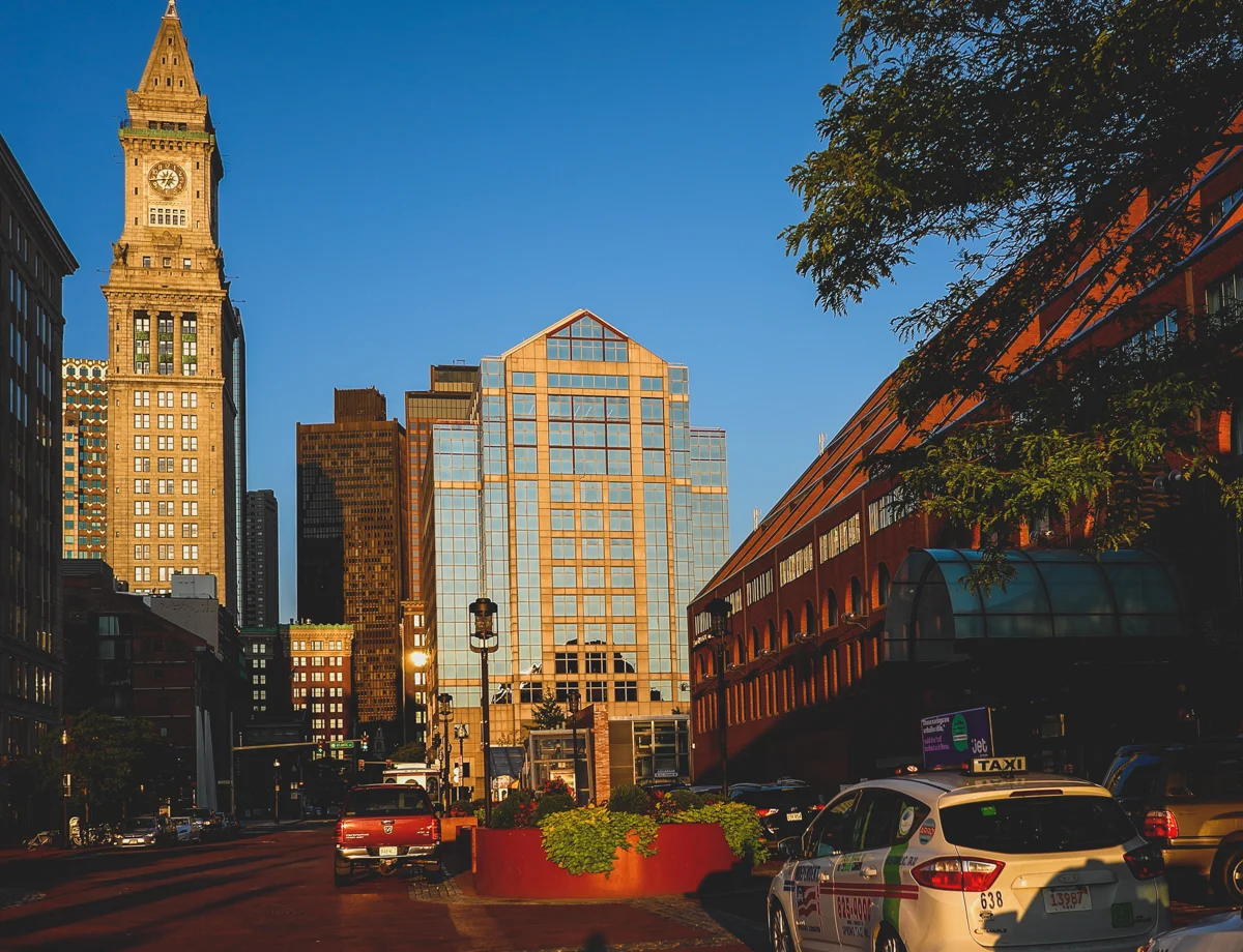
Marriot Boston Long Wharf to the near right and Customs house Tower in the background.
The Cristopher Columbus Waterfront park is one of my favourite places in Boston. It sits right between Long Wharf and Commercial Wharf. I had the opportunity to work at an office at Commercial wharf a long way back at the start of my career. I have fond memories of sitting at the park bench and enjoying a bagged lunch from Faneuil Hall. I try to visit the place whenever i visit Boston. If you haven’t been there make sure to go next time you are at Boston.

The Christopher Columbus Waterfront Park between Long Wharf and Commercial Wharf, Boston .
My favourite things to see and do near the Boston Waterfront
Christopher Colombus Park
New England Aquarium
Boston Children’s Museum
Faneuil Hall
Harbour and Whale Watching Cruises
The Institute of Contemporary Art
Boston tea Party Ships and Museum
Dining at the selection of restaurants near the waterfront ranging from High End Tasting Menus to food courts at Faneuil Hall and Food Trucks
Where to Stay to make the most of the Boston Waterfront
Luxury
Oakwood at One India Street, Boston
Intercontinental Boston
Hilton Boston Downtown Faneuil Hall
Budget
YOTEL BOSTON
PIER BOULEVARD APARTMENTS
BOSTON YACHT HAVEN